Marker Logo
THE HISTORICAL
MARKER DATABASE
“Bite-Size Bits of Local, National, and Global History”
Westlake in Tarrant County, Texas — The American South (West South Central)
 

Star Stagecoach Route


Star Stagecoach Route Marker image. Click for full size.
Photographed by Morgan Petermann, June 30, 2025
1. Star Stagecoach Route Marker
Inscription. In 1845, the Postmaster General was directed to establish Star Stage Routes to deliver mail by stagecoach to small towns in Texas that were not located on a main railroad line from 1850 to early 1880's. Postal records show from 1854 to 1859, a Star Stagecoach route was commissioned to follow mostly what is now Roanoke Road, apparently coming straight over the top of the hill and down through what is now Stagecoach Hills in Westlake. This route ran weekly from Alton to Birdville, county seats that were later replaced by Denton and Ft. Worth, to a stop south of here named Plascido. Stagecoaches in this area were pulled by mules as roads were unimproved and better navigated by them; and, mules were less desired by the Indians. Travel during this time was dangerous with bandits or hostile Indians often stealing horses and supplies. Stagecoach stations were burned and sometimes drivers, guards, and passengers were killed. The unique airpark community of Stagecoach Hills was named after this Star Stage route and developed by Harold Thornton in 1971, owner of the family property at the time.
 
Erected by Town of Westlake, Westlake
Paid Advertisement
Click or scan to see
this page online
Academy.
 
Topics. This historical marker is listed in these topic lists: CommunicationsIndigenous Peoples and Communities. A significant historical year for this entry is 1845.
 
Location. 32° 57.994′ N, 97° 13.686′ W. Marker is in Westlake, Texas, in Tarrant County. It is at the intersection of Thornton Drive and Roanoke Rd, on the left when traveling west on Thornton Drive. Touch for map. Marker is at or near this postal address: 13258 Thornton Dr, Roanoke TX 76262, United States of America. Touch for directions.

Regionally, this marker is in the Prairies & Lakes Region and in the Dallas-Fort Worth Metropolitan Area. It is also in the American South. Globally, it is in North America, a Gulf of Mexico state, the Western Hemisphere, the Western World, and the Anglosphere. Historically, it finds itself in what was once New Spain, the Republic of Texas, and one of the Confederate States of America.

Other nearby markers. At least 8 other markers are within 2 miles of this marker, measured as the crow flies: Pioneer Stone Burial Cairns (approx. 1.2 miles away); Mount Gilead Cemetery (approx. 1.3 miles away); Mount Gilead Baptist Church
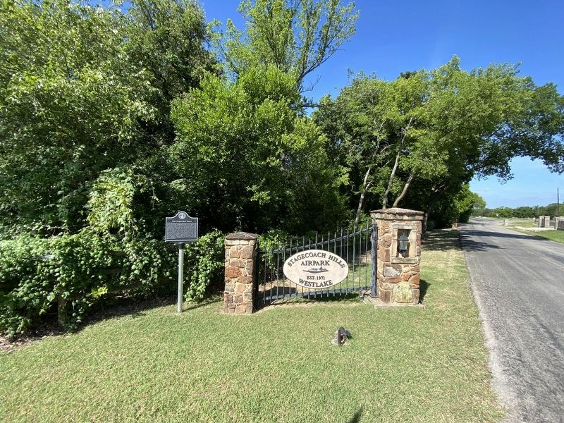
Star Stagecoach Route Marker image. Click for full size.
Photographed by Morgan Petermann, June 30, 2025
2. Star Stagecoach Route Marker
(approx. 1.3 miles away); Mahotea Boone Trail (approx. 1.3 miles away); Buck T. King Homestead (approx. 1½ miles away); Westlake and the Cross Timbers (approx. 1.6 miles away); Bourland Cemetery (approx. 1.6 miles away); Possum Trot School (approx. 1.6 miles away). Touch for a list and map of all markers in Westlake.
 
 
Credits. This page was last revised on July 1, 2025. It was originally submitted on June 30, 2025, by Morgan Petermann of Hurst, Texas. This page has been viewed 168 times since then and 49 times this year. Photos:   1, 2. submitted on June 30, 2025, by Morgan Petermann of Hurst, Texas. • James Hulse was the editor who published this page.

m=277057

CeraNet Cloud Computing sponsors the Historical Marker Database.
This website earns income from purchases you make after using our links to Amazon.com. We appreciate your support.
Paid Advertisement
Jul. 13, 2026