Crosby in Crow Wing County, Minnesota — The American Midwest (Upper Plains)
Portsmouth Mine
Photographed by McGhiever, June 27, 2025
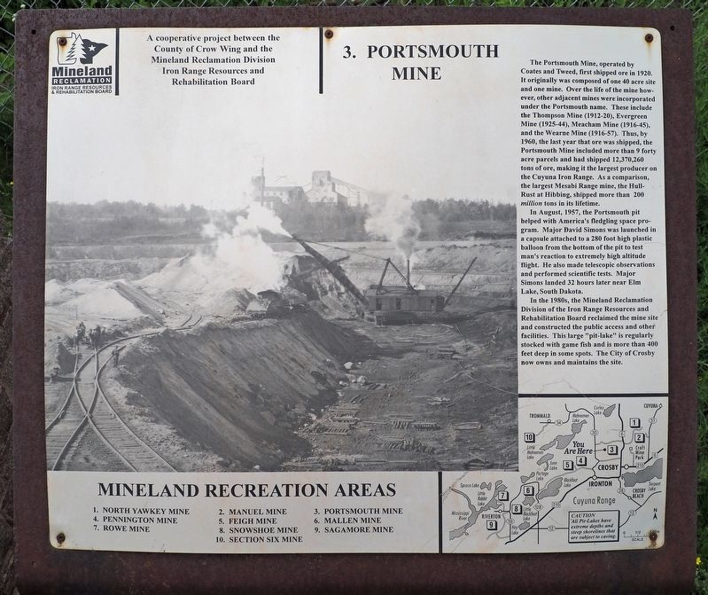
1. Portsmouth Mine Marker
The Portsmouth Mine, operated by Coates and Tweed, first shipped ore in 1920. It originally was composed of one 30 acre site and one mine. Over the life of the mine however, other adjacent mines were incorporated under the Portmouth name. These include the Thompson Mine (1912-20), Evergreen Mine (1925-44), Meacham Mine (1916-45), and the Wearne Mine (1916-57). Thus, by 1960, the last year that ore was shipped, the Portsmouth Mine included more than 9 forty acre parcels and had shipped 12, 370,260 tons of ore, making it the largest producer on the Cuyuna Iron Range. As a comparison, the largest Mesabi Range mine, the Hull-Rust at Hibbing, shipped more than 200 million tons in its lifetime.
In August, 1857, the Portsmouth pit helped with America's fledgling space program. Major David Simons was launched in a capsule attached to a 280 foot high plastic balloon from the bottom of the pit to test man's reaction to extremely high altitude flight. He also made telescopic observations and performed scientific tests. Major Simons landed 32 hours later near Elm Lake, South Dakota.
In the 1980s, the Mineland Reclamation Division
this page online
Mineland Recreation Areas
1. North Yawkey Mine
2. Manuel Mine
3. Portsmouth Mine
4. Pennington Mine
5. Feigh Mine
6. Mallen Mine
7. Rowe Mine
8. Snowshoe Min
9. Sagamore Mine
10. Section Six Mine
Erected by Crow Wing County and the Mineland Reclamation Division. (Marker Number 3.)
Topics. This historical marker is listed in these topic lists: Air & Space • Industry & Commerce • Parks & Recreational Areas. A significant historical year for this entry is 1920.
Location. 46° 29.423′ N, 93° 57.454′ W. Marker is in Crosby, Minnesota, in Crow Wing County. It is at the intersection of Cuyuna Lake Trail and Minnesota Highway 6 on Cuyuna Lake Trail. Touch for map. Marker is at or near this postal address: 23065 State Highway 6, Crosby MN 56441, United States of America. Touch for directions.

Regionally, this marker is in the Northland.

Photographed by McGhiever, June 27, 2025
2. Portsmouth Mine Marker (right) at the Portsmouth Lake Overlook
Other nearby markers. At least 8 other markers are within walking distance of this marker: A different marker also named Portsmouth Mine (here, next to this marker); a different marker also named Portsmouth Mine (here, next to this marker); Croft Mine Historical Park (approx. 0.3 miles away); Deerwood Mail Cart (approx. 0.6 miles away); Soo Line Depot (approx. 0.6 miles away); Fitger Brewing Company (approx. 0.6 miles away); Crosby Veterans Memorial (approx. ¾ mile away); Cuyuna Range Veterans Memorial (approx. 0.8 miles away). Touch for a list and map of all markers in Crosby.
Credits. This page was last revised on July 2, 2025. It was originally submitted on June 30, 2025, by McGhiever of Minneapolis, Minnesota. This page has been viewed 160 times since then and 42 times this year. Photos: 1, 2. submitted on June 30, 2025, by McGhiever of Minneapolis, Minnesota.
