Cedar Falls in Black Hawk County, Iowa — The American Midwest (Upper Plains)
Lawn City
Prairie Pathways - An Interpretive Journey

Photographed by Jason Voigt, June 18, 2025
1. Lawn City Marker
Cedar Falls boosters used "Garden City" and "Lawn City" to describe the well-kept lawns and tree-lined streets in quiet residential areas. Although Cedar Falls was initially settled by families relocating from eastern and midwestern states, after the Civil War, the city's population boomed with immigrants from Denmark, Germany, France, and Ireland. Danish settlers were especially drawn to Cedar Falls where the Dannervirke, a Danish language newspaper, was published from 1882-1954.
The Victorian and Queen Anne houses that are still standing on Washington Street are examples of 19th and 20th century gracious living. Built by successful businessmen of the community, the homes have been well maintained as private residences. Located across from Overman Park, the Barnum Bryant Dempster house, constructed in 1861, is now home to the Cedar Falls Historical Society. The Townsend Knapp home, built in 1867, is home to the Cedar Falls Woman's Club. They are among the oldest homes in the city.
Erected by Cedar Valley Trails.
Topics. This historical marker is listed in these topic lists: Architecture • Communications
this page online
Location. 42° 32.288′ N, 92° 26.867′ W. Marker is in Cedar Falls, Iowa, in Black Hawk County. It is at the intersection of West 1st Street and Clay Street, on the right when traveling west on West 1st Street. Touch for map. Marker is at or near this postal address: 221 W 1st St, Cedar Falls IA 50613, United States of America. Touch for directions.

Regionally, this marker is in the American Midwest and in the Corn Belt. Globally, it is in North America, the Western Hemisphere, the Western World, and the Anglosphere. Historically, it finds itself in what was once the territory of the Mississippian Culture and also the Louisiana Purchase.
Other nearby markers. At least 8 other markers are within walking distance of this marker: Millrace (here, next to this marker); Sturgis Park (a few steps from this marker); Historic Cedar Falls (about 400 feet away, measured in a direct line); Ice House Museum (about 500 feet away); Overman Park (about 800 feet away); Jacob Hoffman Cabin (about 800 feet away); Soldiers Monument (approx. half a mile
Photographed by Jason Voigt, June 18, 2025
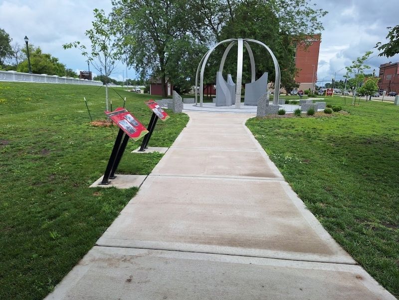
2. Lawn City Marker
Marker is the closest to the front of the photo.
Credits. This page was last revised on July 1, 2025. It was originally submitted on July 1, 2025, by Jason Voigt of Glen Carbon, Illinois. This page has been viewed 278 times since then and 102 times this year. Photos: 1, 2. submitted on July 1, 2025, by Jason Voigt of Glen Carbon, Illinois.
