Cedar Falls in Black Hawk County, Iowa — The American Midwest (Upper Plains)
Millrace
Prairie Pathways - An Interpretive Journey

Photographed by Jason Voigt, June 18, 2025
1. Millrace Marker
Cheap Energy
The 6-foot drop in the Cedar River attracted William Sturgis and Erasmus Adams to the area in 1845. The falls on the Cedar provided a dependable source of energy to operate a saw mill for lumber and a grist mill to grind grain. Sturgis built a timber brush dam and cut a millrace (channel to direct water to the mills, parallel to the river with a gate to control the water level. Water from the river was diverted into the millrace and then water was allocated to each mill as needed to drive the generator. A larger millrace was built in 1867 which attracted new businesses including three large flour mills, an oatmeal and cornstarch plant, a saw mill, and woolen and paper mills.
The millrace also produced electricity. A small private electric generator was built on the millrace in the 1890s. When the City of Cedar Falls bought the millrace in the 1930s, it constructed a power plant that went into operation in 1941. The "hydro" plant, located at the east end of the millrace, provided cost effective energy for many years. The millrace was filled in during the construction of the Highway 20 bridge in 1971.
Erected by Cedar
this page online
Topics. This historical marker is listed in these topic lists: Industry & Commerce • Waterways & Vessels. A significant historical year for this entry is 1845.
Location. 42° 32.289′ N, 92° 26.865′ W. Marker is in Cedar Falls, Iowa, in Black Hawk County. It is at the intersection of West 1st Street and Clay Street, on the right when traveling west on West 1st Street. Touch for map. Marker is at or near this postal address: 221 W 1st St, Cedar Falls IA 50613, United States of America. Touch for directions.

Regionally, this marker is in the American Midwest and in the Corn Belt. Globally, it is in North America, the Western Hemisphere, the Western World, and the Anglosphere. Historically, it finds itself in what was once the territory of the Mississippian Culture and also the Louisiana Purchase.
Other nearby markers. At least 8 other markers are within walking distance of this marker: Lawn City (here, next to this marker); Sturgis Park (within shouting distance of this marker); Historic Cedar Falls (about 400 feet away, measured in a direct line); Ice House Museum (about 500 feet away); Overman Park (about
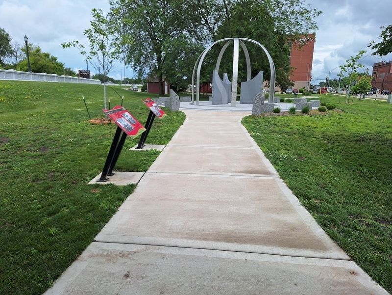
Photographed by Jason Voigt, June 18, 2025
2. Millrace Marker
Marker is in the back of the two.
Credits. This page was last revised on July 1, 2025. It was originally submitted on July 1, 2025, by Jason Voigt of Glen Carbon, Illinois. This page has been viewed 118 times since then and 27 times this year. Photos: 1, 2. submitted on July 1, 2025, by Jason Voigt of Glen Carbon, Illinois.
