
Near Keystone in Pennington County, South Dakota — The American Midwest (Upper Plains)
Profile in Granite
| — | Norbeck Byway | — |
Photographed by Mark Parker, June 30, 2025
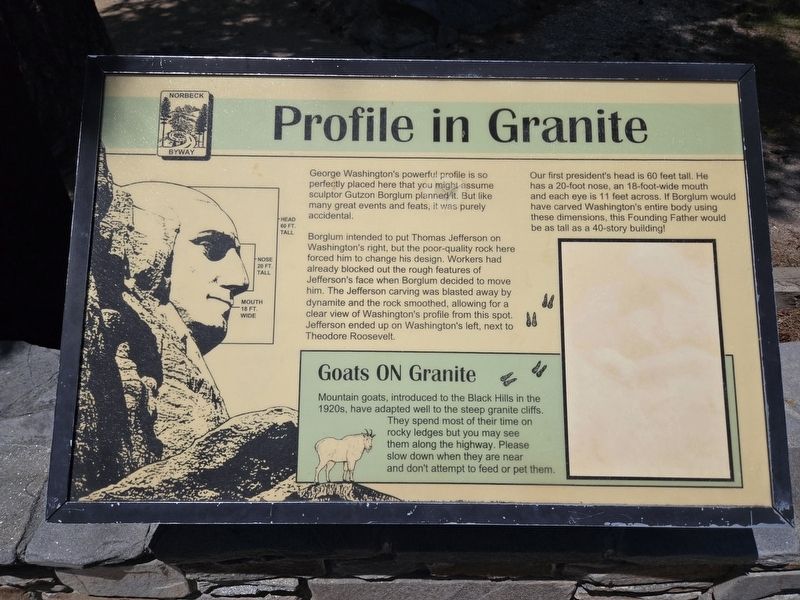
1. Profile in Granite Marker
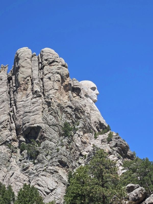
George Washington's powerful profile is so perfectly placed here that you might assume sculptor Gutzon Borglum planned it. But like many great events and feats, it was purely accidental.
Borglum intended to put Thomas Jefferson on Washington's right, but the poor-quality rock here forced him to change his design. Workers had already blocked out the rough features of Jefferson's face when Borglum decided to move him. The Jefferson carving was blasted away by dynamite and the rock smoothed, allowing for a clear view of Washington's profile from this spot. Jefferson ended up on Washington's left, next to Theodore Roosevelt.
Our first president's head is 60 feet tall. He has a 20-foot nose, an 18-foot-wide mouth and each eye is 11 feet across. If Borglum would have carved Washington's entire body using these dimensions, this Founding Father would be as tall as a 40-story building!
Goats on Granite
Mountain goats, introduced to the Black Hills in the 1920s, have adapted well to the steep granite cliffs. They spend most of their time on rocky ledges but you may see them along the highway. Please slow down when they
this page online
Topics. This historical marker is listed in these topic lists: Arts, Letters, Music • Parks & Recreational Areas.
Location. 43° 52.554′ N, 103° 27.656′ W. Marker is near Keystone, South Dakota, in Pennington County. It is on South Dakota Route 244 3.1 miles west of U.S. 16A, on the left when traveling west. The marker is at a scenic view area next to the highway. Touch for map. Marker is at or near this postal address: 13000 SD 244, Keystone SD 57751, United States of America. Touch for directions.

Regionally, this marker is in South Dakota’s West River, in the Badlands, and in Greater Rapid City. It is also in the American Black Hills, in the Lewis & Clark Corridor, on the prairies, and on the Northern Plains. Globally, it is in North America, the Western Hemisphere, the Western World, and the Anglosphere. Historically, it finds itself in what was once Rupert’s Land and also the Louisiana Purchase.
Other nearby markers. At least 8 other markers are within walking distance of this marker: Abraham Lincoln (approx.
Photographed by Mark Parker, June 30, 2025
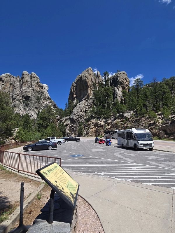
2. Profile in Granite Marker in parking area. Washington profile in the background
Photographed by Mark Parker, June 30, 2025
3. Washington profile view at Mt. Rushmore
Credits. This page was last revised on July 5, 2025. It was originally submitted on July 2, 2025, by Mark Parker of Hickory, North Carolina. This page has been viewed 90 times since then and 22 times this year. Photos: 1, 2, 3. submitted on July 2, 2025, by Mark Parker of Hickory, North Carolina. • J. Makali Bruton was the editor who published this page.
