Greenwood in Newport News, Virginia — The American South (Mid-Atlantic)
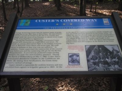
Custer’s Covered Way
1862 Peninsula Campaign
Photographed by Bill Coughlin, August 11, 2008
1. Custer’s Covered Way Marker
George Armstrong Custer had the dubious honor of graduating last in the 1861 class at West Point. He was commissioned a second lieutenant in the 5th U.S. Cavalry and fought with the Army of the Potomac in almost every major battle from Bull Run to Appomattox.
During the Peninsula Campaign, Lieutenant Custer served with distinction as a staff officer and scout. He made an uneasy observation flight in the balloon Constitution at Warwick Court House and wrote that “My confidence in balloons at that time was not sufficient.” In addition, Custer supervised the construction of the covered way before you and the connecting rifle pit for the Berdan Sharpshooters. A covered way protected troops moving between the main line and secondary positions. During the Battle of Williamsburg on May 5, 1862, Custer discovered several abandoned redoubts on the Confederate left flank. By seizing these fortifications, the Union Army gained a tactical advantage.
Custer earned a reputation for reckless bravery and was advanced from captain to brigadier general in 1863. At the age of 23, Custer commanded a cavalry brigade and was one of the
this page online
(captions)
First Lieutenant George A. Custer (reclining at right) relaxes with Union officers at Cumberland Landing, May 1862. Courtesy of Library of Congress.
Brevet Major General George Armstrong Custer.
Erected by Virginia Civil War Trails.
Topics and series. This historical marker is listed in these topic lists: Air & Space • War, US Civil. In addition, it is included in the Virginia Civil War Trails series list. A significant historical date for this entry is May 5, 1862.
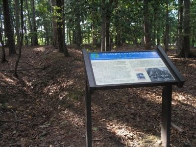
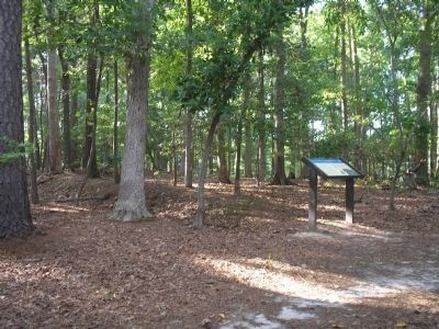
Location. 37° 10.997′ N, 76° 32.033′ W. Marker is in Newport News, Virginia. It is in Greenwood. It can be reached from Constitution Way, on the right when traveling east. Marker is located in Newport News Park, on the Discovery Trail. Touch for map. Marker is at or near this postal address: 901 Constitution Way, Newport News VA
Photographed by Bill Coughlin, August 11, 2008
2. Marker in Newport News Park

Regionally, this marker is on Virginia’s Peninsula, in Hampton Roads, in Coastal Virginia, and in the Hampton Roads Metropolitan Area. It is also in the American South, specifically in the Upper South, in the Tidewater, and on the Eastern Seaboard. Globally, it is in the North Atlantic Region, North America, the Western Hemisphere, the Western World, and the Anglosphere. Historically, it finds itself in what was once the territory of the Mississippian Culture, one of the original Thirteen Colonies, one of the Confederate States of America, and the Antebellum South.
Other nearby markers. At least 8 other markers are within walking distance of this marker: Mott’s Battery (within shouting distance of this marker); Berdan’s Sharpshooters (about 300 feet away, measured in a direct line); The "Great Flood" of '99 (about 300 feet away); Battle of Dam No. 1 (approx. 0.2 miles away); Battle of Lee’s Mill (Dam Number 1) (approx. 0.2 miles away); Third Regiment Vermont Volunteer Infantry (approx. 0.2 miles away); Peninsula Campaign Warwick River (approx. 0.2 miles away);
Photographed by Bill Coughlin, August 11, 2008
3. Marker on the Two Forts Trail
Related markers. Click here for a list of markers that are related to this marker. This set of markers are on the Two Forts & Discovery Walking Trails in Newport News Park.
Credits. This page was last revised on July 2, 2025. It was originally submitted on September 8, 2008, by Bill Coughlin of Woodland Park, New Jersey. This page has been viewed 2,795 times since then and 82 times this year. Last updated on July 2, 2025, by Evan Dwyer of Richmond, Virginia. Photos: 1, 2, 3. submitted on September 8, 2008, by Bill Coughlin of Woodland Park, New Jersey. • Devry Becker Jones was the editor who published this page.
