
North Newport News , Virginia — The American South (Mid-Atlantic)
“The Bullets Would Whistle Around my Head”
1862 Peninsula Campaign
Photographed by Bill Coughlin, August 11, 2008
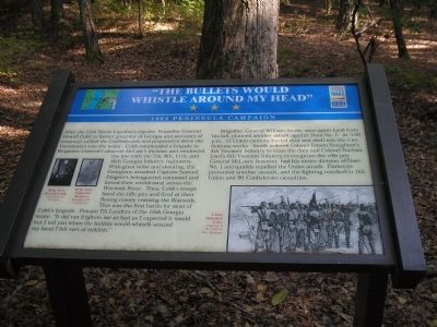
1. "The Bullets Would Whistle Around my Head" Marker
After the 15th North Carolina’s repulse, Brigadier General Howell Cobb (a former governor of Georgia and secretary of treasury) rallied the Confederates and prepared to drive the Vermonters into the water. Cobb commanded a brigade in Brigadier General Lafayette McLaw’s division and reinforced the line with the 7th, 8th, 11th, and 16th Georgia Infantry regiments. With great noise and shouting, the Georgians attacked Captain Samuel Pingree’s beleaguered command and forced their withdrawal across the Warwick River. Thus, Cobb’s troops lined the rifle pits and fired at their fleeing enemy crossing the Warwick. This was the first battle for most of Cobb’s brigade. Private Eli Landers of the 16th Georgia wrote, “It did not frighten me as bad as I expected it would but I tell you when the bullets would whistle around my head I felt sort of ticklish.”
Brigadier General William Smith, once again lucid from his fall, planned another attack against Dam No. 1. At 5:00 p.m., 22 Union cannons hurled shot and shell into the Confederate works. Smith ordered Colonel Edwin Stoughton’s 4th Vermont Infantry to cross the dam and Colonel
this page online
Erected by Virginia Civil War Trails.
Topics and series. This historical marker is listed in this topic list: War, US Civil. In addition, it is included in the Virginia Civil War Trails series list.
Location. 37° 11.203′ N, 76° 32.415′ W. Marker is in Newport News, Virginia. It is in North Newport News. It is on Twin Forts Loop east of Long Meadow Trail, on the left when traveling east. Marker is located in Newport News Park, on the Twin Forts Walking Trail, on the north side of Lee Hall Reservoir. Touch for map. Marker is at or near this postal address: 13560 Twin Forts Loop, Newport News VA 23603, United States of America. Touch for directions.

Regionally, this marker is on Virginia’s Peninsula, in Hampton Roads, in Coastal Virginia, and in the Hampton Roads Metropolitan Area. It is also in the American
Photographed by Bill Coughlin, August 11, 2008
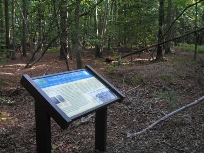
2. Marker in Newport News Park
Other nearby markers. At least 8 other markers are within walking distance of this marker: “Just Like Sap – Boiling, in the Stream” (about 400 feet away, measured in a direct line); “Their Conduct was Worthy of Veterans” (about 600 feet away); “Every Kind of Obstruction was Skillfully Used” (approx. 0.2 miles away); One-Gun Battery (approx. 0.2 miles away); Third Regiment Vermont Volunteer Infantry (approx. 0.3 miles away); Battle of Lee’s Mill (Dam Number 1) (approx. 0.3 miles away); Battle of Dam No. 1 (approx. 0.3 miles away); Ten Pound Parrott Rifle and Limber (approx. 0.3 miles away). Touch for a list and map of all markers in Newport News.
More about this marker. The bottom right of the marker contains a drawing
Photographed by Bill Coughlin, August 11, 2008
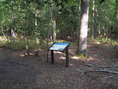
3. Marker on the Two Forts Walking Trail
The left of the marker features photographs of Brig. Gen Howell Cobb, University of Georgia and Brig. Gen. Lafayette McLaws, Museum of the Confederacy.
Related markers. Click here for a list of markers that are related to this marker. This set of markers are on the Two Forts & Discovery Walking Trails in Newport News Park.
Also see . . .
1. Yorktown. CWSAC Battle Summaries. (Submitted on September 7, 2008, by Bill Coughlin of Woodland Park, New Jersey.)
2. Tidewater Virginia, The 1862 Peninsula Campaign. Civil War Traveler. (Submitted on September 7, 2008, by Bill Coughlin of Woodland Park, New Jersey.)
Photographed by Bill Coughlin, August 11, 2008
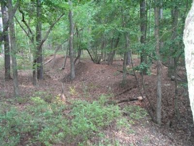
4. Confederate Earthworks
These Confederate earthworks, located near the marker, were shelled by Union Artillery prior to the second attack by the 4th Vermont Infantry. The attack was unsuccessful.
Credits. This page was last revised on July 2, 2025. It was originally submitted on September 7, 2008, by Bill Coughlin of Woodland Park, New Jersey. This page has been viewed 1,738 times since then and 37 times this year. Last updated on July 2, 2025, by Evan Dwyer of Richmond, Virginia. Photos: 1, 2, 3, 4. submitted on September 7, 2008, by Bill Coughlin of Woodland Park, New Jersey. • Devry Becker Jones was the editor who published this page.
