Downtown East in Minneapolis in Hennepin County, Minnesota — The American Midwest (Upper Plains)
The West Side Milling District
— Saint Anthony Falls Heritage Trail —
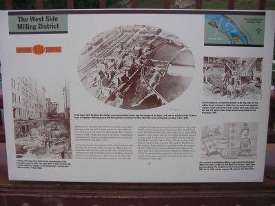
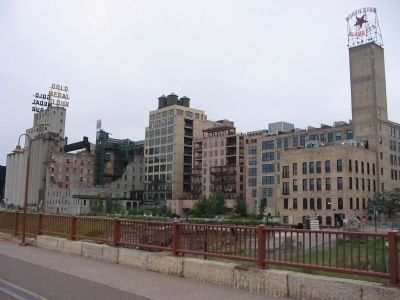
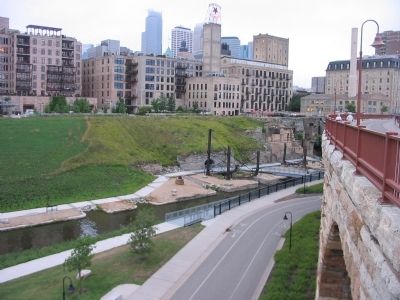
As flour production boomed in the 1870s, other industries were crowded out. From the 1880s through the 1920s, some two dozen flour mills lined the canal on both sides. Grain elevators, machine shops, barrel factories, and other facilities clustered around. Flour milling was not labor intensive. It depended more on machines than men, and employees were generally well paid. Although unions formed in other industries, they made little headway among mill workers until after World War I. After 1930 Minneapolis's fifty-year leadership in flour milling passed to other places. One by one milling operations ceased. An era ended in 1965 when General Mills closed its mills at the falls and moved to Golden Valley. The St. Anthony Falls Historic District was created in 1971, and the Washburn A Mill became a National Historic Landmark in 1983. Devastated by fire in 1991, it survives as a dramatic ruin. Most of the other mills have been torn down or adapted to different uses. Under the ground there remains an intricate system of canals, water gates, raceways, and turbine pits, along with foundations of many mills.
marker photo captions:
To the lower right, the Stone Arch Bridge curves across Upton Island, now the location of the Upper Lock and the activities of the US Army Corps of Engineers. Minneapolis was still the country's top producer of flour when this aerial photograph was taken in the 1920s.
Looking south along First Street during reconstruction of the waterpower canal in 1885. The canal shown is being covered with a plank roadway for wagons. In the background, a second-story railroad trestle is being rebuilt.
Barrel-making was an important industry at the falls, with over two million barrels produced in 1880. Flour was stored and shipped in wooden barrels until the turn of the century when cloth sacks came into use. The picture shows empty barrels being loaded into the Washburn A Mill.
Flour produced at the Washburn Mill won a gold medal at the International Millers Convention in 1880, and Gold Medal Flour became a brand name known worldwide. The Washburn-Crosby Company became General Mills, Inc. in 1928, and the company still produces Gold Medal Flour.
Erected by the St. Anthony Falls Heritage Board.
Topics. This historical marker is listed in these topic lists: Industry & Commerce • Waterways & Vessels. A significant historical year for this entry is 1857.
Location. 44° 58.82′ N, 93° 15.35′ W. Marker is in Minneapolis, Minnesota, in Hennepin County. It is in Downtown East. Marker can be reached from West River Parkway west of Portland Avenue South. Marker is attached to the south railing of the Stone Arch Bridge. Touch for map. Marker is at or near this postal address: 1 Portland Avenue, Minneapolis MN 55401, United States of America. Touch for directions.
Other nearby markers. At least 8 other markers are within walking distance of this marker. Beneath the Surface (a few steps from this marker); Changing the Shape of the Falls (within shouting distance of this marker); The Heritage of Hydro (within shouting distance of this marker); Tailrace Skyline (within shouting distance of this marker); What is Urban Archaeology? (about 300 feet away, measured in a direct line); Stone Arch Bridge - Great Northern Railway (about 300 feet away); Bridges of the St. Anthony Falls Area (about 400 feet away); Minneapolis Underground (about 400 feet away). Touch for a list and map of all markers in Minneapolis.
Additional commentary.
1. Great Mill Disaster heard ten miles away in St. Paul.
On May 2, 1878, a spark ignited airborne flour dust within the mill, creating an explosion that demolished the Washburn A and killed 18 workers instantly. The ensuing fire resulted in the deaths of four more people, destroyed five other mills, and reduced Minneapolis’s milling capacity by one third. Known as the Great Mill Disaster, the explosion made national news and served as a focal point that led to reforms in the milling industry. In order to prevent the buildup of combustible flour dust, ventilation systems and other precautionary devices were installed in mills throughout the country.
— Submitted December 10, 2015, by Mark Hilton of Montgomery, Alabama.
Additional keywords. Mill Ruins Park
Credits. This page was last revised on April 24, 2024. It was originally submitted on February 20, 2010, by Keith L of Wisconsin Rapids, Wisconsin. This page has been viewed 1,340 times since then and 71 times this year. Photos: 1, 2, 3. submitted on February 20, 2010, by Keith L of Wisconsin Rapids, Wisconsin. • Bill Pfingsten was the editor who published this page.


