Near Crow Wing in Crow Wing County, Minnesota — The American Midwest (Upper Plains)
Hunting Hospitality
Photographed by McGhiever, June 28, 2025
1. Hunting Hospitality Marker
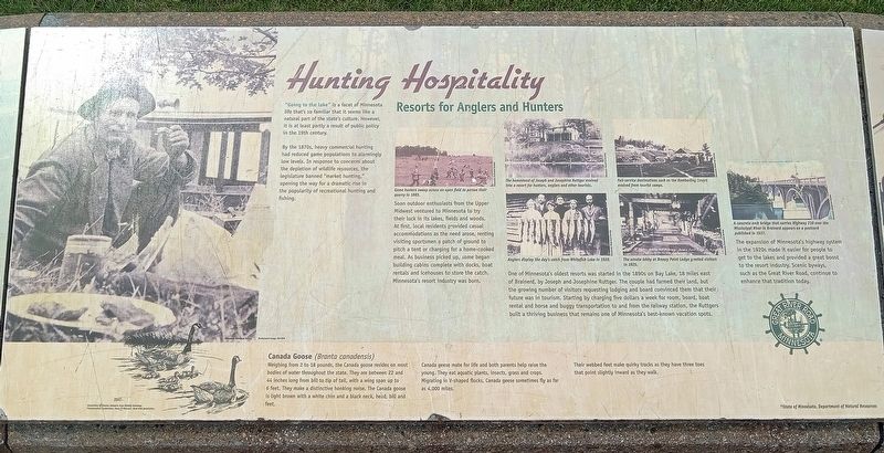
"Going to the lake" is a facet of Minnesota life that's so familiar that it seems like a natural part of the state's culture. However, it is at least partly a result of public policy in the 19th century.
By the 1870s, heavy commercial hunting had reduced game populations to alarmingly low levels. In response to concerns about the depletion of wildlife resources, the legislature banned "market hunting," opening the way for a dramatic rise in the popularity of recreational hunting and fishing.
Game hunters sweep across an open field to pursue their quarry in 1885.
Soon outdoor enthusiasts from the Upper Midwest ventured to Minnesota to try their luck in its lakes, fields and woods. At first, local residents provided casual accommodations as the need arose, renting visiting sportsmen a patch of ground to pitch a tent or charging for a home-cooked meal. As business picked up, some began building cabins complete with docks, boat rentals and icehouses to store the catch. Minnesota's resort industry was born.
The homestead of Joseph and Josephine Ruttger evolved into a resort for hunters, anglers and other tourists.
Full-service destinations such as the Kamberling Resort evolved from tourist camps.
Anglers display the day's catch from Whitefish Lake in 1920.
The ornate lobby at Breezy Point Lodge greeted visitors in 1925.
One
this page online
A concrete arch bridge that carries Highway 210 over the Mississippi River in Brainerd appears on a postcard published in 1937.
The expansion of Minnesota's highway system in the 1920s made it easier for people to get to the lakes and provided a great boost to the resort industry. Scenic byways, such as the Great River Road, continue to enhance that tradition today.
Canada Goose (Branta canadensis)
Weighing from 2 to 18 pounds, the Canada goose resides on most bodies of water throughout the state. They are between 22 and 44 inches long from bill to tip of tail, with a wing span up to 6 feet. They make a distinctive honking
Photographed by McGhiever, June 28, 2025
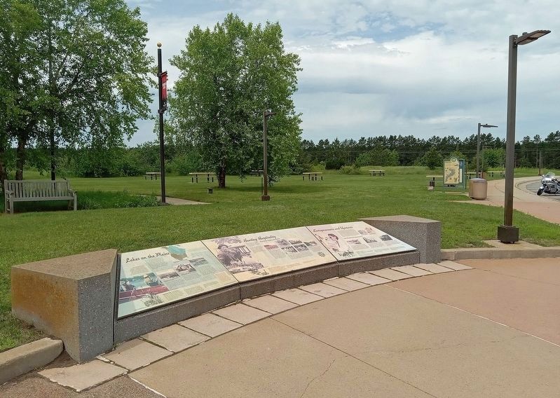
2. Hunting Hospitality Marker (center) at the Brainerd Lakes Welcome Center
Canada geese mate for life and both parents help raise the young. They eat aquatic plants, insects, grass and crops. Migrating in V-shaped flocks, Canada geese sometimes fly as far as 4,000 miles.
Their webbed feet make quirky tracks as they have three toes that point slightly inward as they walk.
Topics. This historical marker is listed in these topic lists: Entertainment • Government & Politics • Industry & Commerce • Roads & Vehicles. A significant historical year for this entry is 1890.
Location. 46° 15.628′ N, 94° 19.17′ W. Marker is near Crow Wing, Minnesota, in Crow Wing County. It can be reached from the intersection of N. Koering Road and Minnesota Highway 371. The marker is at the Explore Brainerd Lakes Welcome Center and Rest Area. Touch for map. Marker is at or near this postal address: 7053 N Koering Road, Brainerd MN 56401, United States of America. Touch for directions.

Regionally, this marker is in the Northland. It is also in the American Midwest, in the Corn Belt, and in the Great River Road Region. Globally, it is in North America, the Great North Woods, the Western Hemisphere, the Western World, and the Anglosphere. Historically, it finds itself in what was once Rupert’s Land, the territory of the Mississippian Culture, and the Northwest Territory.
Other nearby markers. At least 8 other markers are within walking distance of this marker: Entrepreneurs and Upstarts (here, next to this marker); Lakes on the Plains (here, next to this marker); Roughnecks and River Pigs (a few steps from this marker); Ojibwe Origins (a few steps from this marker); Land in the Middle (a few steps from this marker); Mississippi Crossings (a few steps from this marker); Paul Bunyan Statue (a few steps from this marker); Lumberjack Legend (within shouting distance of this marker). Touch for a list and map of all markers in Crow Wing.
Credits. This page was last revised on July 4, 2025. It was originally submitted on July 3, 2025, by McGhiever of Minneapolis, Minnesota. This page has been viewed 101 times since then and 21 times this year. Photos: 1. submitted on July 3, 2025, by McGhiever of Minneapolis, Minnesota. 2. submitted on July 2, 2025, by McGhiever of Minneapolis, Minnesota.
