West Bloomfield Township in Orchard Lake Village in Oakland County, Michigan — The American Midwest (Great Lakes)
Apple Island: A Geological Rarity
Photographed by John Ridley, May 11, 2025
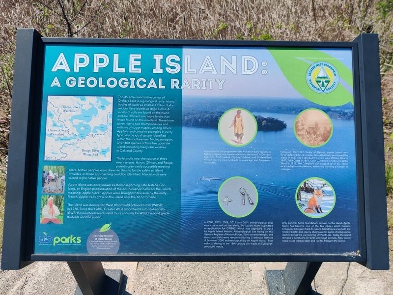
1. Apple Island: A Geological Rarity Marker
This 35-acre island in the center of Orchard Lake is a geological rarity: inland bodies of water as small as Orchard Lake seldom have islands as large as this. A variety of soils are found on the island and are different and more fertile than those found on the mainland. These have given rise to two champion trees and millions of sugar maples, among others. Apple Island contains examples of every type of ecological system identified within the Southeastern Michigan region. Over 400 species of flora live upon the island, including many rare varieties in Oakland County.
The island is near the source of three river systems: Huron, Clinton, and Rouge, providing an easily accessible meeting place. Native peoples were drawn to the site for the safety an island provides, as those approaching could be identified. Also, islands were sacred to the native people.
Apple Island was once known as Menahsagorning, (Me-Nah-Sa-Gor-Ning, an English pronunciation of the Anishinaabek name for the island, meaning “apple place." Apples were brought to the area by the early French. Apple trees grew on the island until the 1877 tornado.
The
this page online
Erected by Greater West Bloomfield Historical Society.
Topics. This historical marker is listed in this topic list: Indigenous Peoples and Communities.
Location. 42° 35.202′ N, 83° 21.343′ W. Marker is in Orchard Lake Village, Michigan, in Oakland County. It is in West Bloomfield Township. It is on Indian Trail. Touch for map. Marker is at or near this postal address: 3845 Indian Trail, West Bloomfield MI 48324, United States of America. Touch for directions.

Regionally, this marker is in Southeast Michigan and in Greater Detroit. It is also in the American Midwest. Globally, it is in North America, the Western Hemisphere, the Western World, and the Anglosphere. Historically, it finds itself in what was once the Northwest Territory.
Other nearby markers. At least 8 other markers are within walking distance of this marker: Gateway to Nature (a few

Photographed by John Ridley, May 11, 2025
2. Apple Island: A Geological Rarity Marker
Credits. This page was last revised on July 5, 2025. It was originally submitted on July 4, 2025, by John Ridley of Chelsea, Michigan. This page has been viewed 179 times since then and 33 times this year. Photos: 1, 2. submitted on July 4, 2025, by John Ridley of Chelsea, Michigan. • J. Makali Bruton was the editor who published this page.
