Knaresborough in North Yorkshire, England, United Kingdom — Northwestern Europe (the British Isles)
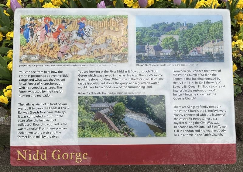
Nidd Gorge
Photographed by Ray Gurganus, April 18, 2025
1. Nidd Gorge Marker
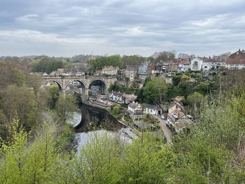
The railway viaduct in front of you was built to carry the Leeds & Thirsk Railway (Leeds Northern Railway). It was completed in 1851, three years after the first viaduct collapsed. Round to your left is the war memorial. From there you can look down to the weir and the former linen mill by the river.
You are looking at the River Nidd as it flows through Nidd Gorge which was carved in the last Ice Age. The Nidd's source is on the slopes of Great Whernside in the Yorkshire Dales. The castle is positioned above the gorge and a guard on watch would have had a good view of the surrounding land.
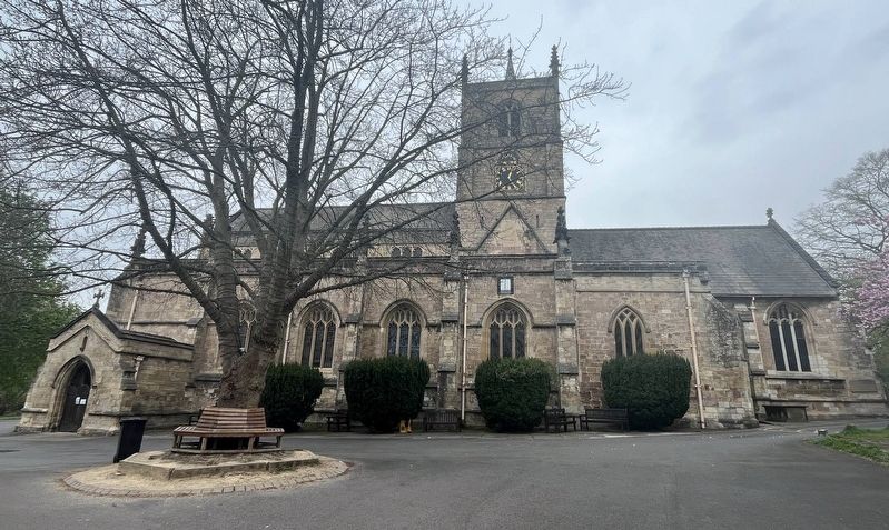
From here you can see the tower of the Parish Church of St John the Baptist, a fine building founded by Henry I in 1114. In 1343 the wife of Edward III, Queen Phillippa took great interest in the restoration work, hence it became known as "the Queen's Church".
There are Slingsby family tombs in the Parish Church,
this page online
Topics. This historical marker is listed in these topic lists: Bridges & Viaducts • Forts and Castles • Railroads & Streetcars • Waterways & Vessels.
Location. 54° 0.427′ N, 1° 28.168′ W. Marker is in Knaresborough, England, in North Yorkshire. It can be reached from Waterside. On the grounds of Knaresborough Castle. Touch for map. Marker is at or near this postal address: 23a Waterside, Knaresborough, England HG5 8DE, United Kingdom. Touch for directions.

Regionally, this marker is in Yorkshire & The Humber. Globally, it is on the Atlantic Ocean, in the North Atlantic Region, in Europe, in Atlantic Europe, on one of the British Isles, in the Western World, and in the Anglosphere. Historically, it finds itself in what was once the Roman Empire.
Other nearby markers. At least 8 other markers are within walking distance
Photographed by Ray Gurganus, April 18, 2025
2. Nidd Gorge and Railway Bridge
Photographed by Ray Gurganus, April 18, 2025
3. St John the Baptist Church
Credits. This page was last revised on July 8, 2025. It was originally submitted on July 5, 2025, by Ray Gurganus of Washington, District of Columbia. This page has been viewed 75 times since then and 9 times this year. Photos: 1, 2, 3. submitted on July 5, 2025, by Ray Gurganus of Washington, District of Columbia. • Andrew Ruppenstein was the editor who published this page.
Editor’s want-list for this marker. photo of the marker within its surroundings • Can you help?
