
Scarborough in North Yorkshire, England, United Kingdom — Northwestern Europe (the British Isles)
Besieged
Scarborough Castle

Photographed by Ray Gurganus, April 15, 2025
1. Besieged Marker
The town and castle of Scarborough were occupied by the forces of Sir High Cholmley, who initially supported Parliament. But he became disillusioned with its cause and decided to support Charles I. Sir Hugh campaigned by sea and land, intercepting shipping and launching inland raids with his force of 600 foot soldiers, 100 dragoons and 100 horsemen Following the royalist defeat at Marston Moor in 1644, however, the forces of Parliament closed in on Scarborough.
On 18th February 1645 the Royal garrison withdrew into the castle. The Parliamentarians occupied the church below the castle and brought in heavy guns to bombard the fortifications After three days of intense firing, the guns split the keep in two.
Many months later on the 25th July, without ammunition or food and only 25 men fit for duty, Sir Hugh surrendered. His force marched out of the castle with the honours of war, its drums beating and bearing weapons.
Go inside
this page online
Topics. This historical marker is listed in these topic lists: Forts and Castles • Wars, Non-US. A significant historical year for this entry is 1644.
Location. 54° 17.264′ N, 0° 23.369′ W. Marker is in Scarborough, England, in North Yorkshire. It is on Castle Road. Touch for map. Marker is at or near this postal address: Castle Rd, Scarborough, England YO11, United Kingdom. Touch for directions.

Regionally, this marker is in England’s Yorkshire & The Humber. Globally, it is on the Atlantic Ocean, in the North Atlantic Region, in Europe, in Atlantic Europe, on one of the British Isles, in the Western World, and in the Anglosphere. Historically, it finds itself in what was once the Roman Empire.
Other nearby markers. At least 8 other markers are within walking distance of this marker: World War I (here, next to this marker); Gun Batteries (here, next to this marker); The First Settlements (here, next
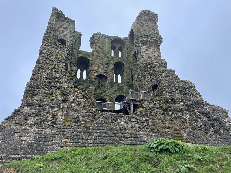
Photographed by Ray Gurganus, April 15, 2025
2. Scarborough Castle
Credits. This page was last revised on July 6, 2025. It was originally submitted on July 5, 2025, by Ray Gurganus of Washington, District of Columbia. This page has been viewed 76 times since then and 7 times this year. Photos: 1, 2. submitted on July 5, 2025, by Ray Gurganus of Washington, District of Columbia. • Andrew Ruppenstein was the editor who published this page.
Editor’s want-list for this marker. photo of the marker within its surroundings • Can you help?
