
First Ward in Buffalo in Erie County, New York — The American Northeast (Mid-Atlantic)
Ohio Street Bridge
Photographed by Paige Miller, July 5, 2025
1. Ohio Street Bridge Marker
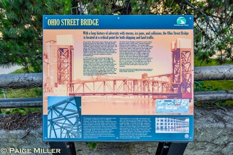
At one time, Ohio Street was a critical north-south industrial artery for land traffic. The Ohio Street Bridge linked the downtown business district to the foundries, grain elevators, flour and steel mills, rail yards, and docks of Buffalo's harbor. The first bridge was a stationary toll bridge operated by The Buffalo & Hamburg Turnpike Co. built in the late 1820's or early 30's. The Common Council tried for years to get the private company to build a moveable span.
In 1870 however, the covered toll bridge was destroyed by an August storm. The bridge was replaced in 1871 with a new swing bridge, which was destroyed two years later by a lake-going vessel. After the accident, two temporary pontoon bridges constructed of canal boats with wooden planks for a roadway were built, but they were destroyed by ice jams in the river. So a steam ferry was used, consisting of a tug with a flat-boat. The ferry carried between 400 and 800 teams a day across the Buffalo
this page online
The Ohio Street Bridge is located at a point where the River takes a sharp bend, making navigation difficult for lake freighters. The swing bridges swiveled from a pivot point on a pier on the middle of the river. When a ship went by, the bridge was turned so that it was parallel to shore. But this style bridge reduced the navigable width of the channel significantly, so in 1908, a single leaf bascule bridge was built. A bridge of this type pivots on one shore utilizing counterweights, raising and lowering the span to the other shore or pier in the river. It was the largest of it's type in the U.S. at the time. The bridge deck was 166 ft. long weighing 500 tons and could be raised or lowered on the north bank in less than two minutes.
Shown here is the Ohio Street Bridge looking northeast. Background image adapted from Library of Congress, Prints and Photographs Division, HAER, 15 BUF, 44-37.
The bascule bridge still limited navigational space. Land traffic was affected, too. In 1929 for example, the bridge was raised 10,929 times with over 1344 hours of traffic
Photographed by Paige Miller, July 5, 2025
2. Ohio Street Bridge Marker
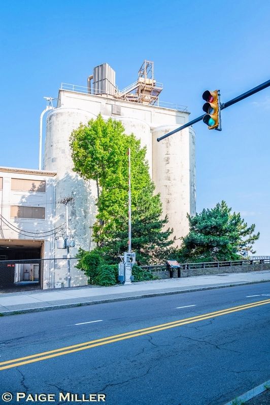
The marker is on the sidewalk in front of the yellow-white Lafarge Cement building.
Construction of a new bridge was delayed until after the Skyway and the Niagara Secton of the Thruway were completed in the late 1950s. The present bridge, a vertical lift bridge, opened in 1962. The entire span of the bridge is rafted by means of counter-weights (each weighing 400 tons) located in the 135-foot-tower on each side. The center span of the bridge is 350 feet long and weighs 700 tons. The bridge is operated by the City of Buffalo and, until recently, was staffed 24 hours a day. The bridge tender controls the bridge from the house-like structure on the south end of the bridge.
Erected by Shoreline Trail.
Topics. This historical marker is listed in these topic lists: Bridges & Viaducts •
Photographed by Paige Miller, July 5, 2025
3. Ohio Street Bridge Marker
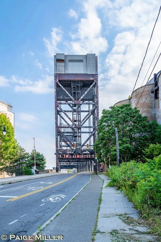
The southern end of the Ohio Street Bridge, marker visible on the sidewalk at the left.
Location. 42° 51.672′ N, 78° 52.049′ W. Marker is in Buffalo, New York, in Erie County. It is in the First Ward. It is on Ohio Street 0.1 miles north of Ganson Street, on the right when traveling south. Ohio Street is now shown as "Empire State Trl" on Google Maps. Touch for map. Marker is at or near this postal address: 575 Ohio Street, Buffalo NY 14203, United States of America. Touch for directions.

Regionally, this marker is in Upstate New York and specifically in Western New York. It is also in the American Northeast and in the Mid-Atlantic. Globally, it is in North America, on the Great Lakes, in the Western Hemisphere, in the Western World, and in the Anglosphere. Historically, it finds itself in what was once the Viceroyalty of New France, the Haudenosaunee (Iroquois) Confederacy, New Netherland, and one of the original Thirteen Colonies.
Other nearby markers. At least 8 other markers are within walking distance of this marker: The Buffalo Harbor's Grain Elevators — Childs Street (about 500 feet away, measured in a direct line); The Grain Elevators
Photographed by Paige Miller, July 5, 2025
4. Ohio Street Bridge Marker
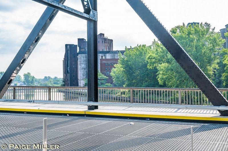
View of the Buffalo River and grain elevators as seen from the Ohio Street Bridge looking east
More about this marker. Marker is just a few feet south of the southern end of the Ohio Street Bridge. There is no place to park within view of the marker. Parking can be found on Silo City Row, or to the north of the bridge on Louisiana Street (and from there you can walk across the Ohio Street Bridge to the marker).
Photographed by Paige Miller, July 5, 2025
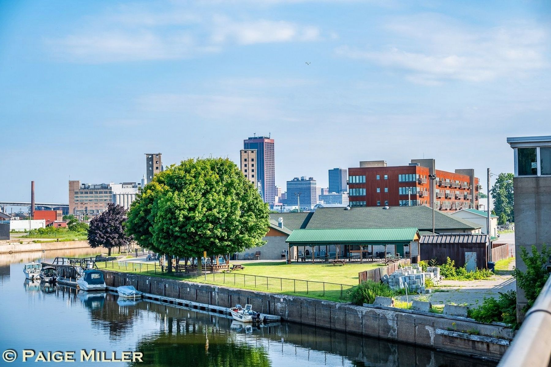
5. Ohio Street Bridge Marker
View of the downtown Buffalo skyline, as seen from the Ohio Street Bridge facing northwest.
Credits. This page was last revised on July 10, 2025. It was originally submitted on July 5, 2025, by Paige Miller of Getzville, New York. This page has been viewed 174 times since then and 39 times this year. Photos: 1, 2, 3, 4, 5. submitted on July 5, 2025, by Paige Miller of Getzville, New York. • Andrew Ruppenstein was the editor who published this page.
