Lockport in Niagara County, New York — The American Northeast (Mid-Atlantic)
Erie Canal
Photographed by Bradley Owen, July 2, 2025
1. Erie Canal Marker
(Panel 1):
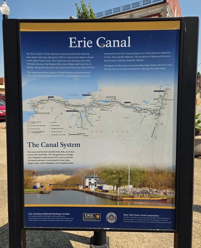
The Erie Canal is North America’s most successful and enduring man-made waterway. Opened in 1825, it connects the Atlantic Ocean to the upper Great Lakes. The canal runs east and west more than 350 miles between the Hudson River near Albany and Lake Erie at Buffalo. Along the way, locks raise and lower boats more than 570 feet.
The canal opened the interior of North America and transformed New York into the Empire State. Settlers and immigrants pressed westward on the Erie Canal, giving rise to cities and new industries in New York and the Midwest. The products of farms and factories moved east to markets along the Atlantic.
Enlarged over the years to accommodate larger boats, the Erie Canal still operates as an active and historic waterway for all to enjoy.
The Canal System
You can travel the Erie Canal by boat, bike, or on foot across New York State. The Cayuga-Seneca, Oswego, and Champlain canals branch off to form a network of inland waterways connecting the Great Lakes, Finger Lakes, Lake Champlain, and Canadian waters.
(Panel 2):
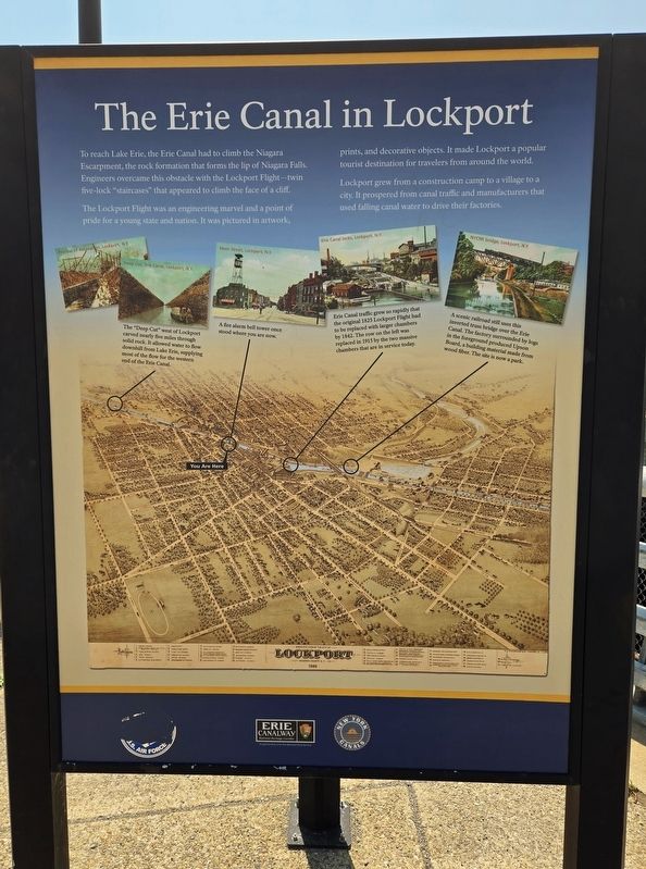
The Erie Canal in Lockport
To reach Lake Erie, the
this page online
The Lockport Flight was an engineering marvel and a point of pride for a young state and nation. It was pictured in artwork, prints, and decorative objects. It made Lockport a popular tourist destination for travelers from around the world.
Lockport grew from a construction camp to a village to a city. It prospered from canal traffic and manufacturers that used falling canal water to drive their factories.
(Captions):
The "Deep Cut" west of Lockport carved nearly five miles through solid rock. It allowed water to flow downhill from Lake Erie, supplying most of the flow for the western end of the Erie Canal.
A fire alarm bell tower once stood where you are now.
Erie Canal traffic grew so rapidly that the original 1825 Lockport Flight had to be replaced with larger chambers by 1842. The row on the left was replaced in 1915 by the two massive chambers that are in service today.
A scenic railroad still uses this inverted truss bridge over the Erie Canal. The factory surrounded by logs in the foreground produced Upson Board, a building material made from wood fiber. The site is now a park.
Topics and series.
Photographed by Bradley Owen, July 2, 2025
2. The Erie Canal in Lockport Marker
Location. 43° 10.174′ N, 78° 41.662′ W. Marker is in Lockport, New York, in Niagara County. It is at the intersection of Main Street (New York State Route 31) and Cottage Street, on the right when traveling west on Main Street. Touch for map. Marker is at or near this postal address: 1 Main Street, Lockport NY 14094, United States of America. Touch for directions.

Regionally, this marker is in Upstate New York, specifically in Western New York, and in the Buffalo Metropolitan Area. It is also in the American Northeast and in the Mid-Atlantic. Globally, it is in North America, on the Great Lakes, in the Western Hemisphere, in the Western World, and in the Anglosphere. Historically, it finds itself in what was once the Viceroyalty of New France, the Haudenosaunee (Iroquois) Confederacy, New Netherland, and one of the original Thirteen Colonies.
Other nearby markers. At least 8 other markers are within walking distance
Photographed by Bradley Owen, July 2, 2025
3. Erie Canal Marker
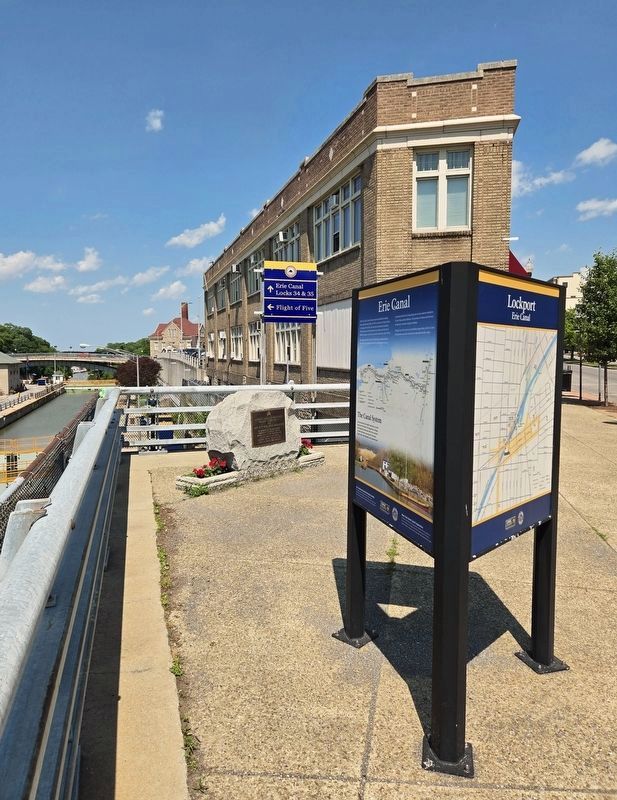
The Erie Canal and a lock can be seen at left-center and the Irish Immigrant Laborers marker is in the center.
Photographed by Bradley Owen, July 2, 2025
4. The Erie Canal in Lockport Marker
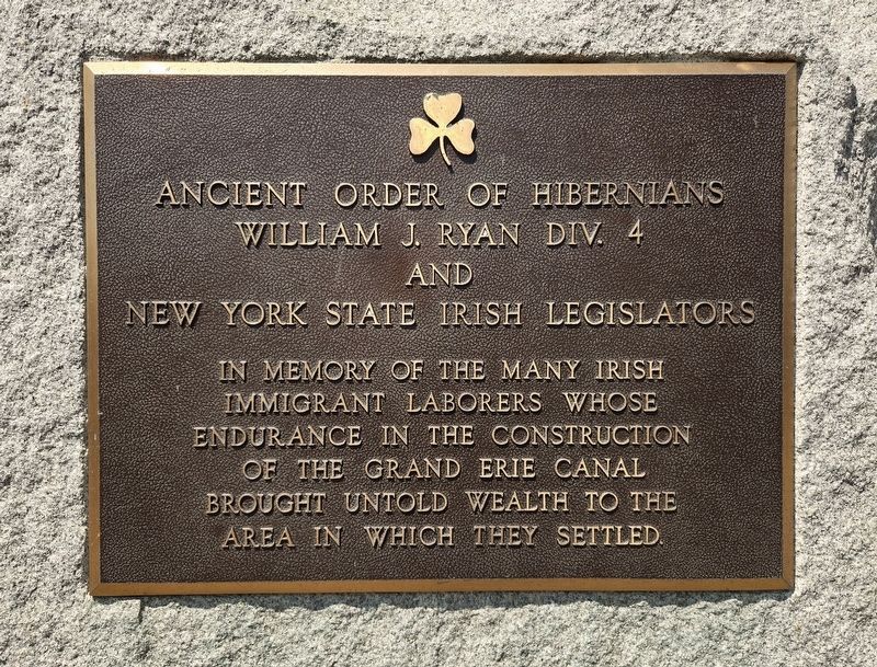
Photographed by Bradley Owen, July 2, 2025
5. Irish Immigrant Laborers Marker Nearby
In memory of the many Irish Immigrant Laborers whose endurance in the construction of the grand Erie Canal brought untold wealth to the area in which they settled.
Credits. This page was last revised on July 5, 2025. It was originally submitted on July 5, 2025, by Bradley Owen of Morgantown, West Virginia. This page has been viewed 183 times since then and 41 times this year. Photos: 1, 2, 3, 4, 5. submitted on July 5, 2025, by Bradley Owen of Morgantown, West Virginia.
