
Stone Mountain in DeKalb County, Georgia — The American South (South Atlantic)
Sherman's Neckties
Photographed by Darren Jefferson Clay, June 22, 2025
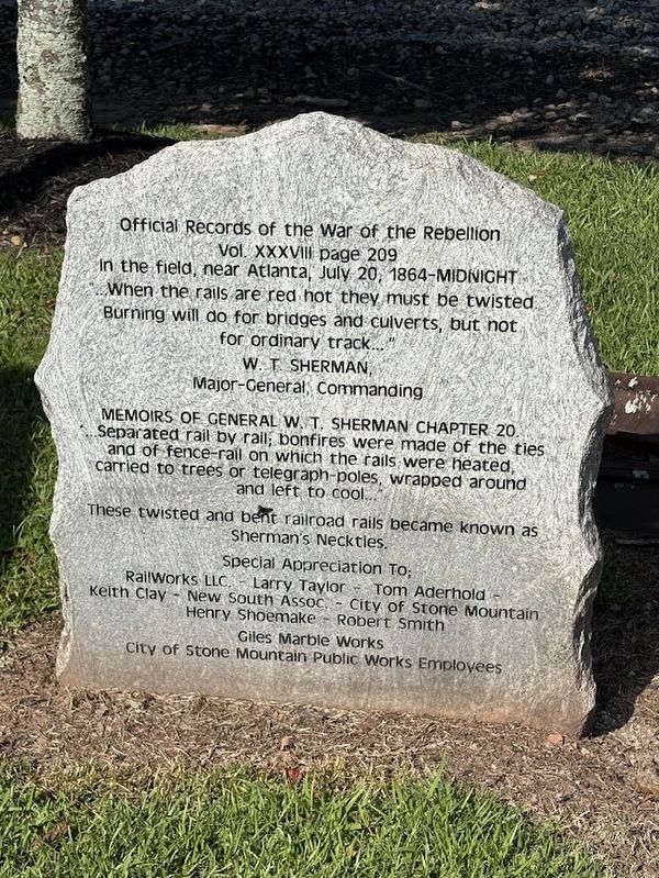
1. Sherman's Neckties Marker
Vol. XXXVIII page 209
In the field, near Atlanta, July 20, 1864-MIDNIGHT
"...When the rails are red hot they must be twisted.
Burning will do for bridges and culverts, but not
for ordinary track..."
W. T. SHERMAN,
Major-General, Commanding
MEMOIRS OF GENERAL W. T. SHERMAN CHAPTER 20.
Separated rail by rail; bonfires were made of the ties
and of fence-rail on which the rails were heated,
carried to trees or telegraph-poles, wrapped around and left to cool..."
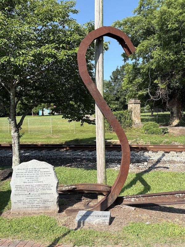
These twisted and bent railroad rails became known as Sherman's Neckties.
Special Appreciation To;
RailWorks LLC. - Larry Taylor - Tom Aderhold -
Keith Clay - New South Assoc. - City of Stone Mountain
Henry Shoemake - Robert Smith
Giles Marble Works
City of Stone Mountain Public Works Employees
Topics. This historical marker is listed in this topic list: War, US Civil. A significant historical date for this entry is July 20, 1864.
Location. 33° 48.479′ N, 84° 10.255′ W. Marker is in Stone Mountain, Georgia, in DeKalb County. It is on West Mountain Street west of Main Street, on the left when traveling west.
this page online

Regionally, this marker is in Georgia’s Piedmont and in Metro Atlanta. It is also in the American South and specifically in the Deep South. Globally, it is in North America, the Western Hemisphere, the Western World, and the Anglosphere. Historically, it finds itself in what was once the territory of the Mississippian Culture, one of the original Thirteen Colonies, one of the Confederate States of America, and the Antebellum South.
Other nearby markers. At least 8 other markers are within 2 miles of this marker, measured as the crow flies: Stone Mountain Inn (about 400 feet away, measured in a direct line); Georgia Railroad Depot (about 500 feet away); Stone Mountain City Cemetery Confederate Monument (approx. 0.3 miles away); Unknown Confederate Dead (approx. 0.3 miles away); 150 Confederate Dead (approx. 0.3 miles away); Garrard's Cavalry at Stone Mtn. Depot (approx. 0.3 miles away); Stone Mountain Cemetery (approx. 0.3 miles away); Old Indian Trail (approx.
Photographed by Darren Jefferson Clay, June 22, 2025
2. Sherman's Neckties Marker
Photographed by Darren Jefferson Clay, June 22, 2025
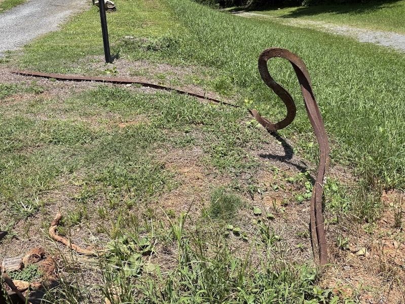
3. Sherman's Necktie seen at the Battle of Allatoona Pass battlefield.
Credits. This page was last revised on July 7, 2025. It was originally submitted on July 5, 2025, by Darren Jefferson Clay of Duluth, Georgia. This page has been viewed 320 times since then and 125 times this year. Photos: 1, 2, 3. submitted on July 5, 2025, by Darren Jefferson Clay of Duluth, Georgia. • Bernard Fisher was the editor who published this page.
