
Allanburg in Niagara Falls in Niagara Region, Ontario — Central Canada (North America)
Gate House
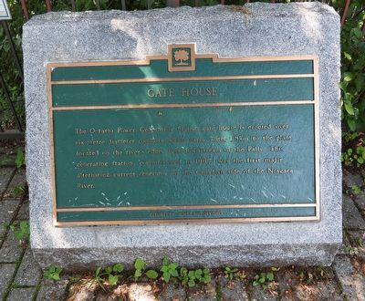
Photographed by Kevin Westell, July 3, 2025
1. Gate House - Marker
Topics. This historical marker is listed in these topic lists: Industry & Commerce • Science & Medicine. A significant historical year for this entry is 1905.
Location. 43° 4.207′ N, 79° 4.158′ W. Marker is in Niagara Falls, Ontario, in Niagara Region. It is in Allanburg. It can be reached from Niagara River Parkway, on the right when traveling north. The marker is on the Trans-Canada Trail, just north-east of the old gate house for the Ontario Power Company, and at the west end of a 70 metre bridge that takes the Trans-Canada Trail over a stretch of water. Touch for map. Marker is at or near this postal address: 7310 Niagara River Parkway, Niagara Falls ON L0S 1A0, Canada. Touch for directions.

Regionally, this marker is on Ontario’s Golden Horseshoe and in Niagara Canada. It
this page online
Other nearby markers. At least 8 other markers are within walking distance of this marker: Ontario Power Screen House (about 120 meters away, measured in a direct line); The Stranded Scow (about 210 meters away); Bridgewater Mills (about 240 meters away); Burch’s Mills (approx. 0.3 kilometers away); Toronto Power Generating Station (approx. 0.4 kilometers away); Niagara Park Greenhouses (approx. 0.7 kilometers away); Niagara Control Works (approx. 0.8 kilometers away); Niagara Tunnel Project (approx. 0.9 kilometers away). Touch for a list and map of all markers in Niagara Falls.
Another marker is no longer nearby. Stranded Scow (was about 210 meters away but has been replaced with another marker now near it).
Photographed by Kevin Westell, July 3, 2025
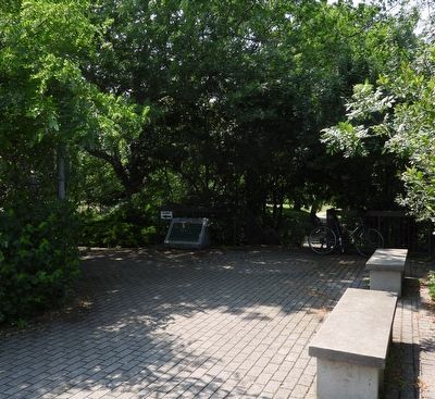
2. Gate House - Marker in context
Photo from the west end of the bridge. Photo faces north-west. The marker is lurking in the shade, at a fork in the Trans-Canada Trail; that rejoin in a few yards.
Photographed by Kevin Westell, July 3, 2025
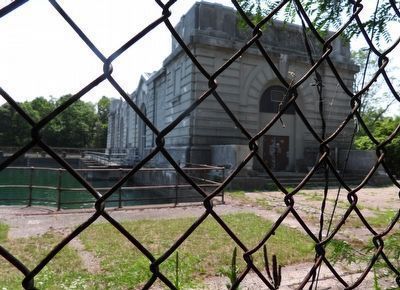
3. Gate House
Photo faces south-west, so this is the north-east face of the building. (There are better pictures from Niagara River Parkway, on the opposite side.)
Photographed by Kevin Westell, July 18, 2025
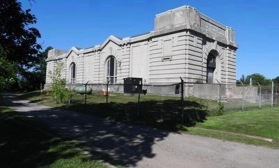
4. Gate House - viewed from Niagara River Parkway
The gravel road leads to the building's rear entrance.
Credits. This page was last revised on July 23, 2025. It was originally submitted on July 5, 2025, by Kevin Westell of St. Catharines, Ontario. This page has been viewed 98 times since then and 13 times this year. Photos: 1. submitted on July 5, 2025, by Kevin Westell of St. Catharines, Ontario. 2, 3. submitted on July 6, 2025, by Kevin Westell of St. Catharines, Ontario. 4. submitted on July 19, 2025, by Kevin Westell of St. Catharines, Ontario. • Andrew Ruppenstein was the editor who published this page.
