Allanburg in Niagara Falls in Niagara Region, Ontario — Central Canada (North America)
Niagara Control Works
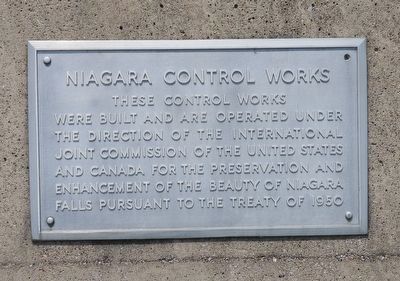
Photographed by Kevin Westell, July 3, 2025
1. Niagara Control Works - Marker
Topics. This historical marker is listed in these topic lists: Natural Resources • Waterways & Vessels. A significant historical year for this entry is 1950.
Location. 43° 4.145′ N, 79° 3.569′ W. Marker is in Niagara Falls, Ontario, in Niagara Region. It is in Allanburg. It is on Niagara River Parkway, on the right when traveling west. The marker is visible from the road, mounted on a concrete wall to the east (right) side of the main entrance to the International Niagara Control Works property. Touch for map. Marker is at or near this postal address: 7700 Niagara River Parkway, Niagara Falls ON L0S 1A0, Canada. Touch for directions.

Regionally, this marker is on Ontario’s Golden Horseshoe and in Niagara Canada. It is also in Central Canada. Globally, it is in North America, on the Great Lakes, in the Western Hemisphere, in the Western World, and in the Anglosphere.
this page online
Other nearby markers. At least 8 other markers are within walking distance of this marker: Niagara Tunnel Project (within shouting distance of this marker); Bridgewater Mills (approx. 0.6 kilometers away); Ontario Power Screen House (approx. 0.7 kilometers away); Gate House (approx. 0.8 kilometers away); Laura (Ingersoll) Secord (approx. 0.8 kilometers away); Church of the Holy Trinity (approx. 0.8 kilometers away); Raid on Fort Schlosser 1813 (approx. one kilometer away); Fort Chippawa 1791 (approx. one kilometer away). Touch for a list and map of all markers in Niagara Falls.
Also see . . . Niagara Treaty of 1950 (Niagara River Remedial Action Plan). Overview:
On February 27, 1950, the Treaty between Canada and the United States of America Concerning the Diversion of the Niagara River was signed to ensure the preservation and enhancement of the scenic beauty of Niagara Falls and the Niagara River, while providing for the most beneficial use of the river waters.
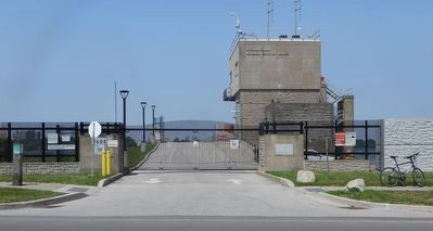
Photographed by Kevin Westell, July 3, 2025
2. Niagara Control Works - Marker in context
Marker is just right of the main gate.
Credits. This page was last revised on July 7, 2025. It was originally submitted on July 6, 2025, by Kevin Westell of St. Catharines, Ontario. This page has been viewed 126 times since then and 37 times this year. Photos: 1, 2. submitted on July 6, 2025, by Kevin Westell of St. Catharines, Ontario. • Andrew Ruppenstein was the editor who published this page.
