Webster Station in Dayton in Montgomery County, Ohio — The American Midwest (Great Lakes)
Fire Blocks - The Flood and the Fire
| — | Patterson Boulevard Canal Parkway | — |
Photographed by Craig Doda, June 28, 2025
1. Fire Blocks - The Flood and the Fire Marker
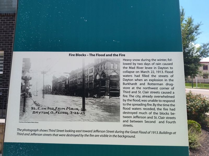
Heavy snow during the winter, followed by two days of rain caused the Mad River levee in Dayton to collapse on March 22, 1913. Flood waters had filled the streets of Dayton when an explosion in the Burkhardt and Rotterman drugstore at the northwest corner of Third and St. Clair streets caused a fire. The city, already overwhelmed by the flood, was unable to respond to the spreading fire. By the time the flood waters receded, the fire had destroyed much of the blocks between Jefferson and St. Clair streets and between Second and Fourth streets.
The photograph shows Third Street looking east toward Jefferson Street during the Great Flood of 1913. Buildings at Third and Jefferson streets that were destroyed by the fire are visible in the background.
Topics. This historical marker is listed in these topic lists: Architecture • Disasters • Industry & Commerce • Waterways & Vessels. A significant historical date for this entry is March 22, 1913.
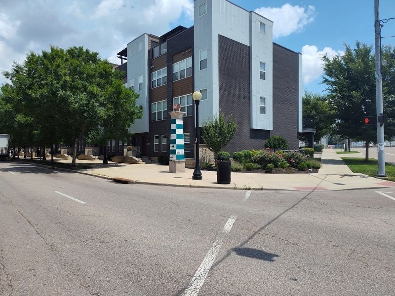
Location. 39° 45.544′ N, 84° 11.22′ W. Marker is in Dayton, Ohio, in Montgomery County. It is in Webster Station. It is at the intersection of South Patterson Boulevard and East
this page online

Regionally, this marker is in the Miami Valley. It is also in the American Midwest and in the Corn Belt. Globally, it is in North America, the Western Hemisphere, the Western World, and the Anglosphere. Historically, it finds itself in what was once the Haudenosaunee (Iroquois) Confederacy, the territory of the Mississippian Culture, and the Northwest Territory.
Other nearby markers. At least 8 other markers are within walking distance of this marker: The Rebuilding - Fire Blocks and Merchants Row (here, next to this marker); The Beaver Power Building (here, next to this marker); The Fire Blocks - Merchants Row (here, next to this marker); Canal Buildings of the Past (here, next to this marker); Dayton Canal-Era Timeline (here, next to this marker); a different marker also named The Fire Blocks - Merchants Row (here, next to this marker); Fire Blocks - Buildings that Survived the Fire (here, next to this
Photographed by Craig Doda, June 28, 2025
2. Fire Blocks - The Flood and the Fire Marker
Credits. This page was last revised on July 26, 2025. It was originally submitted on July 6, 2025, by Craig Doda of Napoleon, Ohio. This page has been viewed 73 times since then and 17 times this year. Photos: 1, 2. submitted on July 6, 2025, by Craig Doda of Napoleon, Ohio. • Devry Becker Jones was the editor who published this page.
