Midtown Dayton in Montgomery County, Ohio — The American Midwest (Great Lakes)
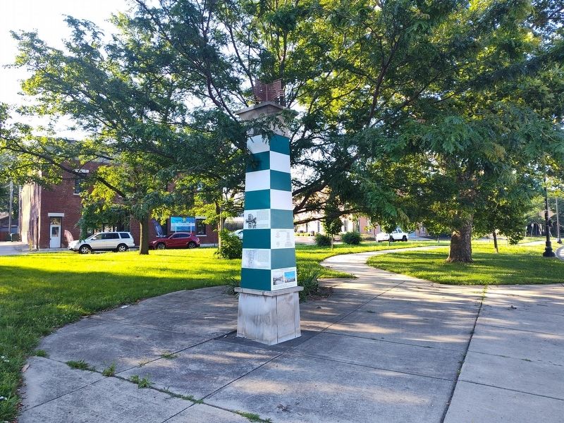
Trade at the Canal Basin
| — | Patterson Boulevard Canal Parkway | — |

Photographed by Craig Doda, July 5, 2025
1. Trade at the Canal Basin Marker
In 1831, 7,065 passengers came to Dayton from Cincinnati via the Miami Erie Canal. Dayton then had a population of about 3,000. In the same year, Dayton shipped 59,550 barrels of flour, 5,602 barrels of whiskey, 563,000 pounds of bulk bacon and pork, and 344 barrels of linseed oil.
The Miami Erie Canal continued to be used to export heavy tonnage even after the arrival of the railroad. In one year during the late 1870s, 23,167 bushels of corn, 104,130 bushels of oats, 33,530,000 pounds of ice, 67,000 pounds of machinery, and 148,000 pounds of paper cleared the port of Dayton. The factory products shipped from Dayton provide evidence of the extent of industrialization since the 1830s.
Left image: The Canal Basin photographed in the late nineteenth century looking northwest from Canal Street to Second Street. Logs are seen piled up on the dock, ready to be loaded for export.
Right image: The map shows the major nineteenth century canals in Ohio. Upon the completion of the Miami Erie Canal, goods would be transported from Dayton north via Miami Erie Canal, Lake Erie, the Erie Canal and onto New York, considerably reducing distance and travel time.
Topics.
this page online
Location. 39° 45.343′ N, 84° 11.263′ W. Marker is in Dayton, Ohio, in Montgomery County. It is in Midtown Dayton. It is at the intersection of South Patterson Boulevard and East 6th Street, on the right when traveling north on South Patterson Boulevard. Touch for map. Marker is at or near this postal address: 322 E 6th St, Dayton OH 45402, United States of America. Touch for directions.

Regionally, this marker is in Ohio’s Miami Valley. It is also in the American Midwest and in the Corn Belt. Globally, it is in North America, the Western Hemisphere, the Western World, and the Anglosphere. Historically, it finds itself in what was once the Haudenosaunee (Iroquois) Confederacy, the territory of the Mississippian Culture, and the Northwest Territory.
Other nearby markers. At least 8 other markers are within walking distance of this marker: The Canal and Industrial Growth (here, next to this marker); The Miami Erie Canal (here, next to this marker); Adaptive Reuse of the Armory
Photographed by Craig Doda, July 5, 2025
2. Trade at the Canal Basin Marker
Credits. This page was last revised on July 26, 2025. It was originally submitted on July 6, 2025, by Craig Doda of Napoleon, Ohio. This page has been viewed 91 times since then and 22 times this year. Photos: 1, 2. submitted on July 6, 2025, by Craig Doda of Napoleon, Ohio. • Devry Becker Jones was the editor who published this page.
