Midtown Dayton in Montgomery County, Ohio — The American Midwest (Great Lakes)
The Canal and Industrial Growth
| — | Patterson Boulevard Canal Parkway | — |
Photographed by Craig Doda, July 5, 2025
1. The Canal and Industrial Growth Marker
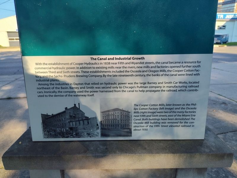
With the establishment of Cooper Hydraulics in 1838 near Fifth and Wyandot streets, the canal became a resource for commercial hydraulic power. In addition to existing mills near the rivers, new mills and factories opened further south between Third and Sixth streets. These establishments included the Osceola and Oregon Mills, the Cooper Cotton Factory, and the Sachs-Prudens Brewing Company. By the late nineteenth century, the banks of the canal were lined with industrial plants.
Among the industries in Dayton that relied on hydraulic power was the large Barney and Smith Car Works, located northeast of the Basin. Barney and Smith was second only to Chicago's Pullman company in manufacturing railroad cars. Ironically, the company used the power harnessed from the canal to help propagate the railroad, which contributed to the demise of the waterway itself.
The Cooper Cotton Mills, later known as the Phillips Cotton Factory (left image) and the Osceola Mills (right image) were two of the many factories near Fifth and Sixth streets, east of the Miami Erie Canal. Both buildings have been demolished. The Osceola Mill building was removed for the construction of the Fifth Street elevated railroad in about 1930.
Topics.
this page online
Location. 39° 45.343′ N, 84° 11.264′ W. Marker is in Dayton, Ohio, in Montgomery County. It is in Midtown Dayton. It is at the intersection of South Patterson Boulevard and East 6th Street, on the right when traveling north on South Patterson Boulevard. Touch for map. Marker is at or near this postal address: 322 E 6th St, Dayton OH 45402, United States of America. Touch for directions.

Regionally, this marker is in Ohio’s Miami Valley. It is also in the American Midwest and in the Corn Belt. Globally, it is in North America, the Western Hemisphere, the Western World, and the Anglosphere. Historically, it finds itself in what was once the Haudenosaunee (Iroquois) Confederacy, the territory of the Mississippian Culture, and the Northwest Territory.
Other nearby markers. At least 8 other markers are within walking distance of this marker: The Miami Erie Canal (here, next to this marker); Adaptive Reuse of the Armory (here, next to this marker); The Canal and the Parkway
Photographed by Craig Doda, July 5, 2025
2. The Canal and Industrial Growth Marker
Credits. This page was last revised on July 26, 2025. It was originally submitted on July 6, 2025, by Craig Doda of Napoleon, Ohio. This page has been viewed 83 times since then and 13 times this year. Photos: 1, 2. submitted on July 6, 2025, by Craig Doda of Napoleon, Ohio. • Devry Becker Jones was the editor who published this page.
