
Antioch in Nashville in Davidson County, Tennessee — The American South (East South Central)
Antioch Pike
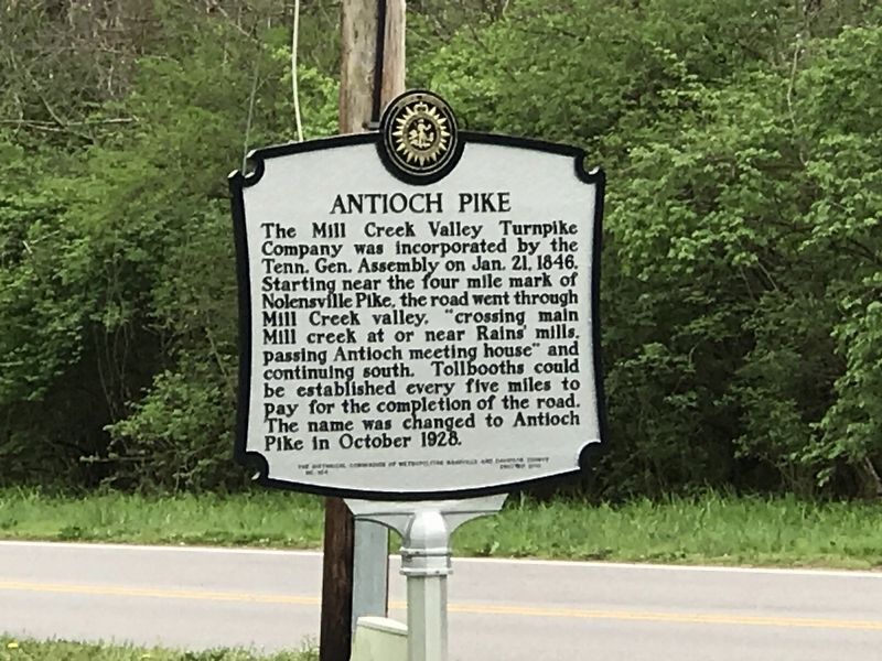
Photographed by Duane and Tracy Marsteller, March 28, 2020
1. Antioch Pike Marker
Erected 2018 by The Historical Commission of Metropolitan Nashville and Davidson County. (Marker Number 164.)
Topics and series. This historical marker is listed in these topic lists: Industry & Commerce • Roads & Vehicles. In addition, it is included in the Tennessee, The Historical Commission of Metropolitan Nashville and Davidson County series list. A significant historical month for this entry is October 1928.
Location. 36° 4.235′ N, 86° 41.082′ W. Marker is in Nashville, Tennessee, in Davidson County. It is in Antioch. It is on Antioch Pike 0.1 miles north of Goodwin Road, on the right when traveling north. Marker has been moved from it's previous location to a new location at the intersection
this page online

Regionally, this marker is in Middle Tennessee. It is also in the American South and specifically in the Upper South. Globally, it is in North America, the Western Hemisphere, the Western World, and the Anglosphere. Historically, it finds itself in what was once the territory of the Mississippian Culture, one of the Confederate States of America, and the Antebellum South.
Other nearby markers. At least 8 other markers are within 3 miles of this marker, measured as the crow flies: Locust Hill (approx. 0.8 miles away); Antioch High School (approx. 1.3 miles away); John Haywood (approx. 1.9 miles away); Ezell House (approx. 2 miles away); Lake Providence Community (approx. 2.2 miles away); GranDale (approx. 2½ miles away); Una Community (approx. 2½ miles away); Tennessee Hospital for the Insane (approx. 2.6 miles away). Touch for a list and map of all markers in Nashville.

Photographed by Darren Jefferson Clay, April 17, 2023
2. Antioch Pike Marker
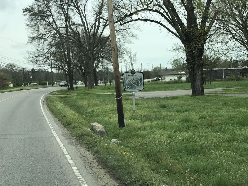
Photographed by Duane and Tracy Marsteller, March 28, 2020
3. Antioch Pike Marker

Photographed by Darren Jefferson Clay, July 2, 2025
4. Antioch Pike Marker

Photographed by Darren Jefferson Clay, July 2, 2025
5. Antioch Pike Marker
Credits. This page was last revised on July 8, 2025. It was originally submitted on March 31, 2020, by Duane and Tracy Marsteller of Murfreesboro, Tennessee. This page has been viewed 1,033 times since then and 37 times this year. Last updated on July 6, 2025, by Darren Jefferson Clay of Duluth, Georgia. Photos: 1. submitted on March 31, 2020, by Duane and Tracy Marsteller of Murfreesboro, Tennessee. 2. submitted on April 17, 2023, by Darren Jefferson Clay of Duluth, Georgia. 3. submitted on March 31, 2020, by Duane and Tracy Marsteller of Murfreesboro, Tennessee. 4, 5. submitted on July 6, 2025, by Darren Jefferson Clay of Duluth, Georgia. • Devry Becker Jones was the editor who published this page.
