Henefer in Summit County, Utah — The American Mountains (Southwest)
Weber River Crossing and Campsite
Photographed by Jeremy Snow, June 20, 2025
1. Weber River Crossing and Campsite Marker
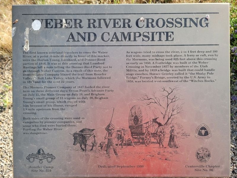
The Mormon Pioneer Company of 1847 forded the river here on three different days: Orson Pratt's Advance Party on July 15, the Main Group on July 19, and Brigham Young's small group of 15 wagons on July 20. Brigham Young's small group, which stayed with him because of his illness, camped 1/4 mile upstream from the crossing.
Both sides of the crossing were used as campsites by pioneer companies, and some who died were buried there. Fording the Weber River was dangerous.
As wagons tried to cross the river, 2 to 4 feet deep and 100 feet wide, many mishaps took place. A ferry or raft, run by the Mormons, was being used 825 feet above this crossing as early
this page online
Erected 1998 by Sons of Utah Pioneers. (Marker Number 86.)
Topics and series. This historical marker is listed in these topic lists: Bridges & Viaducts • Roads & Vehicles • Settlements & Settlers. In addition, it is included in the Daughters of Utah Pioneers series list. A significant historical year for this entry is 1846.
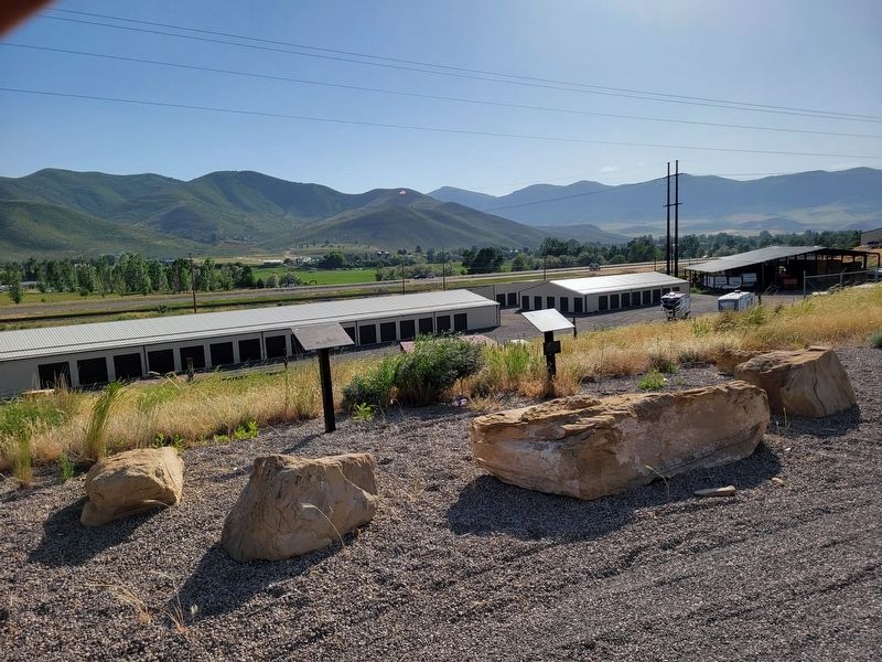
Location. 41° 0.738′ N, 111° 28.904′ W. Marker is in Henefer, Utah, in Summit County. It is on Old Highway 30, on the left when traveling north. Touch for map. Marker is at or near this postal address: 625 Old Hwy 30, Henefer UT 84033, United States of America. Touch for directions.

Regionally, this marker is in Utah’s Uinta Mountains, in the Wasatch Front, and in Greater Provo. It is also in the American Mountain West and on the Colorado Plateau. Globally, it is in North
Photographed by Jeremy Snow, June 20, 2025
2. Weber River Crossing and Campsite Marker
Other nearby markers. At least 8 other markers are within walking distance of this marker: Deputy Sheriff Rodney Badger Gave His Life (here, next to this marker); Weber Canyon Explorers Trail (approx. 0.4 miles away); Intersection of Old Pioneer Trail of 1847 and the Lincoln Highway (approx. 0.9 miles away); James and William Hennefer (approx. 0.9 miles away); Echo Gristmill (approx. 0.9 miles away); The Pioneer Camp (approx. 0.9 miles away); Native Americans (approx. 0.9 miles away); Over a Century of Building (approx. 0.9 miles away). Touch for a list and map of all markers in Henefer.
Credits. This page was last revised on July 6, 2025. It was originally submitted on July 6, 2025, by Jeremy Snow of Cedar City, Utah. This page has been viewed 117 times since then and 26 times this year. Photos: 1, 2. submitted on July 6, 2025, by Jeremy Snow of Cedar City, Utah. • Andrew Ruppenstein was the editor who published this page.
