Stafford in Fort Bend County, Texas — The American South (West South Central)
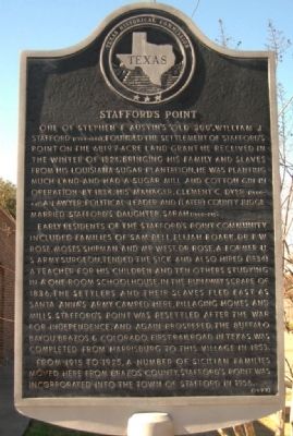
Stafford's Point
Photographed by Gregory Walker, January 22, 2010
1. Stafford's Point Marker
Early residents of the Stafford's Point community included families of Sam Bell, Elijah Roark, Dr. P. W. Rose, Moses Shipman, and Mr. West. Dr. Rose, a former U. S. Army surgeon, tended the sick and also hired (1834) a teacher for his children and ten others studying in a one-room schoolhouse. In the Runaway Scrape of 1836, the settlers and their slaves fled east as Santa Anna's Army camped here, pillaging homes and mills. Stafford's Point was resettled after the War for Independence, and again prospered. The Buffalo Bayou, Brazos & Colorado, first railroad in Texas, was completed from Harrisburg to this village in 1853.
From 1915 to 1925, a number of Sicilian families moved here from Brazos County. Stafford's Point was incorporated into the town of Stafford in 1956.
Erected 1977 by Texas Historical Commission. (Marker Number 9068.)
Topics. This historical marker is listed in these topic lists: African Americans • Agriculture • Industry & Commerce • Railroads & Streetcars • Science & Medicine • Settlements & Settlers • War, Texas Independence. A significant historical year for this entry is 1824.
Location. 29° 37.424′ N, 95° 34.985′ W. Marker is in Stafford, Texas, in Fort Bend County. It is at the intersection of Dulles Avenue and Viking Lane, on the right when traveling south on Dulles Avenue. Next to the
this page online

Regionally, this marker is in the Houston Metropolitan Area. It is also on the American Gulf Coast. Globally, it is in North America, a Gulf of Mexico state, the Western Hemisphere, the Western World, and the Anglosphere. Historically, it finds itself in what was once New Spain, the Republic of Texas, one of the Confederate States of America, and the Antebellum South.
Other nearby markers. At least 8 other markers are within 3 miles of this marker, measured as the crow flies: Paschal Paolo Borden (approx. 1.2 miles away); Stafford Plantation (approx. 1.2 miles away); William J. Stafford Cemetery (approx. 1.3 miles away); Court Hardware Company (approx. 1.6 miles away); Buffalo Bayou, Brazos & Colorado (approx. 1.8 miles away); Sugar Land First United Methodist Church (approx. 2.2 miles away); Stafford Municipal School District (approx. 2.8 miles away); Sugar Land Independent School District No. 17 (approx. 2.9 miles away).
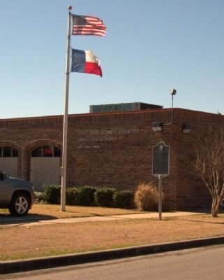
Photographed by Gregory Walker, January 22, 2010
2. Stafford's Point Marker next to library.
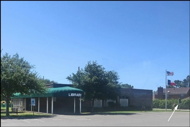
Photographed by Jim Evans, May 4, 2014
3. Stafford's Point Marker
Credits. This page was last revised on December 21, 2019. It was originally submitted on February 21, 2010, by Gregory Walker of La Grange, Texas. This page has been viewed 2,885 times since then and 149 times this year. Photos: 1, 2. submitted on February 21, 2010, by Gregory Walker of La Grange, Texas. 3. submitted on May 4, 2014, by Jim Evans of Houston, Texas. • Bill Pfingsten was the editor who published this page.
