
Chippawa in Niagara Falls in Niagara Region, Ontario — Central Canada (North America)
Ussher's Creek Bridge

Photographed by Kevin Westell, July 3, 2025
1. Ussher's Creek Bridge - Marker
Designed by Ellis Engineering. Built by Rankin Construction
Erected by Niagara Parks.
Topics. This historical marker is listed in these topic lists: Bridges & Viaducts • Parks & Recreational Areas • War of 1812. A significant historical year for this entry is 1911.
Location. 43° 3.059′ N, 79° 1.332′ W. Marker is in Niagara Falls, Ontario, in Niagara Region. It is in Chippawa. It is on Niagara River Parkway, on the right when traveling north. Touch for map. Marker is at or near this postal address: 8771 Niagara River Parkway, Niagara Falls ON L2G 0N8, Canada. Touch for directions.

Regionally, this marker is on Ontario’s Golden Horseshoe and in Niagara Canada. It is also in Central Canada. Globally, it is in North America, the Western
this page online
Other nearby markers. At least 8 other markers are within walking distance of this marker: The Battle of Chippawa (about 180 meters away, measured in a direct line); a different marker also named The Battle of Chippawa (about 210 meters away); a different marker also named Battle of Chippawa (approx. 0.2 kilometers away); Chippawa Battlefield Panel 6 (approx. 0.2 kilometers away); Chippawa Battlefield Panel 5 (approx. 0.2 kilometers away); Chippawa Battlefield Panel 4 (approx. 0.2 kilometers away); Chippawa Battlefield Panel 3 (approx. 0.2 kilometers away); Chippawa Battlefield Panel 2 (approx. 0.2 kilometers away). Touch for a list and map of all markers in Niagara Falls.
Photographed by Kevin Westell, July 3, 2025
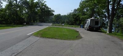
2. Ussher's Creek Bridge - Marker in context
Photo faces north. The marker just right of the bridge (distant left); at the north end of a little picnic area.
Photographed by Kevin Westell, July 3, 2025
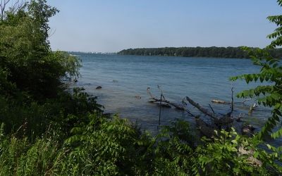
3. View of Navy Island's North End
Photo faces north. Past Navy Island is Niagara Falls, New York.
Credits. This page was last revised on July 6, 2025. It was originally submitted on July 6, 2025, by Kevin Westell of St. Catharines, Ontario. This page has been viewed 108 times since then and 11 times this year. Photos: 1, 2, 3. submitted on July 6, 2025, by Kevin Westell of St. Catharines, Ontario. • Andrew Ruppenstein was the editor who published this page.
