Presque Isle in Presque Isle County, Michigan — The American Midwest (Great Lakes)
Get Into Your Sanctuary
Photographed by Mark Parker, June 24, 2025
1. Get Into Your Sanctuary - Sanctuary Sentinels Marker
Get Into Your Sanctuary
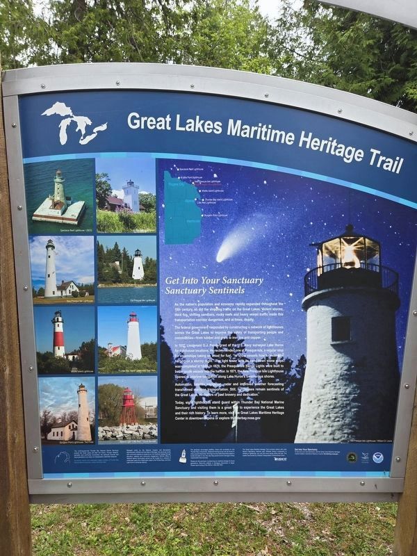
Sanctuary Sentinels
As the nation's population and economy rapidly expanded throughout the 19th century, so did the shipping traffic on the Great Lakes. Violent storms, thick fog, shifting sandbars, rocky reefs and heavy vessel traffic made this transportation corridor dangerous, and at times, deadly.
The federal government responded by constructing a network of lighthouses across the Great Lakes to improve the safety of transporting people and commodities — from lumber and grain to iron ore and copper.
In 1837, Lieutenant G.J. Pendergrast of the U.S. Navy surveyed Lake Huron for lighthouse locations. He recommended one at Presque Isle, a regular stop for steamships taking on wood for fuel, "to show vessels how to enter the harbor on a stormy night." The light tower with its hand-hewn stone steps was completed in 1840. In 1870, the Presque Isle Range Lights were built to better guide vessels into the harbor. In 1871, the New Presque Isle Lighthouse opened to improve navigation along Lake Huron's treacherous shores.
Automation, satellite navigation, radar and improved weather forecasting
this page online
Today, eight lighthouses stand guard within Thunder Bay National Marine Sanctuary and visiting them is a great wey to experience the Great Lakes and their rich history. To learn more, visit the Great Lakes Maritime Heritage Center in downtown Alpena or explore thunderbay.noaa.gov
Photo credit Old Presque Isle Lighthouse / William D. Lewis
(Lighthouses top left to bottom right)
Spectacle Reef lighthouse / USCG • New Presque Isle Lighthouse • Middle Island Lighthouse • Sturgeon Point Lighthouse / Ted Fines • Old Presque Isle Lighthouse • Thunder Bay Island Lighthouse / Bob Wick • Alpena Light "Little Red" Lighthouse / Chuck Bennett
The 4,300-square-mile Thunder Bay National Marine Sanctuary protects the Great Lakes and their rich history. Through research, education, and community involvement, the sanctuary endures that future generations can enjoy our irreplaceable underwater treasures.
Managed jointly by the National Oceanic and Atmospheric Administration (NOAA) and the State of Michigan, the sanctuary works with community partners to preserve our rich maritime heritage through education, research and community engagement. NOAA's Office of National Marine Sanctuaries serves as the trustee for a network of underwater parks from Washington state to the Florida Keys, and from Lake Huron to American Samoa. The sanctuary encourages paddlers, divers, and snorkelers to visit Thunder Bay's shipwrecks. Seasonal mooring buoys can be found on many popular shipwrecks. Moorings not only make shipwrecks easier to locate and safer to visit, they also help prevent anchor damage to these irreplaceable historical sites.
The Great Lakes Maritime Heritage Trail connects visitors with Lake Huron's fascinating maritime past. Whether, diving a shipwreck or climbing a lighthouse, you can find more storiess along the trail. This marker was funded by a federal Transportation Enhancement Grant and by the Northeast Michigan Council of Governments
Please join the sanctuary in preserving our maritime heritage for future generations. Removing artifacts or damaging shipwrecks is illegal. Please report looting to the DNR 1-800-292-7500.
All artwork, historic and underwater images courtesy of the Thunder Bay National Marine Sanctuary unless otherwise noted.
Get Into Your Sanctuary
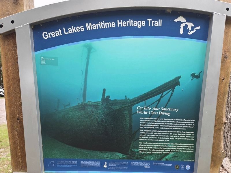
World-Class Diving
After
Photographed by Mark Parker, June 24, 2025
2. Get Into Your Sanctuary Marker - World Class Diving
Today, the Typo sits upright 9 miles from here in 180 feet of water. Still full of coal, this shipwreck provides an incredible opportunity to explore a 19th-century Great Lakes schooner. The schooner's intact forward mast towers above the wreck, while the main and mizzen masts lay broken and spread across the deck with other rigging. The Typo's bell still hangs at the foredeck and its anchors remain lashed to. the bow.
Deep or shallow, intact or broken up, all of Thunder Bay National Marine Sanctuary's shipwrecks offer unique recreational opportunities. Lake Huron's cold, fresh water preserves these special places, but we must do our part too. Get into your sanctuary and enfoy the adventure
Photographed by Mark Parker, June 24, 2025
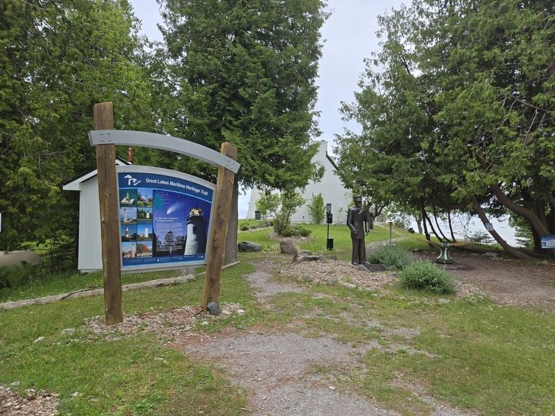
3. Get Into Your Sanctuary Marker near parking area, in trail to Old Presque Isle Lighthouse
Typo
Location: N45°17.475 W83°18.951
Depth:180'
Built: 1873
Lost: 1899
Length: 137'
hoto credit Typo Becky Kagan Schott
The 4,300-square-mile Thunder Bay National Marine Sanctuary protects the Great Lakes and their rich history. Through research, education, and community involvement, the sanctuary endures that future generations can enjoy our irreplaceable underwater treasures.
Managed jointly by the National Oceanic and Atmospheric Administration (NOAA) and the State of Michigan, the sanctuary works with community partners to preserve our rich maritime heritage through education, research and community engagement. NOAA's Office of National Marine Sanctuaries serves as the trustee for a network of underwater parks from Washington state to the Florida Keys, and from Lake Huron to American Samoa. The sanctuary encourages paddlers, divers, and snorkelers to visit Thunder Bay's shipwrecks. Seasonal mooring buoys can be found on many popular shipwrecks. Moorings not only make shipwrecks easier to locate and safer to visit, they also help prevent anchor damage to these irreplaceable historical sites.
The Great Lakes Maritime Heritage Trail connects visitors with Lake Huron's fascinating maritime past. Whether, diving a shipwreck or climbing a lighthouse, you can find more storiess along the trail. This marker was funded by a federal Transportation Enhancement Grant and by the Northeast Michigan Council of Governments
Please join the sanctuary in preserving our maritime heritage for future generations. Removing artifacts or damaging shipwrecks is illegal. Please report looting to the DNR 1-800-292-7500.
All artwork, historic and underwater images courtesy of the Thunder Bay National Marine Sanctuary unless otherwise noted.
Erected by Michigan Department of Natural Resources, Thunder Bay National Marine Sanctuaries, NOAA.
Topics and series. This historical marker is listed in these topic lists: Disasters • Waterways & Vessels. In addition, it is included in the Lighthouses, and the National Oceanic and Atmospheric Administration (NOAA) series lists. A significant historical date for this entry is October 14, 1899.
Location. 45° 20.534′ N, 83° 28.729′ W. Marker is in Presque Isle, Michigan, in Presque Isle County. It is on East Grand Lake Road 0.7 miles north of Range Light Lane, on the right when traveling north. From East Grand Lake Road, follow the dirt road 0.3 miles to the dead end. The marker is near the parking area. Touch for map. Marker is at or near this postal address: 5295 East Grand Lake Rd, Presque Isle MI 49777, United States of America. Touch for directions.

Regionally, this marker is in Northern Michigan Lower Peninsula and in one of the Lake Huron Shore counties. It is also in the American Midwest. Globally, it is in North America, in the Great North Woods, on the Great Lakes, in the Western Hemisphere, in the Western World, and in the Anglosphere. Historically, it finds itself in what was once the Northwest Territory.
Other nearby markers. At least 8 other markers are within walking distance of this marker: 1896 Lansing City Hall Bell (within shouting distance of this marker); Old Presque Isle Lighthouse (approx. ¼ mile away); Thunder Bay National Marine Sanctuary (approx. 0.3 miles away); Presque Isle Lighthouses (approx. 0.3 miles away); Presque Isle History (approx. 0.3 miles away); a different marker also named Get Into Your Sanctuary (approx. 0.6 miles away); L. M. Mason (approx. 0.6 miles away); Albany (approx. 0.6 miles away). Touch for a list and map of all markers in Presque Isle.
Credits. This page was last revised on July 12, 2025. It was originally submitted on July 7, 2025, by Mark Parker of Hickory, North Carolina. This page has been viewed 95 times since then and 25 times this year. Photos: 1, 2, 3. submitted on July 7, 2025, by Mark Parker of Hickory, North Carolina. • J. Makali Bruton was the editor who published this page.
