West Haven in South Central Region, Connecticut — The American Northeast (New England)
West Haven
Photographed by Michael Herrick, February 15, 2010
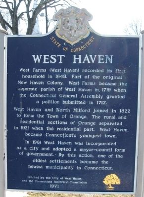
1. West Haven Marker
West Haven and North Milford joined in 1822 to for the Town of Orange. The rural and residential sections of Orange separated in 1921 when the residential part, West Haven became Connecticut's youngest town.
In 1961 West Haven was incorporated as a city and adopted a mayor – council form of government. By this action, one of the oldest settlements became the newest municipality in Connecticut.
Erected by the City of West Haven
and the Connecticut Historical Commission
1971
Erected 1971 by City of West Haven, Connecticut Historical Commission.
Topics. This historical marker is listed in these topic lists: Colonial Era • Settlements & Settlers. A significant historical year for this entry is 1648.
Location. 41° 16.345′ N, 72° 57.001′ W. Marker is in West Haven in South Central Region, Connecticut. It is at the intersection of Main Street and Campbell Avenue,
this page online

Regionally, this marker is in the Connecticut River Valley, on the Connecticut Shoreline, and in Greater New Haven. It is also in the American Northeast, in New England, and on the Eastern Seaboard. Globally, it is in the North Atlantic Region, North America, the Western Hemisphere, the Western World, and the Anglosphere. Historically, it finds itself in what was once New Haven County and also one of the original Thirteen Colonies.
Other nearby markers. At least 8 other markers are within walking distance of this marker: SSg Thomas E. Vitagliano (within shouting distance of this marker); West Haven World War I Monument (within shouting distance of this marker); West Haven Revolutionary War Memorial (about 500 feet away, measured in a direct line); West Haven Twilight League 1933 (approx. 0.7 miles away); Painter Park World War II Memorial (approx. 0.7 miles away); Soldiers’ and Sailors’ Monument
Photographed by Michael Herrick, February 15, 2010
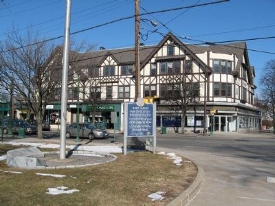
2. West Haven Marker
Also see . . .
1. West Haven, Connecticut on Wikipedia. (Submitted on February 21, 2010, by Michael Herrick of Southbury, Connecticut.)
2. City of West Haven. (Submitted on February 21, 2010, by Michael Herrick of Southbury, Connecticut.)
Credits. This page was last revised on May 19, 2026. It was originally submitted on February 21, 2010, by Michael Herrick of Southbury, Connecticut. This page has been viewed 1,781 times since then and 70 times this year. Photos: 1, 2. submitted on February 21, 2010, by Michael Herrick of Southbury, Connecticut.
