Niagara Falls in Niagara Region, Ontario — Central Canada (North America)
The Stranded Scow
August 6th, 1918

Photographed by Kevin Westell, July 3, 2025
1. Stranded Scow - Marker
Erected by the Niagara Parks Commission on the 100th anniversary of the rescue
Erected 2018 by Niagara Parks.
Topics. This historical marker is listed in this topic list: Waterways & Vessels. A significant historical year for this entry is 1918.
Location. 43° 4.238′ N, 79° 4.318′ W. Marker is in Niagara Falls, Ontario, in Niagara Region. It is on Niagara River Parkway close to Dufferin Isle Road. Touch for map. Marker is at or near this postal address: 7530 Niagara River Parkway, Niagara Falls ON L2E 6X8, Canada. Touch for directions.

Regionally,
this page online
Other nearby markers. At least 8 other markers are within walking distance of this marker: Burch’s Mills (about 90 meters away, measured in a direct line); Gate House (about 210 meters away); Toronto Power Generating Station (about 240 meters away); Ontario Power Screen House (approx. 0.3 kilometers away); Niagara Park Greenhouses (approx. 0.4 kilometers away); Bridgewater Mills (approx. half a kilometer away); William Birch Rankine Hydro-Electric Power Station (approx. 0.8 kilometers away); Wm. B. Rankine (approx. 0.8 kilometers away). Touch for a list and map of all markers in Niagara Falls.
Another marker is no longer nearby. Stranded Scow (was here, next to this marker but has been replaced with another marker now near it).
More about this marker.

Photographed by Kevin Westell, July 3, 2025
2. Stranded Scow - Marker in context
Photo faces north. Marker is adjacent to the Trans-Canada trail. Part of the scow is visible, left of the three walkers (distant right-of-centre). The mist cloud is rising from the Canadian falls, 400 metres north. When the marker's pedestal was originally placed here, it was near the scow; but, the scow moved further downstream in recent years.
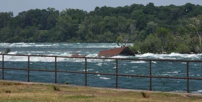
Regarding The Stranded Scow. Recently (2019 and 2022 events), the scow has broken up more, moved 50 metres north (downstream) and rotated.
Photographed by Kevin Westell, July 3, 2025
3. Stranded Scow in 2025
The two rusty flat pieces used to be one side of the scow, now tipped up 45 degrees. During recent years (2019, 2022), the scow rotated 180 degrees, so effectively moved downstream; and broke up more.
Photographed by J. J. Prats, October 15, 2014
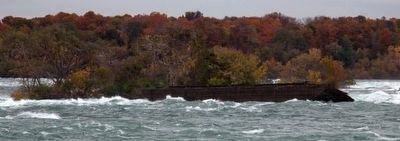
4. Stranded Scow in 2014
In 2014, the scow was all in one piece, in virtually the same position it originally grounded in, during the epic event in 1918.
Oil by Winslow Homer, 1884
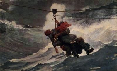
5. "The Life Line"
This painting depicts the usage of a breeches buoy.
(From the George Elkins Collection at the Philadelphia Museum of Art; image from Wikipedia Commons.)
Credits. This page was last revised on September 26, 2025. It was originally submitted on July 9, 2025, by Kevin Westell of St. Catharines, Ontario. This page has been viewed 113 times since then and 28 times this year. Photos: 1, 2, 3, 4, 5. submitted on July 9, 2025, by Kevin Westell of St. Catharines, Ontario. • Andrew Ruppenstein was the editor who published this page.
