Near Crow Wing in Crow Wing County, Minnesota — The American Midwest (Upper Plains)
Roughnecks and River Pigs
Photographed by McGhiever, June 28, 2025
1. Roughnecks and River Pigs Marker
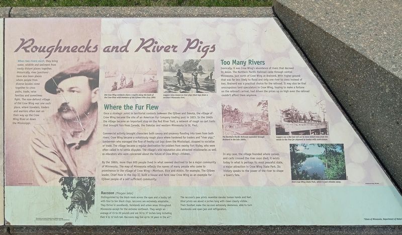
When two rivers meet, they bring water, wildlife and sediment from vastly distant places together. Historically, river junctions have also been places where people from diverse locales come together to cross paths, trade, raise families and sometimes fight. The now-defunct village of Old Crow Wing was one such place, where travelers, traders and warriors often met on their way up the Crow Wing River or down the Mississippi.
Old Crow Wing residents share a respite along the bank of the Crow River with members of the Ojibwe tribe circa 1860.
Loggers (also known as river pigs) float logs down a northern Minnesota river.
Where the Fur Flew
Once a strategic point in territorial contests between the Ojibwe and Dakota, the village of Crow Wing became the site of an American Fur Company trading post in 1823. In the 1840s the village became an important stop on the Red River Trail, a network of rough ox cart trails that brought furs from Canada, the Dakotas and western Minnesota to St. Paul.
Commercial activity brought characters both savory and unsavory flooding into town from both rivers. Crow Wing became a notoriously
this page online
By the 1860's, more than 600 people lived in what seemed destined to be a major community of Minnesota. The map of Minnesota reflects the names of many people who came to prominence in the village of Crow Wing—Morrison, Rice and Aitkin, for example. The Ojibwe leader, Chief Hole in the Day II, built a house and farm near Crow Wing as an example for Ojibwe people of a self sufficient community.
Too Many Rivers
Ironically, it was Crow Wing's abundance of rivers that decreed its doom. The Northern Pacific Railroad came through central Minnesota, just north of Crow Wing at Brainerd. With higher ground that was far less likely to flood and only one river to cross instead of two, Brainerd was a practical choice for
Photographed by McGhiever, June 28, 2025
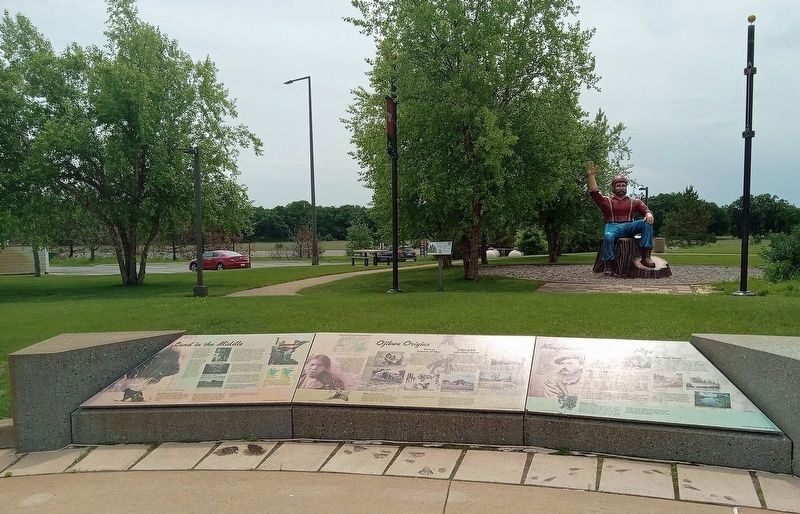
2. Roughnecks and River Pigs Marker (right) at the Brainerd Lakes Welcome Center
The Northern Pacific Railroad expanded through Brainerd in the late 1800s.
Loggers use a flat bed rail car to move felled trees from the woods to the river for shipment to lumber mills downstream.
In any case, the village founded where canoes and carts crossed the river soon died; it exists today in what is perhaps its most peaceful state, a major attraction in Crow Wing State Park. Its history speaks to the power of the river to shape a town's fate.
Visit Crow Wing State Park, which is just minutes away.
Raccoon (Procyon lotor)
Distinguished by the black mask across the eyes and a bushy tail with four to ten black rings, raccoons are extremely adaptable. They thrive in woodlands, farmlands and urban areas throughout Minnesota except for the extreme northeast. They weigh an average of 15 to 20 pounds and are 30 to 37 inches long including their 9 to 12 inch tail. Raccoons may live up to 16 years in the wild.
The raccoon's paw prints resemble slender human hands and feet. Hind prints are about 4 inches long with claws clearly visible. Their forefeet make the raccoon extremely dexterous, able to turn doorknobs and open jars and refrigerators.
Topics. This historical marker is listed in these topic lists: Industry & Commerce • Railroads & Streetcars • Settlements & Settlers • Waterways & Vessels. A significant historical year for this entry is 1823.
Location. 46° 15.626′ N, 94° 19.159′ W. Marker is near Crow Wing, Minnesota, in Crow Wing County. It can be reached from the intersection of N. Koering Road and Minnesota Highway 371. The marker is at the Explore Brainerd Lakes Welcome Center and Rest Area. Touch for map. Marker is at or near this postal address: 7053 N Koering Road, Brainerd MN 56401, United States of America. Touch for directions.

Regionally, this marker is in the Northland. It is also in the American Midwest, in the Corn Belt, and in the Great River Road Region. Globally, it is in North America, the Great North Woods, the Western Hemisphere, the Western World, and the Anglosphere. Historically, it finds itself in what was once Rupert’s Land, the territory of the Mississippian Culture, and the Northwest Territory.
Other nearby markers. At least 8 other markers are within walking distance of this marker: Ojibwe Origins (here, next to this marker); Land in the Middle (here, next to this marker); Paul Bunyan Statue (a few steps from this marker); Lakes on the Plains (a few steps from this marker); Hunting Hospitality (a few steps from this marker); Entrepreneurs and Upstarts (a few steps from this marker); Lumberjack Legend (a few steps from this marker); Mississippi Crossings (within shouting distance of this marker). Touch for a list and map of all markers in Crow Wing.
Credits. This page was last revised on July 9, 2025. It was originally submitted on July 9, 2025, by McGhiever of Minneapolis, Minnesota. This page has been viewed 123 times since then and 28 times this year. Photos: 1. submitted on July 9, 2025, by McGhiever of Minneapolis, Minnesota. 2. submitted on July 6, 2025, by McGhiever of Minneapolis, Minnesota.
