Crosby in Crow Wing County, Minnesota — The American Midwest (Upper Plains)
Croft Mine Historical Park
| — | Northeast Minnesota: The Wild North | — |
Photographed by McGhiever, June 27, 2025
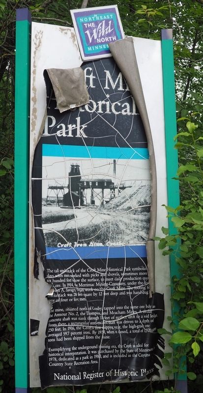
1. Croft Mine Historical Park Marker
The tall smokestack of the Croft Mine Historical Park symbolizes the days when men worked with picks and shovels, sometimes more than six hundred feet below the surface, to meet daily production quotas of iron ore. In 1914, the Merrimac Mining Company, under the leadership of John A. Savage, began work on the Croft Mine. The footing for the smokestack was 28 feet square by 12 feet deep and was hand-dug by a crew of four or five men.
The mine, situated north of Crosby, tapped into the same ore body as the Armour No. 2, the Thompson, and Meacham Mines. A circular concrete shaft was sunk through 110 feet of surface drift to a solid ledge. From there, a rectangular steel-encased shaft was driven to a depth of 250 feet. In 916, the Croft's first shipping year, the high-grade ore averaged 59.7 percent iron. By 1934, when it closed, a total of 1,700,699 tons had been shipped from the mine.
Exemplifying the underground mining era, the Croft is ideal for historical interpretation. It was purchased by the State of Minnesota in 1978, dedicated as a park in 1980, and is included in the Cuyuna Country State Recreation Area.
Topics. This historical marker is listed in these topic lists: Industry & Commerce • Parks & Recreational Areas. A significant historical year for this entry is 1914.
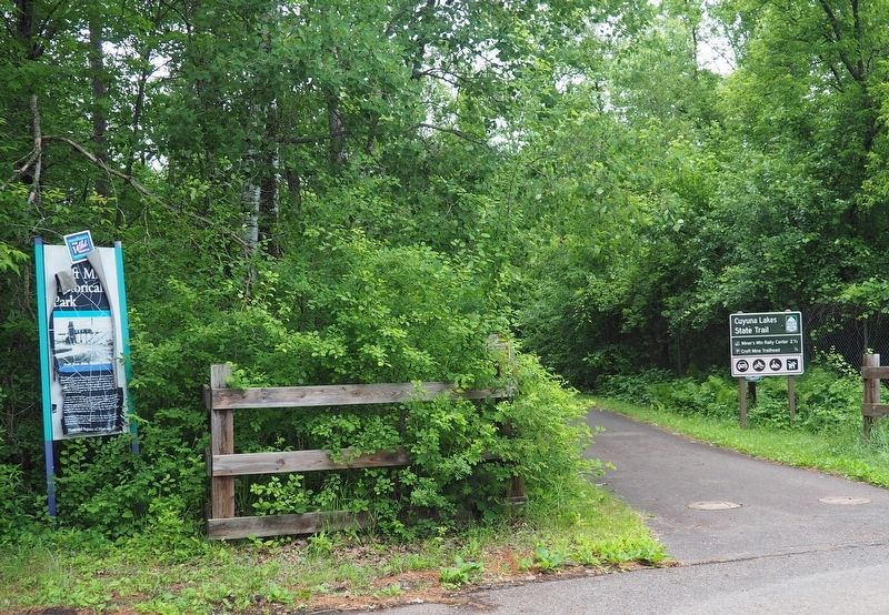
Location. 46° 29.368′ N, 93° 57.059′ W. Marker is in Crosby, Minnesota, in Crow Wing County. It is on 8th Street NE when traveling west. The marker is at the west end of 8th Street NE where it turns into a parking lot for the Cuyuna Lakes State Trail. Touch for map. Marker is in this post office area: Crosby MN 56441, United States of America. Touch for directions.

Regionally, this marker is in the Northland. It is also in the American Midwest, in the Corn Belt, and in the Great River
this page online
Other nearby markers. At least 8 other markers are within walking distance of this marker: Portsmouth Mine (approx. 0.3 miles away); a different marker also named Portsmouth Mine (approx. 0.3 miles away); a different marker also named Portsmouth Mine (approx. 0.3 miles away); Deerwood Mail Cart (approx. 0.4 miles away); Soo Line Depot (approx. 0.4 miles away); Fitger Brewing Company (approx. 0.4 miles away); Crosby Veterans Memorial (approx. 0.7 miles away); Cuyuna Range Veterans Memorial (approx. 0.8 miles away). Touch for a list and map of all markers in Crosby.
More about this marker. The marker is deteriorating badly.
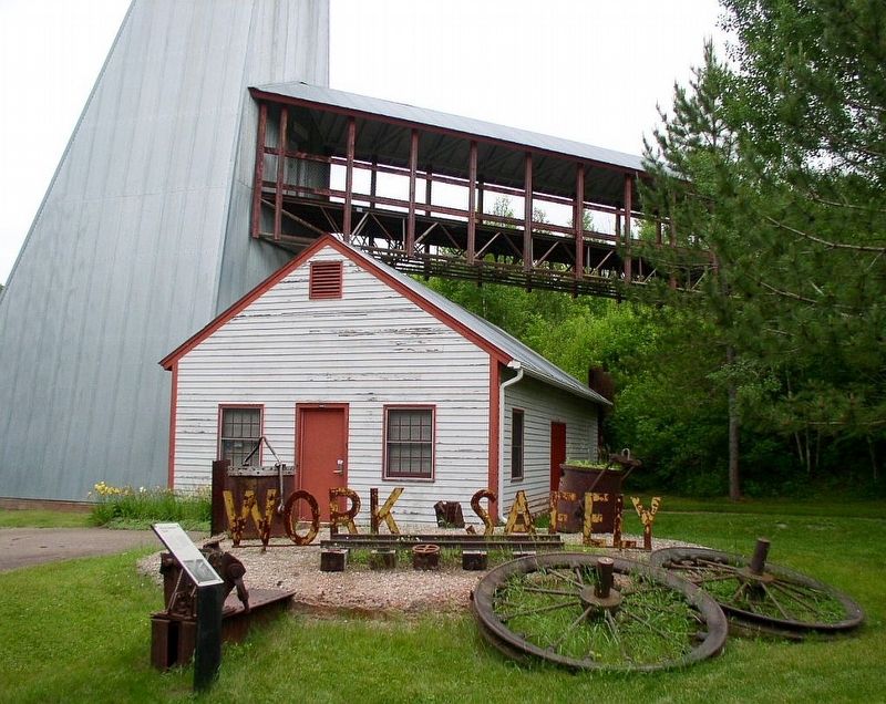
Regarding Croft Mine Historical Park. Croft Mine Historical Park has been closed for years and the site is fenced off. Despite the claim on the marker, it is not listed on the National Register of Historic Places.
Photographed by McGhiever, June 27, 2025
2. Croft Mine Historical Park Marker at the eastern terminus of the Cuyuna Lakes State Trail
Photographed by McGhiever
3. Croft Mine Historical Park when it was open to the public
Credits. This page was last revised on July 9, 2025. It was originally submitted on July 9, 2025, by McGhiever of Minneapolis, Minnesota. This page has been viewed 758 times since then and 290 times this year. Photos: 1, 2, 3. submitted on July 9, 2025, by McGhiever of Minneapolis, Minnesota.
