Waterloo in Black Hawk County, Iowa — The American Midwest (Upper Plains)
Waterloo River Lights Experience
Prairie Pathways - An Interpretive Journey
Photographed by Jason Voigt, June 18, 2025
1. Waterloo River Lights Experience Marker
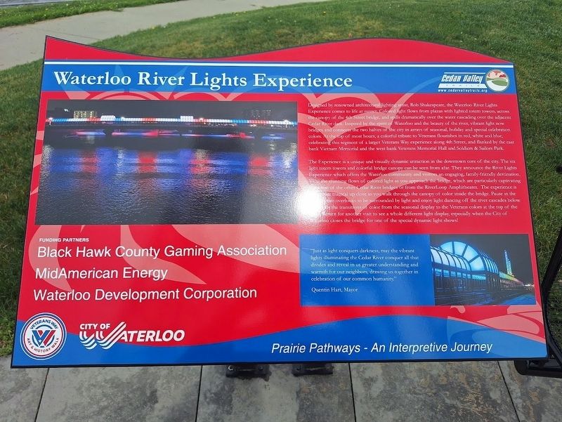
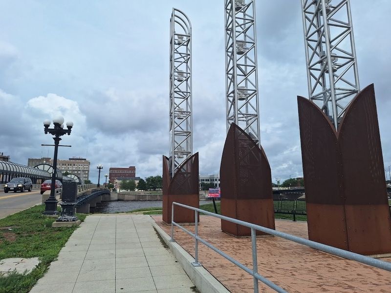
Designed by renowned architectural lighting artist, Rob Shakespeare, the Waterloo River Lights Experience comes to life at sunset. Colored light flows from plazas with lighted totem towers, across the canopy of the 4th Street bridge, and spills dramatically over the water cascading over the adjacent Cedar River dam. Inspired by the spirit of Waterloo and the beauty of the river, vibrant light now bridges and connects the two halves of the city in arrays of seasonal, holiday and special celebration colors. At the top of most hours, a colorful tribute to Veterans flourishes in red, white and blue, celebrating the segment of a larger Veterans Way experience along 4th Street, and flanked by the east bank Vietnam Memorial and the west bank Veterans Memorial Hall and Soldiers & Sailors Park.
The Experience is a unique and visually dynamic attraction in the downtown core of the city. The six light totem towers and colorful bridge canopy can be seen from afar. They announce the River Lights Experience which offers the Waterloo community and visitors an engaging, family-friendly destination. View the stunning flows of colorful
this page online
(side quote:)
"Just as light conquers darkness, may the vibrant lights illuminating the Cedar River conquer all that divides and reveal in us greater understanding and warmth for our neighbors, drawing us together in celebration of our common humanity."
Quentin Hart, Mayor
Erected by Cedar Valley Trails.
Topics. This historical marker is listed in these topic lists: Bridges & Viaducts • Entertainment • Waterways & Vessels.
Location. 42° 29.765′ N, 92° 20.322′ W.
Photographed by Jason Voigt, June 18, 2025
2. Waterloo River Lights Experience Marker

Regionally, this marker is in the American Midwest and in the Corn Belt. Globally, it is in North America, the Western Hemisphere, the Western World, and the Anglosphere. Historically, it finds itself in what was once the territory of the Mississippian Culture and also the Louisiana Purchase.
Other nearby markers. At least 8 other markers are within 7 miles of this marker, measured as the crow flies: West Side Story / Honoring Our Veterans (a few steps from this marker); Replica of the Statue of Liberty (within shouting distance of this marker); USS Frank E. Evans DD754 (within shouting distance of this marker); Sans Souci Island (approx. 1.8 miles away); a different marker also named Replica of the Statue of Liberty (approx. 5.7 miles away); Cedar Falls Freedom Rock Veterans Memorial (approx. 5.7 miles away); Clay Street Park (approx. 5.9 miles away); Overman Park (approx. 6.2 miles away). Touch for a list and map of all markers in Waterloo.
Credits. This page was last revised on July 11, 2025. It was originally submitted on July 11, 2025, by Jason Voigt of Glen Carbon, Illinois. This page has been viewed 93 times since then and 15 times this year. Photos: 1, 2. submitted on July 11, 2025, by Jason Voigt of Glen Carbon, Illinois.
