
Ball's Falls in Lincoln in Niagara Region, Ontario — Central Canada (North America)
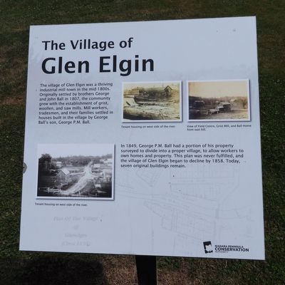
The Village of Glen Elgin
Photographed by Kevin Westell, July 11, 2025
1. The Village of Glen Elgin - Marker
In 1849, George P.M. Ball had a portion of his property surveyed to divide into a proper village, to allow workers to own homes and property. This plan was never fulfilled, and the village of Glen Elgin began to decline by 1858. Today, seven original buildings remain.
Erected by Niagara Peninsula Conservation Authority.
Topics. This historical marker is listed in these topic lists: Colonial Era • Settlements & Settlers. A significant historical year for this entry is 1807.
Location. 43° 8.01′ N, 79° 22.947′ W. Marker is in Lincoln, Ontario, in Niagara Region. It is in Ball's Falls. It is on Sixth Avenue, on the right when traveling west. Panel is steps from Sixth Ave, adjacent to a walking path, south east of the old church. Touch for map. Marker is at or near
this page online

Regionally, this marker is on Ontario’s Golden Horseshoe and in Niagara Canada. It is also in Central Canada. Globally, it is in North America, on the Great Lakes, in the Western Hemisphere, in the Western World, and in the Anglosphere. Historically, it finds itself in what was once a British colony, the Viceroyalty of New France, the Haudenosaunee (Iroquois) Confederacy, and Rupert’s Land.
Other nearby markers. At least 8 other markers are within walking distance of this marker: St. George Anglican Church 1864 (here, next to this marker); Glen Elgin Settlement - Ball's Falls (a few steps from this marker); Fairchild Cabin c. 1800s (within shouting distance of this marker); The Ball Home 1846 (within shouting distance of this marker); Ball's Grist-Mill (within shouting distance of this marker); The Blacksmith Shop c. 1850s (within shouting distance of this marker); The Saw Mill 1816 (about 90 meters away, measured in a direct line); The Grist Mill 1809 (about 90 meters away). Touch for a list and map of all markers in
Photographed by Kevin Westell, July 11, 2025
2. The Village of Glen Elgin - Marker in context
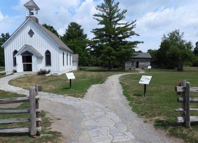
Photo faces north from Sixth Avenue. This marker is on the right side of the gravel chip walking path.
More about this marker. The marker is within Ball's Falls Conservation Area, along a walking path, 5 metres north of the road Sixth Avenue.
Regarding The Village of Glen Elgin. 1. The current "Glen Elgin" is a collection of early buildings clustered within Ball's Falls Conservation Area. Some were not from the original Glen Elgin settlement; but were moved here from nearby communities.
2. Here is one map of the buildings: https://npca.ca/images/uploads/trail-maps/Balls_Falls_2023_TRAIL_BROCHURE-colour.pdf
Credits. This page was last revised on July 19, 2025. It was originally submitted on July 12, 2025, by Kevin Westell of St. Catharines, Ontario. This page has been viewed 114 times since then and 37 times this year. Photos: 1, 2. submitted on July 12, 2025, by Kevin Westell of St. Catharines, Ontario. • Andrew Ruppenstein was the editor who published this page.
