Near Raymond in Madera County, California — The American West (Pacific Coastal)
Yosemite Stage Route
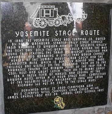
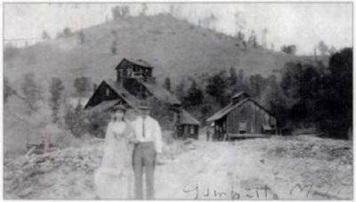
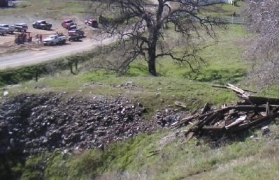
In 1886 the Yosemite Stage and Turnpike Co. owned by Henry Washburn started daily stage service from Raymond to Wawona and on to Yosemite Valley. The next day only the wealthy could afford the $45 round trip exiting the train at Wildcat Junction aka Raymond and boarding a stage that would change horses at Summit House, Grub Gulch, and the Gambetta Mine which is directly behind you. Mine tailings are visible on the mountain. Then on to the Ahwahnee Tavern, the midway point of the trip for a cool rest and great lunch. Then on to Miami Lodge for a fresh team of horses and ending at the Wawona Hotel after a 12 hour stage ride. Completion of the Yosemite Valley Railroad in 1906 and later Highway 140 put an end to the stage runs.
by E Clampus Vitus chapters Grub Gulch 41-49, James Savage 1852, and Dr. Samuel Greg George 1855.
Erected 2009 by E Clampus Vitus. (Marker Number 1.)
Topics and series. This historical marker is listed in these topic lists: Industry & Commerce • Roads & Vehicles. In addition, it is included in the E Clampus Vitus series list. A significant historical date for this entry is April 25, 1865.
Location. 37° 19.267′ N, 119° 46.917′ W. Marker is near Raymond , California, in Madera County. Marker is on Road 600, 9 miles west of State Highway 41, on the left when traveling west. Located 10 miles east of Raymond on Road 600, and 8 to 9 miles west of the junction with Highway 41. Touch for map. Marker is in this post office area: Raymond CA 93653, United States of America. Touch for directions.
Other nearby markers. At least 8 other markers are within 7 miles of this marker, measured as the crow flies. Grub Gulch (approx. 0.7 miles away); Shay's Blacksmith Shop & Canary Cottage (approx. 2 miles away); Gertrude School (approx. 3˝ miles away); Wassama Roundhouse (approx. 4.6 miles away); Wassama Village (approx. 4.9 miles away); Ahwahnee Tavern (approx. 4.9 miles away); Coarsegold (approx. 6.1 miles away); Highway 49 - The Golden Chain (approx. 6.9 miles away).
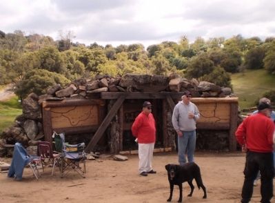
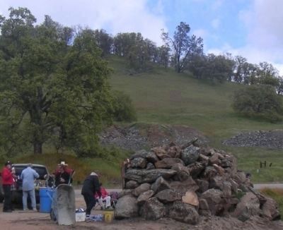
More about this marker. Although the monument commemorates the Yosemite Stage route, the monument is modeled to look like the entrance to a mine. This is to recognize the nearby Gambetta Mine and town of Grub Gulch where most of the local miners lived. The monument uses several tons of local granite and has fooled some that have passed by believing it to actually be a closed mine shaft. The "wings" on either side of the realistic looking mine entrance have maps showing the locations of all the local stage stops along the Raymond to Yosemite route.
Regarding Yosemite Stage Route.
President Theodore Roosevelt once took the train to Wild Cat Station (Raymond) and took the stage on to Yosemite. It is believed that this visit to Yosemite helped lead him to start the National Parks System.
Related markers. Click here for a list of markers that are related to this marker. To better understand the relationship, study each marker in the order shown.
Also see . . . The Roads & Trails to Yosemite. Photos and history of the stage routes to Wawona and the Yosemite Valley. (Submitted on February 23, 2010.)
Credits. This page was last revised on August 1, 2020. It was originally submitted on February 22, 2010, by Lester J Letson of Fresno, California. This page has been viewed 2,072 times since then and 73 times this year. Photos: 1, 2, 3, 4. submitted on February 22, 2010, by Lester J Letson of Fresno, California. 5. submitted on February 25, 2010, by Lester J Letson of Fresno, California. • Syd Whittle was the editor who published this page.
