Near Higginsville in Lafayette County, Missouri — The American Midwest (Upper Plains)
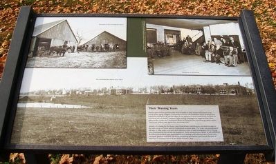
Their Waning Years
Photographed by William Fischer, Jr., November 11, 2015
1. Their Waning Years Marker
Without government pensions like those available to their former adversaries in the Union Army, aging, indigent Confederate veterans with disabilities relied on family and friends for assistance. By the late 1880s, it was apparent that the burden was too great for individual acts of charity. A massive fund-raising campaign was waged and like other states farther south, the Confederate Home of Missouri was conceived as a place where, "worn-out soldiers may spend their declining years."
Initially all funding for the home came from private contributions solicited throughout the state, from ex-Union and ex-Confederate veterans alike. The home was incorporated on Aug. 17, 1889, and a year later more than 300 acres of land belonging to Grove Young were purchased as the site for the institution. Early administrators aimed at self-sufficiency. Residents performed some maintenance on buildings and helped produce food in the orchards, gardens and farm. However, mounting operational costs forced the state of Missouri to assume control of the home on June 1, 1897.
Erected by Missouri State Parks.
Topics. This historical
this page online
Location. Marker has been permanently removed. It was located near 39° 5.873′ N, 93° 43.411′ W. Marker was near Higginsville, Missouri, in Lafayette County. It could be reached from Inner Loop Road, on the left when traveling north. Marker is near the pavilion on the Confederate Memorial State Historic Site grounds, with loop road entrance near MO Routes 213 and 20. Touch for map. Marker was in this post office area: Higginsville MO 64037, United States of America.
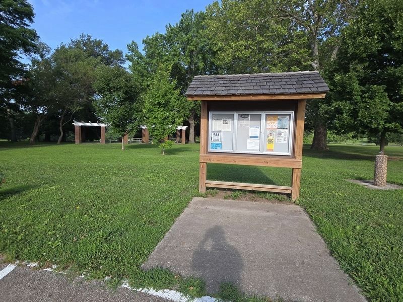
We have been informed that this marker is no longer there and will not be replaced. This page is an archival view of what was.
Regionally, this marker was in the Missouri River Corridor. It was also in the American Midwest, in the Lewis & Clark Corridor, in the Corn Belt, and on the Santa Fe Trail Corridor. Globally, it was in North America, the Western Hemisphere, the Western World, and the Anglosphere. Historically, it found itself in what was once the territory of the Mississippian Culture, the Louisiana Purchase, and the Antebellum

Photographed by William Fischer, Jr., November 11, 2015
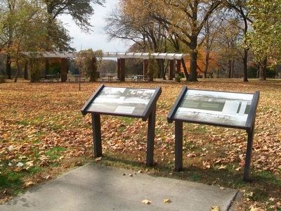
2. Their Waning Years and Confederate Memorial Park Markers
Other nearby markers. At least 8 other markers are within walking distance of this location: Missouri's Confederate Home (here, next to this marker); Confederate Soldiers' Monument (within shouting distance of this marker); Confederate Home Chapel Restoration (approx. 0.3 miles away); Confederate Memorial State Historic Site (approx. 0.3 miles away); Confederate States of America - National Flags (approx. 0.3 miles away); Our Confederate Dead (approx. 0.3 miles away); Confederate States of America - Battle Flags (approx. 0.3 miles away); Lion of Lucerne (approx. 0.3 miles away). Touch for a list and map of all markers in Higginsville.
Other markers no longer nearby. Confederate Memorial Park (was here, next to this marker but has been permanently removed); The Confederate Home of Missouri (was approx. 0.3 miles away but has been permanently removed); Cottage Row [and] The Confederate Home Chapel (was approx. 0.3 miles away but has been permanently removed).
Also see . . . Confederate Memorial State Historic Site. Missouri State Parks website entry (Submitted on November 25, 2015, by William Fischer, Jr. of Reynoldsburg, Ohio.)
Photographed by Mark Parker, July 5, 2025
3. Their Waning Years Marker replaced by a kiosk
Credits. This page was last revised on December 16, 2025. It was originally submitted on November 25, 2015, by William Fischer, Jr. of Reynoldsburg, Ohio. This page has been viewed 443 times since then and 25 times this year. Last updated on July 13, 2025, by Mark Parker of Hickory, North Carolina. Photos: 1, 2. submitted on November 25, 2015, by William Fischer, Jr. of Reynoldsburg, Ohio. 3. submitted on July 13, 2025, by Mark Parker of Hickory, North Carolina. • Devry Becker Jones was the editor who published this page.
