Piqua in Miami County, Ohio — The American Midwest (Great Lakes)
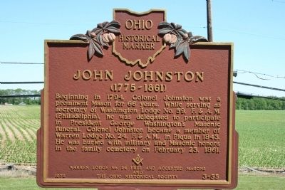
John Johnston
(1775 - 1861)
| — | Ohio Historical Marker | — |
Photographed by Dale K. Benington, June 5, 2009
1. John Johnston Marker
Erected 1978 by Warren Lodge No. 24 Free and Accepted Masons and The Ohio Historical Society. (Marker Number 3-55.)
Topics and series. This historical marker is listed in these topic lists: Cemeteries & Burial Sites • Fraternal or Sororal Organizations. In addition, it is included in the Ohio Historical Society / The Ohio History Connection series list. A significant historical month for this entry is February 1869.
Location. Marker has been reported missing. It was located near 40° 10.771′ N, 84° 15.745′ W. Marker was in Piqua, Ohio, in Miami County. It was on North Hardin Road 0.1 miles Ohio Route 66, on the right when traveling north. This historical marker is located immediately in front of the Piqua Historic Area,
this page online

Regionally, this marker was in the Dayton Metro, in the Miami Valley, and in the Till Plains. It was also in the American Midwest and in the Corn Belt. Globally, it was in North America, the Western Hemisphere, the Western World, and the Anglosphere. Historically, it found itself in what was once the Haudenosaunee (Iroquois) Confederacy, the territory of the Mississippian Culture, and the Northwest Territory.
Other nearby markers. At least 8 other markers are within walking distance of this location: Pickawillany (here, next to this marker); In Commemoration of the 94th & 110th Reg’s. O.V.I. (here, next to this marker); Public History Movement (here, next to this marker); Indian Agency House (a few steps from this marker); Johnston Barn (approx. ¼ mile away); Prehistoric Indian Mound (approx. ¼ mile away); The Cider House (approx. ¼ mile away); The Courtyard (approx. ¼ mile away). Touch for a list and map
Photographed by Dale K. Benington, June 5, 2009
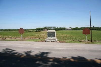
2. John Johnston Marker
View of historical marker, along with two other markers, along the east side of North Hardin Road, with a view of the John Johnston farm (Piqua Historic Area) in the background.
Other markers no longer nearby. Battle of Pickawillany (was here, next to this marker but has been confirmed missing); Fort Pickawillany (was here, next to this marker but has been confirmed missing).
Also see . . . Piqua Historic Area. This web link was both published and made available by, "Touring Ohio." (Submitted on January 23, 2010, by Dale K. Benington of Toledo, Ohio.)
Photographed by Dale K. Benington, June 5, 2009
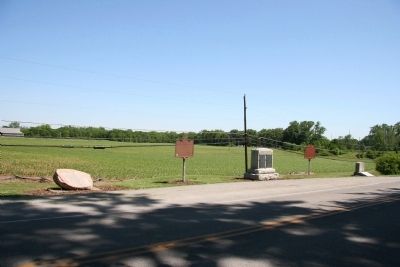
3. John Johnston Marker
Another view of this historical marker, along with other markers, along the east side of North Hardin Road, with a view of the John Johnston farm (Piqua Historic Area) in the background.
Photographed by Dale K. Benington, June 5, 2009
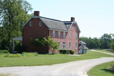
4. John Johnston Home
View of the John Johnston home which is located in the Piqua Historical Area.

Photographed by Trevor L Whited, July 13, 2025
5. John Johnston Marker
The post remains, but the marker is missing
Credits. This page was last revised on July 16, 2025. It was originally submitted on January 23, 2010, by Dale K. Benington of Toledo, Ohio. This page has been viewed 1,694 times since then and 59 times this year. Last updated on July 13, 2025, by Trevor L Whited of Kokomo, Indiana. Photos: 1, 2, 3, 4. submitted on January 23, 2010, by Dale K. Benington of Toledo, Ohio. 5. submitted on July 13, 2025, by Trevor L Whited of Kokomo, Indiana. • Devry Becker Jones was the editor who published this page.
