
City Centre in Kingston upon Hull, England, United Kingdom — Northwestern Europe (the British Isles)
Amy Johnson's Famous Flight, May 1930
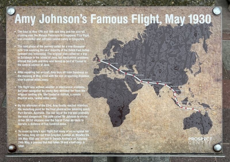
Photographed by Ray Gurganus, April 15, 2025
1. Amy Johnson's Famous Flight, May 1930 Marker
• The next phase of the journey called for a one-thousand-mile trek covering the vast majority of the Dutch East Indies (present day Indonesia). The original plan called for a trip to Surabaya in the island of Java, but mechanical problems altered that path and Amy was forced to land at Tjomal in the central section of Java.
• After repairing her aircraft, Amy took off from Surabaya on the morning of May 22nd with the aim of reaching Atambua, nine hundred miles away.
• The flight was without weather or mechanical problems, but pour navigation by young Amy deviated her from the original landing site, She landed at Haliluk, a remote tropical area, twelve miles away.
• By the afternoon of the 23rd, Amy finally reached Atambua, the launching point for the final phase of her amazing quest, Port Darwin, Australia. The last leg of the trip was probably the most dangerous. The path called for Johnson to cruise in her OH.60 airplane over the Sea of
this page online
• To round up Amy's epic flight that many of us recognise her for today, Amy set out from Croydon, London on Monday the 5th May 1930 and arrived in Darwin Australia on Saturday 24th May, a journey that had taken 19 and a half days in total.
Topics. This historical marker is listed in these topic lists: Air & Space • Women. A significant historical date for this entry is May 17, 1930.
Location. 53° 44.77′ N, 0° 20.589′ W. Marker is in Kingston upon Hull, England. It is in City Centre. It is on Prospect Street. Touch for map. Marker is at or near this postal address: 74 Prospect St, Kingston upon Hull, England HU1 3RT, United Kingdom. Touch for directions.

Regionally, this marker is in England’s Yorkshire & The Humber. Globally, it is on the Atlantic Ocean, in the North Atlantic Region, in Europe, in Atlantic Europe, on one of the British Isles, in the Western World, and in the Anglosphere. Historically, it finds itself in what was once the Roman Empire.
Other nearby markers. At least 7 other markers are within 13 kilometers of this marker, measured as the crow flies: Amy Johnson, 1903-1941 (here, next to this marker); The Story of the Neptune Inn (approx. 0.6 kilometers away); Old Grammar School (approx. 0.7 kilometers away); Hull General Cemetery (approx. 1.6 kilometers away); The Spring Bank West Quaker Burial Ground (approx. 1.7 kilometers away); Welcome to Beverley (approx. 11.7 kilometers away); Beverley Station History (approx. 11.9 kilometers away).
Credits. This page was last revised on July 14, 2025. It was originally submitted on July 14, 2025, by Ray Gurganus of Washington, District of Columbia. This page has been viewed 76 times since then and 14 times this year. Photo 1. submitted on July 14, 2025, by Ray Gurganus of Washington, District of Columbia. • Andrew Ruppenstein was the editor who published this page.
