Lyons in Wayne County, New York — The American Northeast (Mid-Atlantic)
The Erie Canal
Photographed by Paige Miller, October 11, 2008
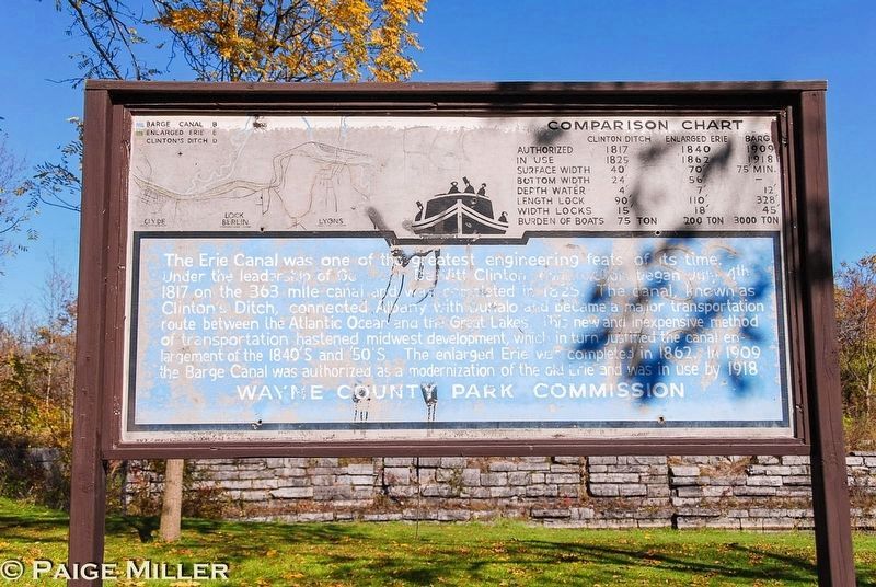
1. The Erie Canal Marker
The Erie Canal was one of the greatest engineering feats of its time. Under the leadership of Governor DeWitt Clinton construction began July 4th 1817 on the 363 mile canal and was completed in 1825. The canal, known as Clinton's Ditch, connected Albany with Buffalo and became a major transportation route between the Atlantic Ocean and the Great Lakes. This new and inexpensive method of transportation hastened midwest development, which in turn justified the canal enlargement of the 1840's and '50'S. The enlarged Erie was completed in 1862. In 1909 the Barge Canal was authorized, as a modernization of the old Erie and was in use by 1918.
Topics and series. This historical marker is listed in this topic list: Waterways & Vessels. In addition, it is included in the Erie Canal series list. A significant historical date for this entry is July 4, 1817.
Location. 43° 4.577′ N, 76° 56.952′ W. Marker is in Lyons, New York, in Wayne County. It is on Peters Road, on the right when traveling west. Touch for map. Marker is at or near this postal address: 9082 Peters Road, Lyons NY 14489, United States of America. Touch for directions.

Regionally,
this page online
Other nearby markers. At least 8 other markers are within 3 miles of this marker, measured as the crow flies: Enlarged Erie Canal Lock 54 “Lock Berlin” (within shouting distance of this marker); Canal Fight (about 600 feet away, measured in a direct line); Mildred Taylor (approx. 2.1 miles away); Gratefully Dedicated (approx. 2.3 miles away); Taylor Memorial Park (approx. 2.3 miles away); Trolley Station (approx. 2.3 miles away); It is 1880 and You are Riding on a Packet Boat (approx. 2.3 miles away); Pomeroy Anvil (approx. 2.3 miles away). Touch for a list and map of all markers in Lyons.
Credits. This page was last revised on July 22, 2025. It was originally submitted on July 15, 2025, by Paige Miller of Getzville, New York. This page has been viewed 159 times since then and 30 times this year. Photo 1. submitted on July 15, 2025, by Paige Miller of Getzville, New York. • Andrew Ruppenstein was the editor who published this page.
