Kure Beach in New Hanover County, North Carolina — The American South (South Atlantic)
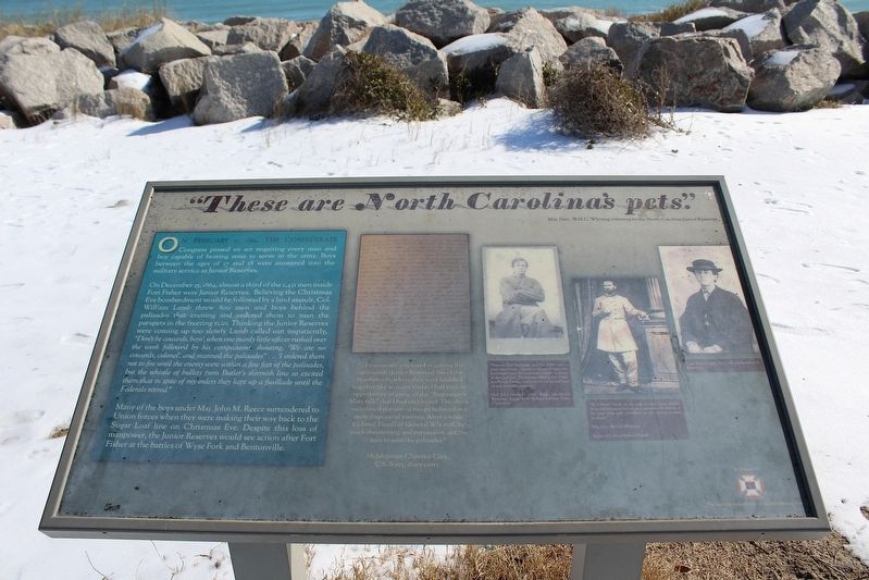
"These are North Carolina's pets."
Maj. Gen. W.H.C. Whiting referring to the North Carolina Junior Reserves
Photographed by Evan Dwyer, January 24, 2025
1. "These are North Carolina's pets." Marker
On February 17, 1864, the Confederate Congress passed an act requiring every man and boy capable of bearing arms to serve in the army. Boys between the ages of 17 and 18 were mustered into the military service as Junior Reserves.
On December 25, 1864, almost a third of the 1,431 men inside Fort Fisher were Junior Reserves. Believing the Christmas Eve bombardment would be followed by a land assault, Col. William Lamb threw 800 men and boys behind the palisades that evening and ordered them to man the parapets in the freezing rain. Thinking the Junior Reserves were coming up too slowly Lamb called out impatiently, "'Don't be cowards, boys', when one manly little officer rushed over the work followed by his companions shouting, 'We are no cowards, colonel', and manned the palisades... I ordered them not to fire until the enemy were within a few feet of the palisades, but the whistle of bullets from Butler's skirmish line so excited them that in spite of my orders they kept up a fusillade until the Federals retired."
Many of the boys under Maj. John M. Reece surrendered to Union forces when they were making their way
this page online
Topics. This historical marker is listed in this topic list: War, US Civil. A significant historical date for this entry is December 25, 1864.
Location. 33° 58.261′ N, 77° 55.01′ W. Marker is in Kure Beach, North Carolina, in New Hanover County. It can be reached from Fort Fisher Boulevard South (U.S. 421) 0.1 miles north of Battle Acre Road. Marker is at the sidewalk intersection with the trail from the Fort Fisher Historic Site Visitor Center, on the ocean side of Federal Point. Touch for map. Marker is in this post office area: Kure Beach NC 28449, United States of America. Touch for directions.

Regionally, this marker is in North Carolina’s Coastal Plain and on the Cape Fear Coast. It is also in the American South, specifically in the Upper South, in the Tidewater, and on the Eastern Seaboard. Globally, it is in the North Atlantic Region, North America, the Western Hemisphere, the Western World, and the Anglosphere. Historically, it finds itself in what
Photographed by Evan Dwyer, January 24, 2025
2. "These are North Carolina's pets." Marker
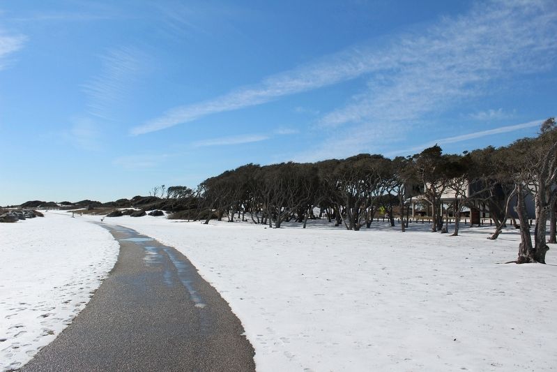
The marker is in the distance at left where the rocks curve, visible on a two-post stand between the two nearest benches.
Other nearby markers. At least 8 other markers are within walking distance of this marker: 32 Pounder Naval Cannon (about 300 feet away, measured in a direct line); a different marker also named 32 Pounder Naval Cannon (about 300 feet away); Fort Fisher & the Civil War (about 300 feet away); Fort Fisher (about 500 feet away); 1st Battle Of Fort Fisher - December, 1864: A "Fiasco" (about 500 feet away); A Desolate Spit Of Land (about 500 feet away); a different marker also named Fort Fisher (about 600 feet away); Our Occupation Of The Fort, Was Not Equivalent To Its Possession. (about 600 feet away). Touch for a list and map of all markers in Kure Beach.
Other markers no longer nearby. Fort Fisher’s Armstrong Cannon (was about 400 feet away but has been confirmed missing); A Trophy of War (was about 400 feet away but has been confirmed missing); Blockade-Running (was about 400 feet away but has been confirmed missing); History Trail (was about 500 feet away but has been confirmed missing); Growth of Fort Fisher, 1861-1862 (was about 600 feet away but has been confirmed missing); Fort Fisher Since 1865 (was about 600 feet away but has been replaced with another marker now near it).
More about this marker. The marker contains a photograph of a handwritten document with the following transcription: "... I was mostly employed in getting the militiamen [Junior Reserves] out of the bombproofs, where they were huddled together like so many sheep, I had then an opportunity of using all the "Boatswain's Mate talk" that I had ever heard. The above mentioned portion of troops behaved in a most disgraceful manner. After a while Colonel Tansill of General W.'s staff, by much threatening and persuasion, got the men to man the palisades." - Midshipman Clarence Cary, C.S. Navy, diary entry.
Right of the document is a photograph captioned "Between Fort Buchanan and Fort Fisher was a clear, open beach. As soon as the march began the fleet poured upon the command a terrific discharge of shot and shell. The first one killed at Fort Fisher was Private Davis, ...cut in two by a large shell (and severely wounded another)" - Col. John Hinsdale, 72nd Regt, 3rd Junior Reserves. Image from Perkins Library, Duke University.
Further to the right is another photograph captioned "To Colonel Tansill, of my staff, we owe many thanks. To his skillful judgement and great experience the defense of the sand front was committed at the critical moment of assault." - Maj. Gen. W.H.C. Whiting. Image of Robert Tansill.
Finally at the far right of the marker is the final photo, a portrait simply captioned Capt. John D. Kerr, Sr. Co. B 7th Battalion Jr. Reserves.
Additional commentary.
1. 2015 Series of Markers
The following markers were placed at Fort Fisher State Historic Site on the site walking trail as part of the 150th Anniversary of the battles in 2015:
278788
278793
278799
278843
278848
278856
278903
278907
278909
278913
278919
278923
278926
278936
A marker in the same style (278761) was placed at the Fort Fisher monument at Battle Acre in 2017. Three other markers outside of the site history trail (278940, 278774, and 278764) are all the same styling and may also be part of the 2015 re-signing effort.
— Submitted July 17, 2025, by Evan Dwyer of Richmond, Virginia.
Credits. This page was last revised on July 27, 2025. It was originally submitted on July 15, 2025, by Evan Dwyer of Richmond, Virginia. This page has been viewed 126 times since then and 17 times this year. Photos: 1, 2. submitted on July 15, 2025, by Evan Dwyer of Richmond, Virginia. • Bernard Fisher was the editor who published this page.
