Kure Beach in New Hanover County, North Carolina — The American South (South Atlantic)
History Trail

Photographed by Bernard Fisher, March 11, 2010
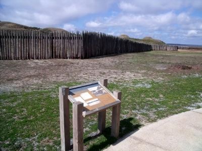
1. History Trail Marker
In the Civil War Fort Fisher kept the port of Wilmington open for crucial supplies from Europe. The fort finally fell in January 1865 after two of the largest sea-land battles of the war.
(captions)
List of guns in Fort Fisher.
The South’s largest earthen fort, Fisher stretched over 1.5 miles and mounted 44 heavy cannon. Due to beach erosion and construction, only 10 percent of the fort survives. Please help us preserve the archaeological remains by following the designated tour trail.
This Armstrong gun faced the ocean. It fired a 150-pound shell with a 30-pound propellant charge.
Map of Fort Fisher with erosion, U.S. 421, and former airstrip.
Erected by Fort Fisher Historic Site. (Marker Number 3.)
Topics. This historical marker is listed in these topic lists: Forts and Castles • War, US Civil. A significant historical month for this entry is January 1865.
Location. Marker has been reported missing. It was located near 33° 58.294′ N, 77° 55.096′ W. Marker was in Kure Beach, North Carolina, in New Hanover County. It could be reached from Fort Fisher Boulevard South (U.S. 421) near Battle Acre Road. This
this page online

Regionally, this marker was in the Coastal Plain and on the Cape Fear Coast. It was also in the American South, specifically in the Upper South, in the Tidewater, and on the Eastern Seaboard. Globally, it was in the North Atlantic Region, North America, the Western Hemisphere, the Western World, and the Anglosphere. Historically, it found itself in what was once the territory of the Mississippian Culture, one of the original Thirteen Colonies, one of the Confederate States of America, and the Antebellum South.
Other nearby markers. At least 8 other markers are within walking distance of this location: 1st Battle Of Fort Fisher - December, 1864: A "Fiasco" (here, next to this marker); A Desolate Spit Of Land (a few steps from this marker); The Whole Garrison Has Gone To Gardening (within shouting distance of this marker); Our Occupation Of The Fort, Was Not Equivalent To Its Possession.
Photographed by Bernard Fisher, March 11, 2010
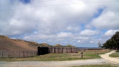
2. History Trail Marker
Other markers no longer nearby. Blockade-Running (was within shouting distance of this marker but has been confirmed missing); A Trophy of War (was within shouting distance of this marker but has been confirmed missing); Fort Fisher’s Armstrong Cannon (was within shouting distance of this marker but has been confirmed missing); Growth of Fort Fisher, 1861-1862 (was within shouting distance of this marker but has been confirmed missing); Lamb Expands the Fort, 1862-1865 (was within shouting distance of this marker but has been confirmed missing); Fort Fisher Since 1865 (was about 300 feet away but has been replaced with another marker now near it).
Related marker. Click here for another marker that is related to this marker. The marker has been replaced in position,
Photographed by Bernard Fisher, March 11, 2010
3. Fort Fisher Historic Site Tour Trail
Also see . . . Fort Fisher. North Carolina Historic Sites (Submitted on March 15, 2010, by Bernard Fisher of Richmond, Virginia.)
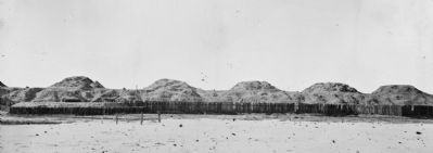
Photographed by Timothy H. O'Sullivan, 1865
4. Fort Fisher, North Carolina. Panoramic view of front. (Part 2)
Library of Congress [LC-B817- 7168]
Credits. This page was last revised on July 16, 2025. It was originally submitted on March 15, 2010, by Bernard Fisher of Richmond, Virginia. This page has been viewed 839 times since then and 24 times this year. Last updated on July 15, 2025, by Evan Dwyer of Richmond, Virginia. Photos: 1, 2. submitted on March 15, 2010, by Bernard Fisher of Richmond, Virginia. 3, 4. submitted on March 16, 2010, by Bernard Fisher of Richmond, Virginia.
