Brandon in Buchanan County, Iowa — The American Midwest (Upper Plains)
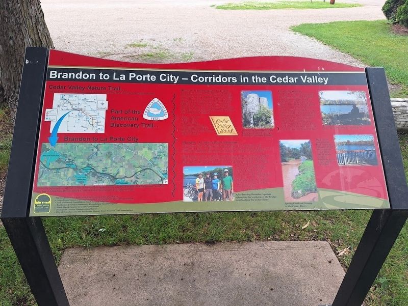
Brandon to La Porte City - Corridors In The Cedar Valley
Photographed by Jason Voigt, June 18, 2025
1. Brandon to La Porte City - Corridors In The Cedar Valley Marker
Historic Transportation Corridor
From 1912 to 1973, the Waterloo, Cedar Falls, & Northern Railway operated the Cedar Valley Road (CVR) as an electronic rail line providing passenger and freight service between Cedar Rapids, Cedar Falls, and Waverly. Brandon provided a depot. The old concrete CVR sign is still visible on the red building located just east of the Brandon Trailhead.
Today, the Cedar Valley Nature Trail provides a modern recreational transportation pathway through Iowa's scenic Cedar Valley Corridor.
Brandon - A Cedar Valley Community
The Cedar Valley Nature Trail passes through 10 communities. The people, the Trail, and the nature of the Cedar Valley combine to form one of the most interesting and enjoyable recreation corridors in the Midwest.
Brandon (pop. 309) is a small community that enjoys its location along the Trail. Each year, the town sponsors a Fools Ride (April) and Sloof Ride (September). Brandon is home to Iowa's Largest Frying Pan. The nearby Lime Creek Campground provides a great overnight stop, and Koutny Pond contains a 12-acre fishing lake. For more information about Trail use
this page online
Coursing Waters
The Cedar Valley contains many drainages, creeks, and wetlands which drain into the broad Cedar River. Heading west, the Trail crosses Mud Creek, Spring Creek, and the Cedar River, and runs along wetlands in the Twin Springs Natural Area and Spring Creek Flats. Woodlands are associated with these wet corridors, making the Trail between Brandon and La Porte City the most wooded section of the Cedar Valley Nature Trail.
Erected by Cedar Valley Nature Trail.
Topics. This historical marker is listed in these topic lists: Parks & Recreational Areas • Railroads & Streetcars. A significant historical year for this entry is 1912.
Location. 42° 18.722′ N, 92° 0.215′ W. Marker is in Brandon, Iowa, in Buchanan County. It is at the intersection of Lime Street and Branard Street, on the right when traveling east on Lime Street. Marker is located in a small park off the Cedar Valley Nature Trail. Touch for map. Marker is at or near this postal address: 601 Lime St, Brandon IA 52210, United States of America. Touch for directions.

Regionally, this marker

Photographed by Jason Voigt, June 18, 2025
2. Brandon to La Porte City - Corridors In The Cedar Valley Marker
Other nearby markers. At least 8 other markers are within 10 miles of this marker, measured as the crow flies: Iowa's Largest Fryin' Pan (approx. ¼ mile away); Veterans Memorial (approx. 0.3 miles away); Brandon Bridge (approx. half a mile away); The Pioneer Spirit (approx. 9.6 miles away); Rural Iowa Heritage Center (approx. 9.6 miles away); The Jesse Wasson Society (approx. 9.6 miles away); Chestnut Firestation (approx. 9.6 miles away); City Hall (approx. 9.7 miles away). Touch for a list and map of all markers in Brandon.
Also see . . . Brandon Area Community Club. Town of Brandon, Iowa's website (address is on the marker) (Submitted on July 16, 2025, by Jason Voigt of Glen Carbon, Illinois.)
Credits. This page was last revised on July 16, 2025. It was originally submitted on July 16, 2025, by Jason Voigt of Glen Carbon, Illinois. This page has been viewed 114 times since then and 15 times this year. Photos: 1, 2. submitted on July 16, 2025, by Jason Voigt of Glen Carbon, Illinois.
