Southwest Area in Cedar Rapids in Linn County, Iowa — The American Midwest (Upper Plains)
The Quarry
Photographed by Jason Voigt, June 18, 2025
1. The Quarry Marker
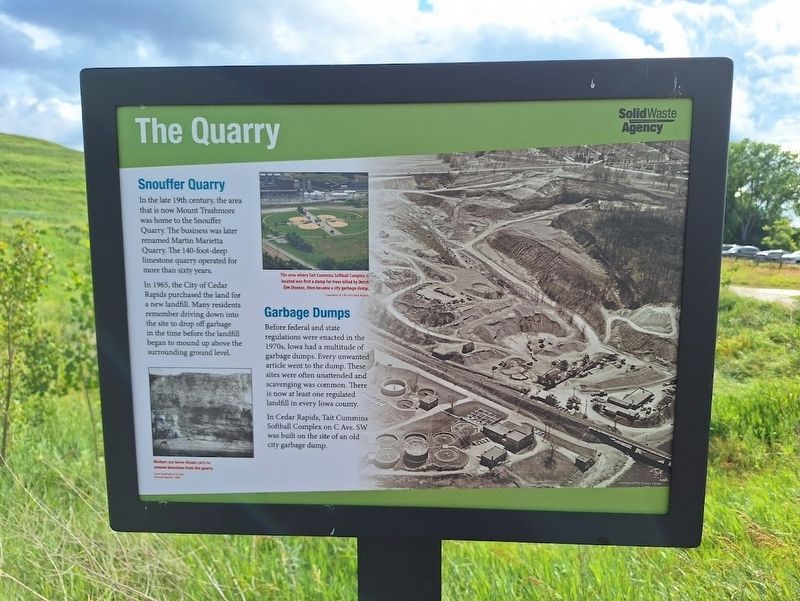
Snouffer Quarry
In the late 19th century, the area that is now Mount Trashmore was home to the Snouffer Quarry. The business was later renamed Martin Marietta Quarry. The 140-foot-deep limestone quarry operated for more than sixty years.
In 1965, the City of Cedar Rapids purchased the land for a new landfill. Many residents remember driving down into the site to drop off garbage in the time before the landfill began to mound up above the surrounding ground level.
Garbage Dumps
Before federal and state regulations were enacted in the 1970s, Iowa had a multitude of garbage dumps. Every unwanted article went to the dump. These sites were often unattended and scavenging was common. There is now at least one regulated landfill in every Iowa county.
In Cedar Rapids, Tait Cummins Softball Complex on C Ave. SW was built on the site of an old city garbage dump.
(photo caption:)
·The area where Tait Cummins Softball Complex is located was first a dump for trees killed by Dutch Elm Disease, then became a city garbage dump.
Erected by Solid Waste Agency.
Topics. This historical marker is listed in these
this page online
Location. 41° 57.895′ N, 91° 38.948′ W. Marker is in Cedar Rapids, Iowa, in Linn County. It is in the Southwest Area. It can be reached from A Street Southwest near C Street Southwest. Marker is located off a trail on the grounds of Mount Trashmore. Touch for map. Marker is at or near this postal address: 2216 A St SW, Cedar Rapids IA 52404, United States of America. Touch for directions.

Regionally, this marker is in Eastern Iowa. It is also in the American Midwest and in the Corn Belt. Globally, it is in North America, the Western Hemisphere, the Western World, and the Anglosphere. Historically, it finds itself in what was once the territory of the Mississippian Culture and also the Louisiana Purchase.
Other nearby markers. At least 8 other markers are within walking distance of this marker: Landfill History (within shouting distance of this marker); Wastewater Plant (about 700 feet away, measured in a direct line); Stumptown (approx. 0.3 miles away); The Floods of 2008 (approx. 0.3 miles away); World War II Memorial
Photographed by Jason Voigt, June 18, 2025
2. The Quarry Marker
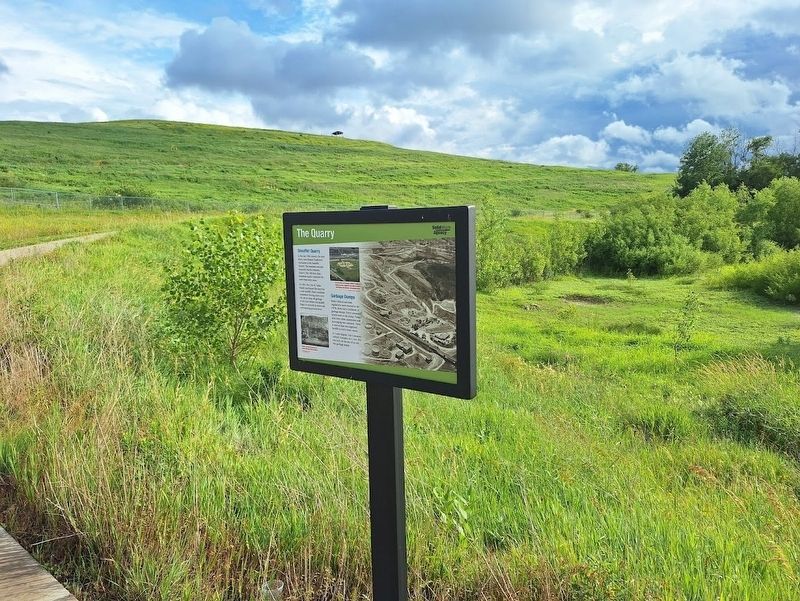
Marker is located along a trail on the grounds of Mount Trashmore.
Regarding The Quarry. Access to view all markers on the grounds of Mount Trashmore requires a check-in on site.
Also see . . . Mount Trashmore. This landfill turned nature park has become an icon in the Cedar Rapids area, attracting locals and outside visitors. Before coming there, it is best to check the hours they are open. (Submitted on July 16, 2025, by Jason Voigt of Glen Carbon, Illinois.)
Credits. This page was last revised on July 16, 2025. It was originally submitted on July 16, 2025, by Jason Voigt of Glen Carbon, Illinois. This page has been viewed 166 times since then and 43 times this year. Photos: 1, 2. submitted on July 16, 2025, by Jason Voigt of Glen Carbon, Illinois.
