Beaver Creek Township in Grayling in Crawford County, Michigan — The American Midwest (Great Lakes)
Fletcher Fire
| — | Forest Heritage Trail | — |
Photographed by Joel Seewald, July 4, 2025
1. Fletcher Fire Marker
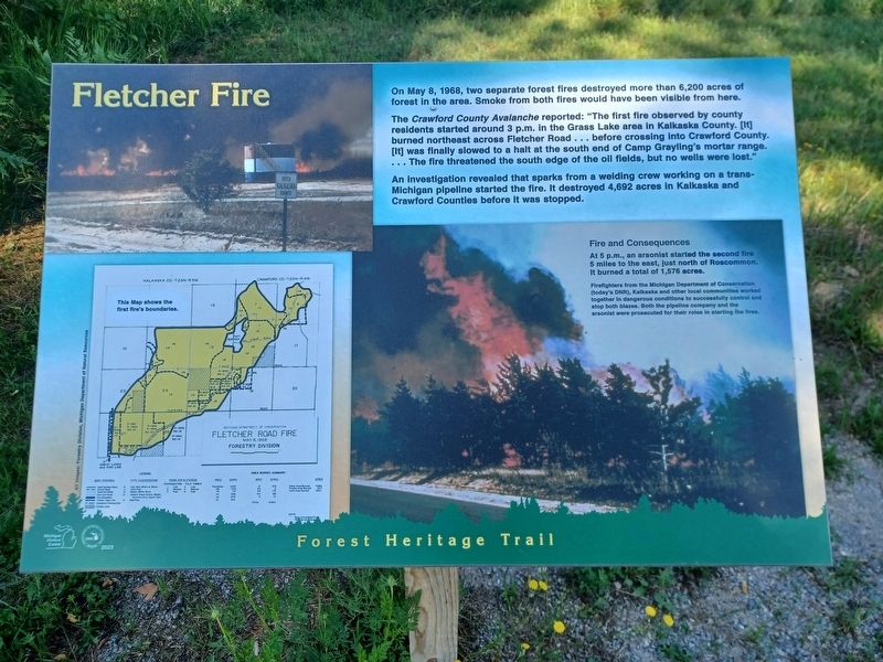
On May 8, 1968, two separate forest fires destroyed more than 6,200 acres of forest in this area. Smoke from both fires would have been visible from here.
The Crawford County Avalanche reported: "The first fire observed by county residents started around 3 p.m. in the Grass Lake area in Kalkaska County. [It] burned northeast across Fletcher Road . . . before crossing into Crawford County. [It] was finally slowed to a halt at the south end of Camp Grayling's mortar range. . . . The fire threatened the south edge of the oil fields, but no wells were lost."
An investigation revealed that sparks from a welding crew working on a trans-Michigan pipeline started the fire. It destroyed 4,692 acres in Kalkaska and Crawford Counties before it was stopped.
Fire and Consequences
At 5 p.m., an arsonist started the second fire 5 miles to the east, just north of Roscommon. It burned a total of 1,576 acres.
Lower right image caption: Firefighters from the Michigan Department of Conservation (today's DNR), Kalkaska and other local communities worked together in dangerous conditions to successfully control and stop both blazes.
this page online
Erected 2023 by Michigan History Center and Michigan Department of Natural Resources.
Topics. This historical marker is listed in these topic lists: Disasters • Environment • Horticulture & Forestry. A significant historical date for this entry is May 8, 1968.
Location. 44° 32.401′ N, 84° 44.459′ W. Marker is in Grayling, Michigan, in Crawford County. It is in Beaver Creek Township. It is at the intersection of West Fletcher Road and South Old 27, on the left when traveling west on West Fletcher Road. Marker is along the Forest Heritage Trail, just east of the intersection. Touch for map. Marker is in this post office area: Grayling MI 49738, United States of America. Touch for directions.

Regionally, this marker is in Northern Michigan Lower Peninsula. It is also in the American Midwest. Globally, it is in North America, the Great North Woods, the Western Hemisphere, the Western World, and the Anglosphere. Historically, it finds itself in what was once the Northwest Territory.
Other nearby markers. At least 8 other markers
Photographed by Joel Seewald, July 4, 2025
2. Fletcher Fire Marker
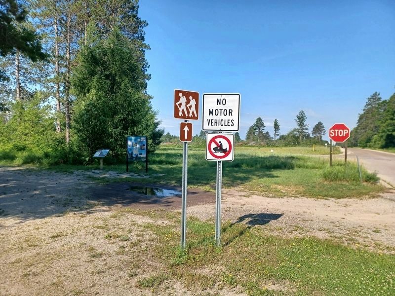
This marker is the angled marker on the left.
Credits. This page was last revised on July 17, 2025. It was originally submitted on July 17, 2025, by Joel Seewald of Madison Heights, Michigan. This page has been viewed 123 times since then and 27 times this year. Photos: 1, 2. submitted on July 17, 2025, by Joel Seewald of Madison Heights, Michigan.
