Kure Beach in New Hanover County, North Carolina — The American South (South Atlantic)
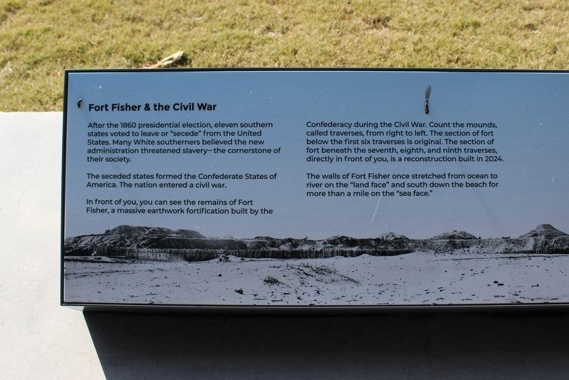
Fort Fisher & the Civil War

Photographed by Evan Dwyer, January 24, 2025
1. Fort Fisher & The Civil War Marker
The seceded states formed the Confederate States of America. The nation entered a civil war.
In front of you, you can see the remains of Fort Fisher, a massive earthwork fortification built by the Confederacy during the Civil War. Count the mounts, called traverses, from right to left. The section of fort below the first six traverses is original. The section of fort beneath the seventh, eighth, and ninth traverses, directly in front of you, is a reconstruction built in 2024.
The walls of Fort Fisher once stretched from ocean to river on the "land face" and south down the beach for more than a mile on the "sea face."
Creating Fort Fisher
From 1862 to 1864, Confederates created Fort Fisher from thousands of cubic yards of sand and timber. Whenever possible, Confederates forced African Americans and American Indians to perform the bulk of construction.
Eventually, Fisher's walls towered over
this page online
Fort Fisher guarded Wilmington, a port city with railroad access to the Confederacy's capital of Richmond. As the U.S. naval blockade sat offshore, Confederate soldiers stationed here protected blockade-running ships with the fort's 44 large seacoast cannons.
Capture of Fort Fisher
The U.S. Army and Navy launched two attacks on Fort Fisher in December 1864 and January 1865. On January 15, 1865, U.S. forces captured the fort.
A combined 3,837 men were killed, wounded, captured, or went missing while fighting here.
The U.S. victory at Fort Fisher effectively closed the port of Wilmington - by then the only supply route left in the Confederacy for vital foreign weapons. The Civil War ended about three months later.
(captions)
When the U.S. military captured Fort Fisher in January 1865, Major General Ulysses S. Grant sent photographer Timothy O'Sullivan to document the earthen fort. O'Sullivan's photographs of Fort Fisher help us visualize what this massive
Photographed by Evan Dwyer, January 24, 2025
2. Fort Fisher & The Civil War Marker
Land Face of Fort Fisher by Timothy O'Sullivan Courtesy Library of Congress
Most of Fort Fisher eroded into the ocean. During World War II, the military used the remains of the fort as a training facility. Construction crews demolished part of the remaining land face to build an airstrip. In 2024, this portion of the fort was rebuilt.
Erected 2024.
Topics. This historical marker is listed in these topic lists: African Americans • Forts and Castles • War, US Civil. A significant historical month for this entry is January 1865.
Location. 33° 58.311′ N, 77° 55.037′ W. Marker is in Kure Beach, North Carolina, in New Hanover County. It can be reached from Fort Fisher Boulevard South (U.S. 421) 0.2 miles Battle Acre Road, on the right when traveling south. Marker is under the Visitor Center exterior overhang. Touch for map. Marker is at or near this postal address: 1610 Fort Fisher Boulevard South, Kure Beach

Photographed by Evan Dwyer, January 24, 2025
3. Fort Fisher & The Civil War Marker

Regionally, this marker is in North Carolina’s Coastal Plain and on the Cape Fear Coast. It is also in the American South, specifically in the Upper South, in the Tidewater, and on the Eastern Seaboard. Globally, it is in the North Atlantic Region, North America, the Western Hemisphere, the Western World, and the Anglosphere. Historically, it finds itself in what was once the territory of the Mississippian Culture, one of the original Thirteen Colonies, one of the Confederate States of America, and the Antebellum South.
Other nearby markers. At least 8 other markers are within walking distance of this marker: 32 Pounder Naval Cannon (here, next to this marker); a different marker also named 32 Pounder Naval Cannon (a few steps from this marker); A Desolate Spit Of Land (about 300 feet away); "These are North Carolina's pets." (about 300 feet away); 1st Battle Of Fort Fisher - December, 1864: A "Fiasco" (about 300 feet away); The Whole Garrison Has Gone To Gardening (about 400 feet away); I Knew That Desperate Work Was In Store (about 500 feet away); "[We] rushed forward like tempest, through the stockade and up the parapet"

Photographed by Evan Dwyer, January 24, 2025
4. Fort Fisher & The Civil War Marker
Other markers no longer nearby. Blockade-Running (was about 300 feet away, measured in a direct line but has been confirmed missing); Fort Fisher’s Armstrong Cannon (was about 300 feet away but has been confirmed missing); A Trophy of War (was about 300 feet away but has been confirmed missing); History Trail (was about 300 feet away but has been confirmed missing); Growth of Fort Fisher, 1861-1862 (was about 400 feet away but has been confirmed missing); Lamb Expands the Fort, 1862-1865 (was about 400 feet away but has been confirmed missing).

Photographed by Evan Dwyer, January 24, 2025
5. Fort Fisher & The Civil War Marker

Photographed by Evan Dwyer, January 25, 2025
6. Fort Fisher's Remains & WWII Air Strip
This drone view shows the remains of the fort at right, with the three rebuilt traverses still devoid of grass at center right, and the indistinct mound across Fort Fisher boulevard that represents the continuation of the original fort. The air strip from 1942 is evident as the long grass gap running from behind the new traverses towards the upper left where it intersects the road. The old visitor center used to stand on the opposite side of the rebuilt traverses. The visitor center at lower right was completed in 2024. The marker referenced on this page is underneath its overhand, just behind the cannon visible beneath the large square window facing the trees and ocean. The Cape Fear River is the body of water in the distance and at right.
Credits. This page was last revised on August 7, 2025. It was originally submitted on July 17, 2025, by Evan Dwyer of Richmond, Virginia. This page has been viewed 140 times since then and 30 times this year. Photos: 1, 2, 3, 4, 5, 6. submitted on July 17, 2025, by Evan Dwyer of Richmond, Virginia. • Bernard Fisher was the editor who published this page.
