Southwest Area in Cedar Rapids in Linn County, Iowa — The American Midwest (Upper Plains)
Stumptown
Photographed by Jason Voigt, June 18, 2025
1. Stumptown Marker
Community of Workers
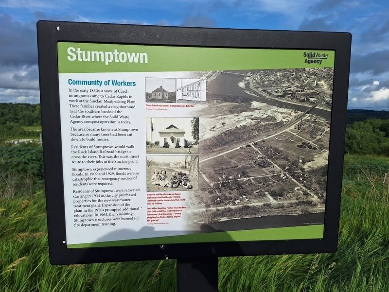
In the early 1850s, a wave of Czech immigrants came to Cedar Rapids to work at the Sinclair Meatpacking Plant. These families created a neighborhood near the southern banks of the Cedar River where the Solid Waste Agency compost operation is today.
The area became known as Stumptown because so many trees had been cut down to build houses.
Residents of Stumptown would walk the Rock Island Railroad bridge to cross the river. This was the most direct route to their jobs at the Sinclair plant.
Stumptown experience numerous floods. In 1909 and 1929, floods were so catastrophic that emergency rescues of residents were required.
Residents of Stumptown were relocated starting in 1934 as the city purchased properties for the new wastewater treatment plant. Expansion of the plant in the 1950s prompted additional relocations. In 1965, the remaining Stumptown structures were burned for fire department training.
[Captions:]
Pierce School was located in Stumptown on Belle Ave.
Matthew and Mary Ruzicka purchased the Pierce school building in 1938 and converted it to the home where they raised their six children.
Their eldest daughter Patricia (Ruzicka) Beer has fond memories of Stumptown, describing it as, "The very best place for children to play, explore and grow up."
Erected by Solid
this page online
Topics. This historical marker is listed in these topic lists: Disasters • Immigration • Industry & Commerce • Settlements & Settlers. A significant historical year for this entry is 1909.
Location. 41° 57.627′ N, 91° 38.837′ W. Marker is in Cedar Rapids, Iowa, in Linn County. It is in the Southwest Area. It can be reached from A Street Southwest east of C Street Southwest. Marker is located off a trail on the grounds of Mount Trashmore. Touch for map. Marker is at or near this postal address: 2216 A St SW, Cedar Rapids IA 52404, United States of America. Touch for directions.

Regionally, this marker is in Eastern Iowa. It is also in the American Midwest and in the Corn Belt. Globally, it is in North America, the Western Hemisphere, the Western World, and the Anglosphere. Historically, it finds itself in what was once the territory of the Mississippian Culture and also the Louisiana Purchase.
Other nearby markers. At least 8 other markers are within walking distance of this marker: The Floods of 2008 (within shouting distance of this marker); Wastewater Plant (approx. 0.2 miles away); Landfill History
Photographed by Jason Voigt, June 18, 2025
2. Stumptown Marker
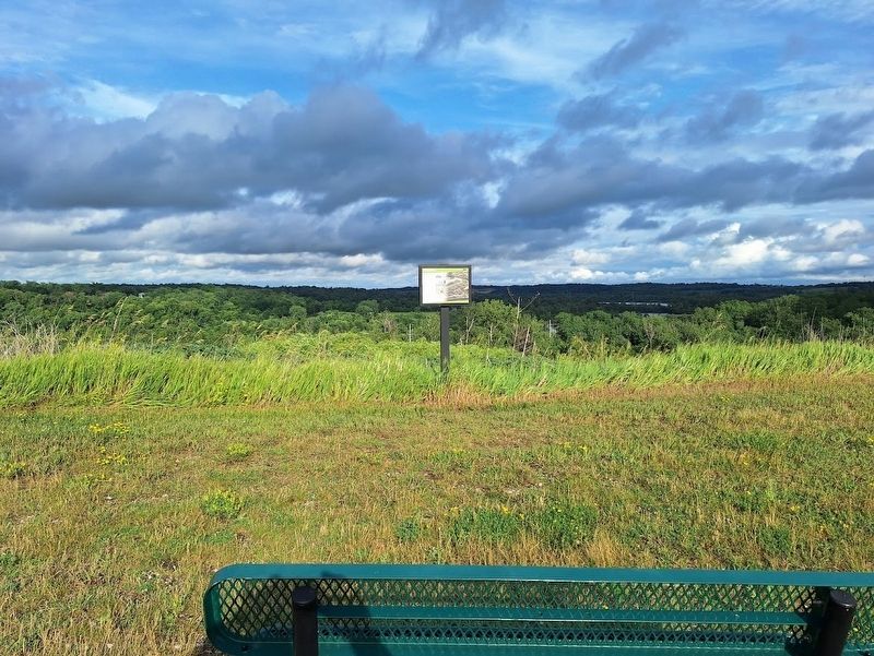
Marker is located off a trail on the grounds of Mount Trashmore
Regarding Stumptown. Access to view all markers on the grounds of Mount Trashmore requires a check-in on site.
Also see . . . Mount Trashmore. This landfill turned nature park has become an icon in the Cedar Rapids area, attracting locals and outside visitors. Before coming there, it is best to check the hours they are open. (Submitted on July 17, 2025, by Jason Voigt of Glen Carbon, Illinois.)
Credits. This page was last revised on February 24, 2026. It was originally submitted on July 17, 2025, by Jason Voigt of Glen Carbon, Illinois. This page has been viewed 744 times since then and 153 times this year. Photos: 1, 2. submitted on July 17, 2025, by Jason Voigt of Glen Carbon, Illinois.
