Milford Mine Memorial Park near Wolford in Crow Wing County, Minnesota — The American Midwest (Upper Plains)
Dikes
| — | Milford Mine Memorial Park | — |
Photographed by McGhiever, June 27, 2025
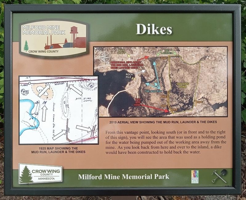
1. Dikes Marker
1925 map showing the mud run, launder & the dikes
2019 aerial view showing the mud run, launder & the dikes
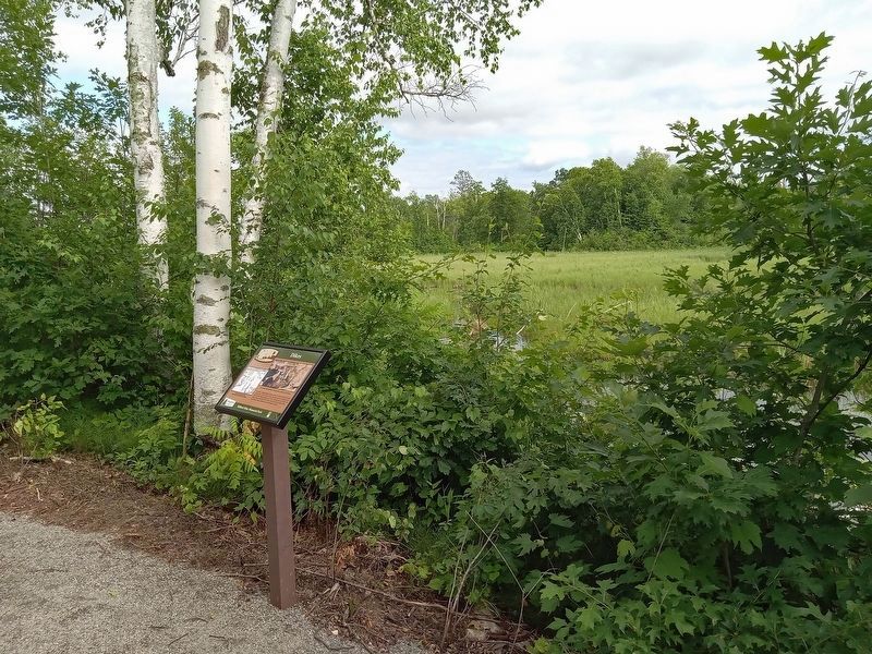
From this vantage point, looking south (or in front and to the right of this sign), you will see the area that was used as a holding pond for the water being pumped out of the working area away from the mine. As you look back from here and over to the island, a dike would have been constructed to hold back the water.
Erected by Crow Wing County.
Topics. This historical marker is listed in these topic lists: Industry & Commerce • Waterways & Vessels. A significant historical year for this entry is 1925.
Location. 46° 32.19′ N, 93° 58.453′ W. Marker is near Wolford, Minnesota, in Crow Wing County. It is in Milford Mine Memorial Park. It can be reached from Milford Lake Drive. The marker is on the trail straight west of the parking lot and trailhead. Touch for map. Marker is in this post office area: Crosby MN 56441, United States of America. Touch for directions.

Regionally, this marker is in the Northland. It is also in the American Midwest, in the Corn Belt, and in the Great River Road Region.
this page online
Other nearby markers. At least 8 other markers are within walking distance of this marker: Cuyuna Iron Range Railway: Spanning Rivers, Lakes, & Wetlands (within shouting distance of this marker); Soo Line Railroad Hauls Cuyuna Ore (about 600 feet away, measured in a direct line); Mud Run, Launder & Dikes (about 600 feet away); Milford Lake: Then & Now (about 600 feet away); The Cuyuna Iron Range (about 700 feet away); Milford Mine (about 700 feet away); Mine Shaft Entrance (about 700 feet away); The Milford Mine Disaster (about 700 feet away). Touch for a list and map of all markers in Wolford.
Photographed by McGhiever, June 27, 2025
2. Dikes Marker overlooking the former holding pond
Credits. This page was last revised on July 17, 2025. It was originally submitted on July 17, 2025, by McGhiever of Minneapolis, Minnesota. This page has been viewed 88 times since then and 18 times this year. Photos: 1, 2. submitted on July 17, 2025, by McGhiever of Minneapolis, Minnesota.
