Near Southwest Harbor in Hancock County, Maine — The American Northeast (New England)
Carroll Homestead
Photographed by Steve Stoessel, October 10, 2024
1. Carroll Homestead Marker
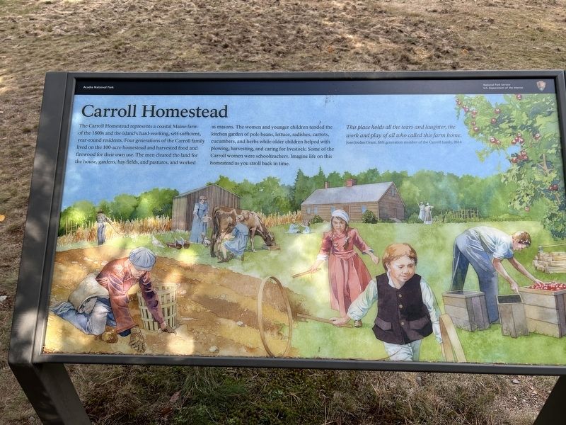
The Carroll Homestead represents a coastal Maine farm of the 1800s and the island's hard-working, self-sufficient, year-round residents. Four generations of the Carroll family lived on the 100-acre homestead and harvested food and firewood for their own use. The men cleared the land for the house, gardens, hay fields, and pastures, and worked as masons. The women and younger children tended the kitchen garden of pole beans, lettuce, radishes, carrots, cucumbers, and herbs while older children helped with plowing, harvesting, and caring for livestock. Some of the Carroll women were schoolteachers. Imagine life on this homestead as you stroll back in time.
This place holds all the tears and laughter, the work and play of all who called this farm home.
Joan Jordan Grant, fifth generation member of the Carroll family, 2014
Erected by National Park Service, U.S. Department of the Interior.
Topics. This historical marker is listed in these topic lists: Agriculture • Settlements & Settlers. A significant historical year for this entry is 2014.
Location. 44° 18.216′ N, 68° 19.559′ W. Marker is near Southwest Harbor,
this page online

Regionally, this marker is on Mount Desert Island and in Downeast Maine. It is also in the American Northeast, in New England, and on the Eastern Seaboard. Globally, it is in the North Atlantic Region, North America, the Great North Woods, the Western Hemisphere, the Western World, and the Anglosphere. Historically, it finds itself in what was once the Viceroyalty of New France and also Acadia.
Other nearby markers. At least 8 other markers are within 4 miles of this marker, measured as the crow flies: Somes Sound (approx. 1.4 miles away); Seawater Bay (approx. 1.4 miles away); Joseph T. Musetti Jr. Veterans Memorial Park (approx. 2.1 miles away); Roads to Discoveries (approx. 2.1 miles away); Carriage Roads - The Gate Lodges (approx. 3.8 miles away); Gateway to Acadia (approx. 3.8 miles away); Drink in the View (approx. 4 miles
Photographed by Steve Stoessel, October 10, 2024
2. Carroll Homestead Marker
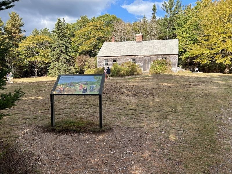
Temporary markers describing life on the farm can be seen in the background, particularly to the right of the house.
Another marker is no longer nearby. Carriage Roads - Building the Roads (was approx. 2.1 miles away but has been confirmed missing).
More about this marker. There were several temporary markers set up around the site describing life on the homestead during the 1800s. This was the only permanent marker.
Credits. This page was last revised on July 25, 2025. It was originally submitted on October 10, 2024, by Steve Stoessel of Niskayuna, New York. This page has been viewed 228 times since then and 31 times this year. Last updated on July 18, 2025, by Win Bent of Austin, Texas. Photos: 1. submitted on October 10, 2024, by Steve Stoessel of Niskayuna, New York. 2. submitted on October 11, 2024, by Steve Stoessel of Niskayuna, New York. • Devry Becker Jones was the editor who published this page.
