Fort Erie in Niagara Region, Ontario — Central Canada (North America)
Fort Erie Ferry Landings
Photographed by Jamie Abel, August 31, 2012
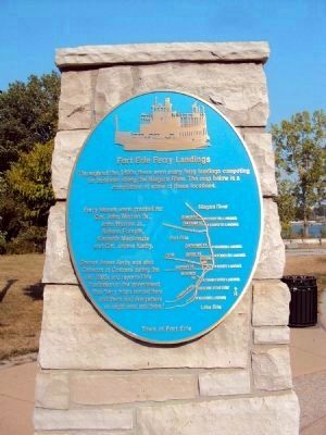
1. Fort Erie Ferry Landings Marker
The Niagara River is visible in the background.
Throughout the 1800s there were many ferry landings competing for business along the Niagara River. The map below is a compilation of some of these locations.
Ferry leases were granted to:
Col. John Warren Sr.,
John Warren Jr.,
Nelson Forsyth,
Kenneth Mackenzie
and Col. James Kerby.
Colonel James Kerby was also Collector of Customs during the mid 1800s and reported his frustration to the government that “ferry boats landed here and there and everywhere as might best suit them.”
Erected by Town of Fort Erie.
Topics. This historical marker is listed in this topic list: Waterways & Vessels. A significant historical year for this entry is 1800.
Location. 42° 54.748′ N, 78° 54.548′ W. Marker is in Fort Erie, Ontario, in Niagara Region. It is on Niagara Boulevard 0.1 kilometers south of Bertie Street, on the right when traveling north. Touch for map. Marker is at or near this postal address: 131 Niagara Boulevard, Fort Erie ON L2A 1X6, Canada. Touch for directions.

Regionally, this marker is on the Golden Horseshoe and in Niagara Canada. It is also in Central Canada. Globally, it is in North America,
this page online
Other nearby markers. At least 8 other markers are within walking distance of this marker: Bertie Street Ferry Landing (here, next to this marker); Freedom Park (within shouting distance of this marker); J.L. Kraft 1874-1953 (about 90 meters away, measured in a direct line); Fight at the Fort Erie Docks (approx. 0.3 kilometers away); Nowak Pier (approx. half a kilometer away in the U.S.); Harrowing Journey (approx. 0.6 kilometers away in the U.S.); International Crossing (approx. 0.6 kilometers away in the U.S.); Black Rock Harbor / From Plantation to Promised Land (approx. 0.6 kilometers away in the U.S.). Touch for a list and map of all markers in Fort Erie.
Also see . . . Ferry at Fort Erie. Photograph and info from the Maritime History of the Great Lakes site. (Submitted on September 9, 2012, by Jamie Abel of Westerville, Ohio.)
Photographed by Jamie Abel, August 31, 2012
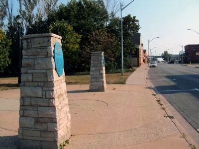
2. Fort Erie Ferry Landings Marker
View looking south down Niagara Boulevard, this marker is the nearest (northernmost) of the two markers adorning pillars at the entrance to Freedom Park.
Credits. This page was last revised on July 25, 2025. It was originally submitted on September 9, 2012, by Jamie Abel of Westerville, Ohio. This page has been viewed 893 times since then and 44 times this year. Last updated on July 19, 2025, by Kevin Westell of St. Catharines, Ontario. Photos: 1, 2. submitted on September 9, 2012, by Jamie Abel of Westerville, Ohio. • Devry Becker Jones was the editor who published this page.
