
Fort Erie in Niagara Region, Ontario — Central Canada (North America)
Frenchman's Creek
Photographed by Dale K. Benington, July 28, 2011
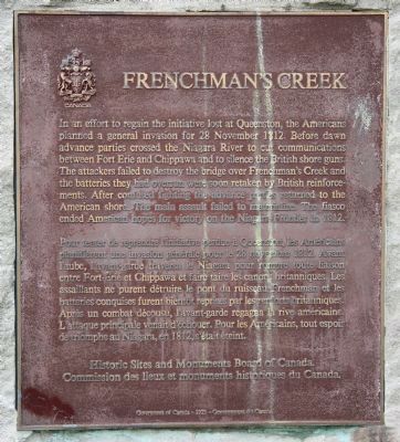
1. Frenchman's Creek Marker

In an effort to regain the initiative lost at Queenston, the Americans planned a general invasion for 28 November 1812. Before dawn advance parties crossed the Niagara River to cut communications between Fort Erie and Chippawa and to silence the British shore guns. The attackers failed to destroy the bridge over Frenchman's Creek and the batteries they had overrun were soon retaken by British reinforcements. After confused fighting the advance parties returned to the American shore. The main assault failed to materialize. The fiasco ended American hopes for victory on the Niagara Frontier in 1812.
this page online
Erected 1923 by Historic Sites and Monuments Board of Canada.
Topics and series. This historical marker is listed in these topic lists: War of 1812 • Waterways & Vessels. In addition, it is included in the Canada, Historic Sites and Monuments Board series list. A significant historical date for this entry is November 28, 1812.
Location. 42° 56.536′ N, 78° 55.588′ W. Marker is in Fort Erie, Ontario, in Niagara Region. It is on Niagara Parkway north of Anger Avenue, on the left when traveling south. This historic marker is located on the Canadian side of the Niagara River, south of Niagara Falls and a short distance north of Fort Erie, and just south of where Frenchman's Creek flows into the Niagara River. Touch for map. Marker is at or near this postal address: 1097 Niagara Parkway, Fort Erie ON L2A 3H6, Canada. Touch for directions.

Regionally, this marker is on Ontario’s Golden Horseshoe and in Niagara Canada. It is also in Central Canada. Globally, it is in North America, on the Great Lakes, in the Western Hemisphere, in
Photographed by Dale K. Benington, July 28, 2011
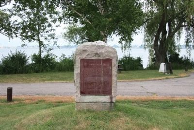
2. Frenchman's Creek Marker
View of historic marker with the Niagara River in the background.
Other nearby markers. At least 8 other markers are within walking distance of this marker: 202 Dufferin Street (approx. 1.4 kilometers away); The Niagara River (approx. 1.4 kilometers away in the U.S.); The Fenian Invasion of 1866 (approx. 1.5 kilometers away in the U.S.); Bertie Hall (approx. 1.5 kilometers away); Niagara River Corridor / Avian Walk (approx. 1.5 kilometers away in the U.S.); Millstone from Joseph Well's Grist Mill (1870's - 1890's) (approx. 1.5 kilometers away); Tow Path Park (approx. 1.6 kilometers away in the U.S.); McAffee Cemetery (approx. 1.6 kilometers away). Touch for a list and map of all markers in Fort Erie.
Another marker is no longer nearby. "The Black Rock" (was approx. 1.4 kilometers away in the U.S. but has been confirmed missing).
Also see . . . Battle of Frenchman's Creek. Wikipedia entry (Submitted on February 8, 2026, by Larry Gertner of New York, New York.)
Photographed by Dale K. Benington, July 28, 2011
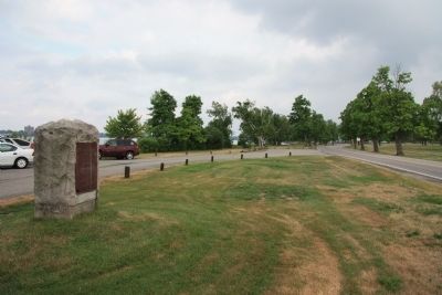
3. Frenchman's Creek Marker
View of the historic marker looking south along the Niagara Parkway.
Photographed by Dale K. Benington, July 28, 2011
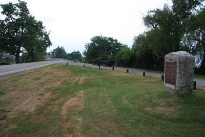
4. Frenchman's Creek Marker
View of historic marker looking north along the Niagara Parkway, with a distant view of the bridge over Frenchman's Creek.
Photographed by Dale K. Benington, July 28, 2011
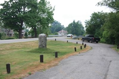
5. Frenchman's Creek Marker
Another view of historic marker looking north along the Niagara Parkway, with a distant view of the bridge over Frenchman's Creek (as seen from the roadside park).
Photographed by Jamie Abel, August 31, 2012
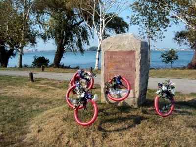
6. Frenchman's Creek Marker
View of the Frenchman's Creek marker accompanied by decorations recognizing the bicentennial of the War of 1812.
Credits. This page was last revised on February 8, 2026. It was originally submitted on November 1, 2011, by Dale K. Benington of Toledo, Ohio. This page has been viewed 1,149 times since then and 83 times this year. Last updated on July 19, 2025, by Kevin Westell of St. Catharines, Ontario. Photos: 1, 2, 3, 4, 5. submitted on November 5, 2011, by Dale K. Benington of Toledo, Ohio. 6. submitted on September 9, 2012, by Jamie Abel of Westerville, Ohio. • Devry Becker Jones was the editor who published this page.
