
Fort Erie in Niagara Region, Ontario — Central Canada (North America)
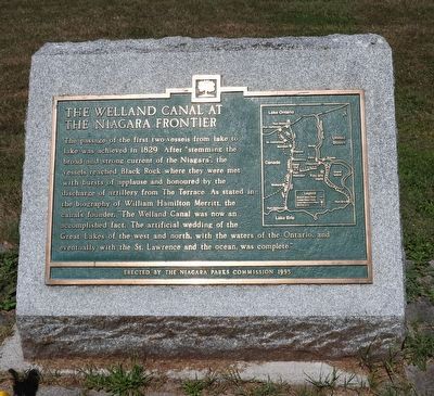
The Welland Canal at the Niagara Frontier
Photographed by Kevin Westell, July 18, 2025
1. The Welland Canal at the Niagara Frontier - Marker
Erected 1995 by The Niagara Parks Commission.
Topics and series. This historical marker is listed in these topic lists: Industry & Commerce • Waterways & Vessels. In addition, it is included in the The Welland Canals series list. A significant historical year for this entry is 1829.
Location. 42° 57.116′ N, 78° 58.342′ W. Marker is in Fort Erie, Ontario, in Niagara Region. It is on Niagara River Parkway, on the right when traveling south. The marker is 10 metres south of the road, adjacent to the biking/walking path. Touch for map. Marker is
this page online

Regionally, this marker is on Ontario’s Golden Horseshoe and in Niagara Canada. It is also in Central Canada. Globally, it is in North America, on the Great Lakes, in the Western Hemisphere, in the Western World, and in the Anglosphere. Historically, it finds itself in what was once a British colony, the Viceroyalty of New France, the Haudenosaunee (Iroquois) Confederacy, and Rupert’s Land.
Other nearby markers. At least 8 other markers are within 3 kilometers of this marker, measured as the crow flies: Marina (within shouting distance of this marker); Niagara's Freedom Trail - Little Africa (within shouting distance of this marker); Bert Miller (approx. 0.4 kilometers away); Crossing of the River Brethren (approx. 0.6 kilometers away); Gonder's Flats (approx. 1.4 kilometers away); For the Birds (approx. 1.4 kilometers away in the U.S.); Restoring Nature (approx. 1.4 kilometers away in the U.S.); Mackenzie's Crossing 1837 (approx. 2.2 kilometers away). Touch for a list and map of all markers in Fort
Photographed by Kevin Westell, July 18, 2025
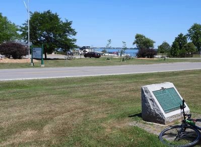
2. The Welland Canal at the Niagara Frontier - Marker in context
Photo faces east.
Photographed by Kevin Westell, July 18, 2025
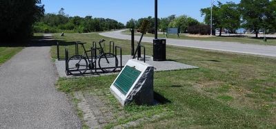
3. The Welland Canal at the Niagara Frontier - Marker in context
Ignore the marker in the foreground! The distant left marker is the one we are interested in today.
Credits. This page was last revised on July 21, 2025. It was originally submitted on July 19, 2025, by Kevin Westell of St. Catharines, Ontario. This page has been viewed 93 times since then and 13 times this year. Photos: 1, 2, 3. submitted on July 19, 2025, by Kevin Westell of St. Catharines, Ontario. • Andrew Ruppenstein was the editor who published this page.
