Preston in Lancashire, England, United Kingdom — Northwestern Europe (the British Isles)
Stoneygate
Photographed by Ray Gurganus, April 10, 2025
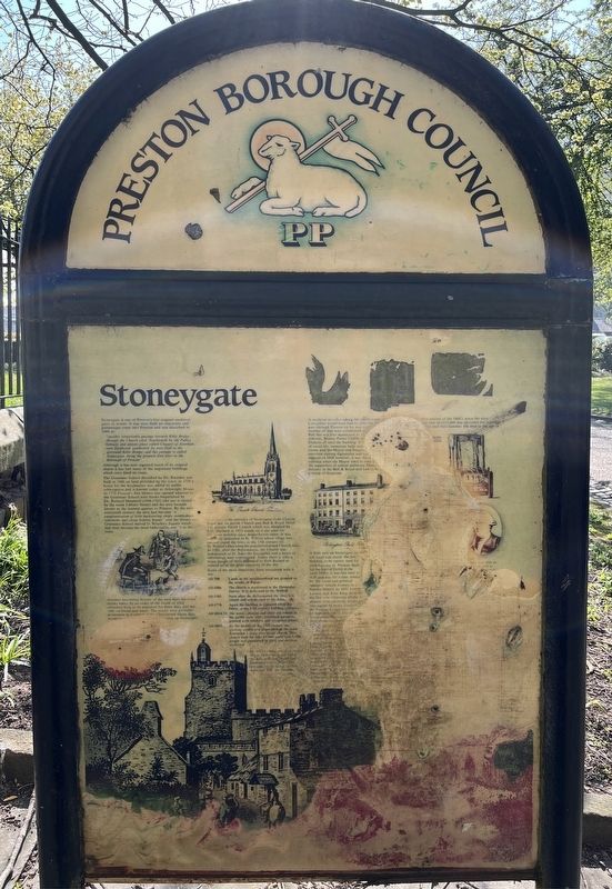
1. Stoneygate Marker
"another remarkable passage towards Rible Bridge through the Church yard. Southwards by the Publiq Schoole and antient place called Chappel of Avenham, over Swilbrook southward by west field to the aforesaid Rible Bridge; and this passage is called Stoneygate being the greatest foot tract to the Burrough of Preston"
Although it has now regained much of its original charm it has lost many of the important buildings which once lined its route. The Grammar School described by Dr. Kuerden was built in 1666 on land provided by the town. In 1728 a house for the headmaster was added by subscription and is known today as Arkwright House. In 1770 Preston's first library was opened adjacent to the Grammar School with books bequeathed by Dr. Richard Shepherd (1694-1761) (the site is record by the name Library Street) and the area became known as the learned quarter to Preston. By the mid-nineteenth century the area had become "a conglomeration of little huckstering
this page online
Another interesting feature of the area were the town stocks where by an order of the Guild of 1562 offenders were to be punished for three days and fed only on bread and water. The stocks were probably positioned in a corner of the churchyard where they would be [illegible] Stoneygate.
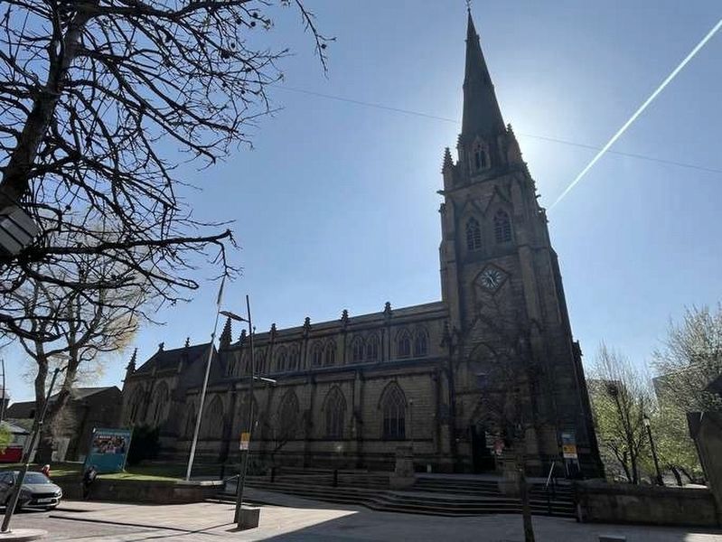
Distinguishing the entrance of Stoneygate from Church Street are the parish Church and Bull & Royal Hotel. The present Parish Church which was designed by E.H. Shellard in 1853 on a site used for Christian worhsip since Anglo-Saxon times. It was originally dedicated to St Wilfrid whose effigy was carried round the town in the 13th century on St Wilfrid's Day when the population drank Church Ales. In 1581, after the Reformation, the church was rededicated to St John the Evangelist and a series of rebuildings commenced. Today there is only a brass plaque of 1623 dedicated to Seth Bushell to remind us of the antiquity of the site.
Some of the most important dates associated
Photographed by Ray Gurganus, April 10, 2025
2. St John the Evangelist Church
• AD 700: Lands in the neighborhood are granted to the monks of Ripon.
• AD 1086: The church is mentioned in the Domesday Survey. It is dedicated to St Wilfrid.
• AD 1581: Soon after the Reformation the church is rebuilt and rededicated to St John.
• AD 1770: Again the building is replaced when the fabric on the 17th century building collapses.
• AD 1814-23: The tower, chancel, and choir are rebuilt in the gothic style with installed parapets, pointed arch windows and octagonal pillars.
• AD 1853: By the middle of the 19th century the growing wealth and population of the town demanded a more prestigious church. This church built for only £9,500 could seat 1,700 people, was completed in 1855 and survives unaltered.
An old building and close to the centre of the original town, the Bull & Royal Hotel has witnessed events important not only to the history of the town but also of the country.
[much of the remainder illegible]
Erected by Preston Borough Council.
Topics. This historical marker is listed in these topic lists: Education • Religion & Religious Structures • Roads & Vehicles. A significant historical year for this entry is 1666.
Location. 53° 45.5′ N, 2° 41.785′ W. Marker is unreadable. Marker is in Preston, England, in Lancashire. It is on Church Street. Touch for map. Marker is at or near this postal address: 140 Church Street, Preston, England PR1 3BU, United Kingdom. Touch for directions.

Regionally, this marker is in North West England. Globally, it is on the Atlantic Ocean, in the North Atlantic Region, in Europe, in Atlantic Europe, on one of the British Isles, in the Western World, and in the Anglosphere. Historically, it finds itself in what was once the Roman Empire.
Other nearby markers. At least 8 other markers are within walking distance of this location: The Old Cock Pit (within shouting distance of this marker); Isaac Simpson, Stephen Simpson (approx. 0.3 kilometers away); Thomas Miller, 1811-1865 (approx. 0.4 kilometers away); Francis Thompson 1859-1907 (approx. 0.4 kilometers away); The Syke (approx. 0.4 kilometers away); The Winckley Club and The Literary & Philosophical Institution (approx. 0.4 kilometers away); The Beginnings of Winckley Square (approx. 0.4 kilometers away); Robert Peel (approx. 0.4 kilometers away). Touch for a list and map of all markers in Preston.
Credits. This page was last revised on July 21, 2025. It was originally submitted on July 19, 2025, by Ray Gurganus of Washington, District of Columbia. This page has been viewed 71 times since then and 15 times this year. Photos: 1, 2. submitted on July 19, 2025, by Ray Gurganus of Washington, District of Columbia. • Andrew Ruppenstein was the editor who published this page.
Editor’s want-list for this marker. Photo of the marker within its surroundings • Can you help?
