
Niagara Falls in Niagara Region, Ontario — Central Canada (North America)
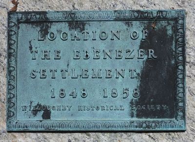
Location of the Ebenezer Settlement 1848 1858
Photographed by Kevin Westell, July 18, 2025
1. Location of the Ebenezer Settlement 1848 1858 Marker
Location of the Ebenezer Settlement
1848 1858
Erected by Willoughby Historical Society.
Topics. This historical marker is listed in these topic lists: Colonial Era • Settlements & Settlers. A significant historical year for this entry is 1848.
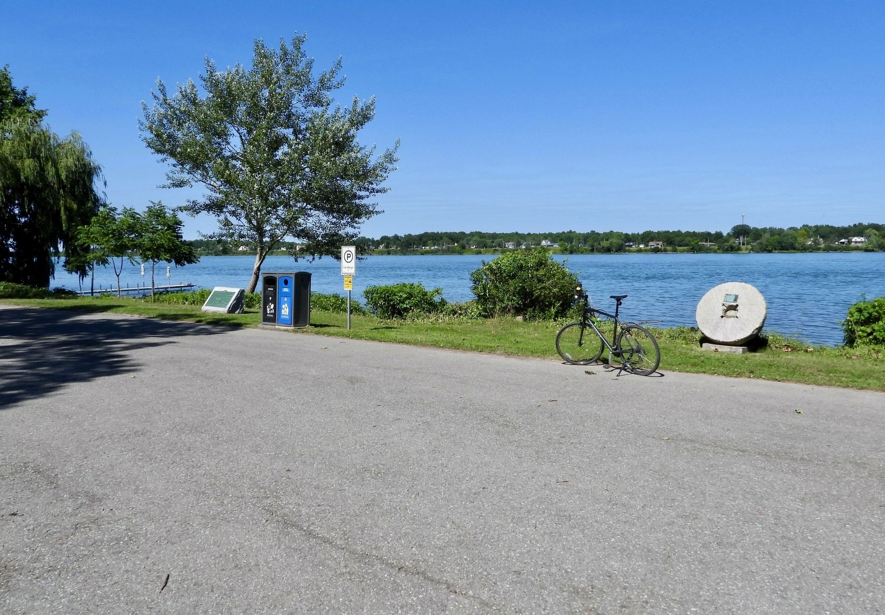
Location. 42° 58.951′ N, 79° 1.46′ W. Marker is in Niagara Falls, Ontario, in Niagara Region. It is on Niagara River Parkway, on the right when traveling north. The plaque is mounted on an ornamental millwheel, beside the river, at the parking lot of "Black Creek Boat Launch". Touch for map. Marker is at or near this postal address: 13693 Niagara River Parkway, Niagara Falls ON L2G 0P8, Canada. Touch for directions.

Regionally, this marker is on Ontario’s Golden Horseshoe and in Niagara Canada. It is also in Central Canada. Globally, it is in North America, on the Great Lakes, in the Western Hemisphere, in the Western World, and in the Anglosphere. Historically, it finds itself in what was once a British colony, the Viceroyalty of New France, the Haudenosaunee (Iroquois) Confederacy, and Rupert’s Land.
Other nearby markers. At least 8 other markers
this page online
More about this marker. The border between the City of Niagara Falls and the Town of Fort Erie passes between this "millwheel" marker and a green-plaque-on-block "conestoga" marker, 40 metres south.
Photographed by Kevin Westell, July 18, 2025
2. Location of the Ebenezer Settlement 1848 1858 - Marker in context
This marker is mounted on the ornamental mill-wheel. The actual boat launch is on the left, between the green-plaque-on-a-block and the wooden dock. In the background are the Niagara River and Grand Island.
Credits. This page was last revised on July 20, 2025. It was originally submitted on July 19, 2025, by Kevin Westell of St. Catharines, Ontario. This page has been viewed 139 times since then and 40 times this year. Photos: 1, 2. submitted on July 19, 2025, by Kevin Westell of St. Catharines, Ontario. • Andrew Ruppenstein was the editor who published this page.
